Objectives of the service
With PeaceEye, we are developing a state-of-the-art technology-conflict-peace interface to better analyse, understand and respond to security challenges. By integrating various geospatial and non-geospatial data sources, we provide stakeholders involved in conflict resolution, mediation, peacebuilding, diplomacy, humanitarian and development aid, together with local actors, with an asset to identify locations of potential violence before it occurs. This increases their capacity for emergency preparedness and contingency planning. Furthermore, it allows them to guide acute interventions and prompt adequate responses. PeaceEye enhances situational awareness for all actors involved in the HDP-Nexus (Humanitarian-Development-Peace), and comprises different interlaced components.
Within the frame of this feasibility study, we intend to test on one hand the quality, potential and technical integration of existing global geospatial datasets containing information on conflict, violence and peacebuilding indicators, and on the other hand the integration of human intelligence information coming from local actors. This part will be one essential part for the entire tool which is planned to be developed in several steps.
Users and their needs
The consortium is keen to establish PeaceEye as a social business serving the achievement of a number of UN Sustainable Development Goals (SDGs) and to ensure the implementation of enduring and sustainable services. Within the feasibility study and the first two years thereafter, we focus on three of the following four customer segments with a focus on Africa, Eurasia and the Middle-East:
-
Civil society (INGOs, NGOs, CBOs, peace activists, think tanks, foundations)
-
Private sector (SMEs and larger companies operating in volatile contexts)
-
International organisations, policy-makers and other public sector
We identified potential customers within each segment and have reached out to probe their needs and willingness to cooperate already. The most acute need from all segments is the lack of information coming from people on the ground, often compounded by degraded security situations and the unwillingness to exchange with untrusted foreigners. Beyond, access to satellite imagery is a strain on resources of these organisations, in particular those of medium and small size, leading to an unequal access to critical intelligence. Different actors may also operate in the same area without communicating to each other, especially the private sector, creating an opportunity for pragmatic exchanges of resources and information.
Depending on the nature of the involvement to contribute and develop PeaceEye, different member levels will be presented, to offer a modular system of products and services, addressing the specific needs of each member/subscriber as accurately as possible. We also consider the financial capacity of different sectors and strive for a fair pricing policy. Certain actors, such as local peace activists and communities who are not in the position to contribute financially will be eligible to apply for free or sponsored access to PeaceEye.
Service/ system concept
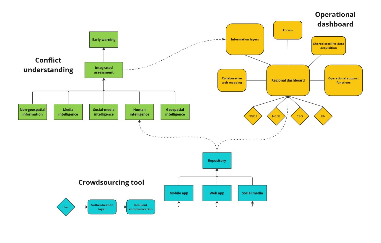
The PeaceEye platform will be divided in three technically standalone but conceptually interrelated components:
-
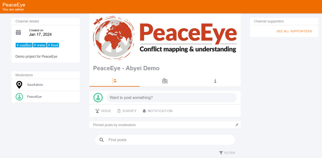
A crowdsourcing component, allowing users on the ground to report geolocated events and trends via different means (progressive web app, mobile app, social media) in a standardised manner. This is already operational due to similar work done in the past by the prime, and now needs to be localised and adapted for use by low-literacy users.
-
A data fusion component for conflict understanding, fusing different data layers including HUMINT from the crowdsourcing component, to output an integrated assessment and derive early warning signs. Media intelligence may be acquired from specialised sources, social-media will be mined by existing internal tools, and non-geospatial information will be extracted via the use of Large-Language Models (LLMs). The consortium has already developed small-scale prototypes for all of these data types.
-
A dashboard component, combining inputs from the other two components in a single view, enriched by different operational functions, and enabling users to collaboratively add geospatial information to a map for the benefits of all. It will be used by NGOs and other field actors to improve their security management and streamline the sharing of information between themselves.
Space Added Value
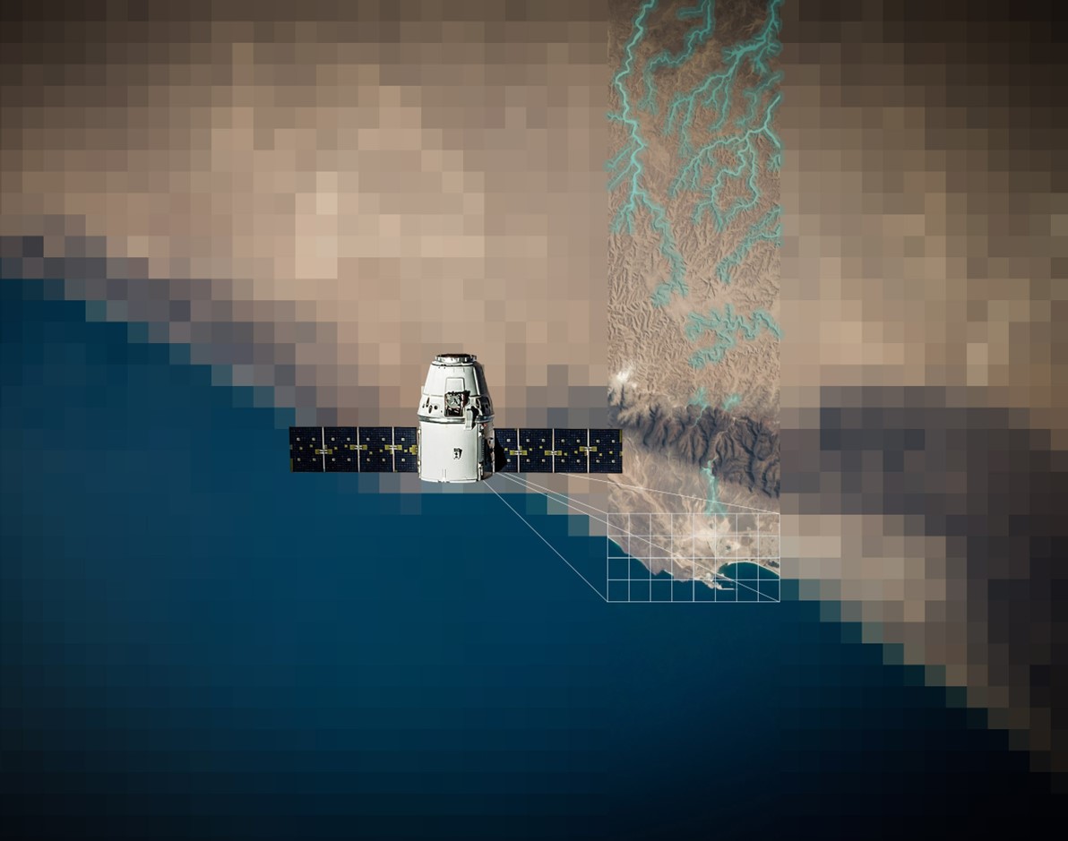
Understanding the spatial component of conflict is critical for operational actors with “boots on the ground”. Earth Observation allows for the remote observation of multiple indicators. This represents a paradigm shift compared to current the current status quo of relying on aggregated social, political and economic analysis, and having at best sparse geolocated information points. Meanwhile, the safe and secure transmission of human intelligence from the field requires advanced telecommunication and navigation technology, in particular when it comes to resilient communications in degraded contexts, which space-based assets are already providing.
Current Status
Across the past months, there have been numerous exchanges with stakeholders and partners across the months of this feasibility, including large international organisations, the Austrian umbrella organisations Globale Verantwortung and its members, and conferences such as the International Digital Security Forum 2023 in Vienna. These repeated exchanges allowed us to rapidly test out new ideas and gather feedback, overall consolidating our proof-of-concept. Some rapid prototyping of these features took place, and emphasis was put on reusing previous work from past university or company projects, such as the current crowdsourcing web app.
As of January 2024, the feasibility study is nearing its end date. The business model, technical feasibility and proof-of-concept are ready, while the business plan and its socio-economic viability analysis remains to be finalised. The consortium will soon propose to move on to a follow-up demonstration project which will include a user workshop in South Sudan.