Objectives of the service
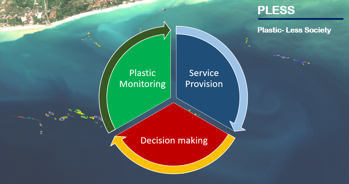
The objective of this study is to assess the technical feasibility and commercial viability of space–based applications in support of reducing environmental impact of marine litter in the form of plastics.
The consortium working on Plastic-Less Society aims to develop services that combine satellite data and oceanographic models to produce added-value information on marine pollution in the form of plastics.
Users and their needs
A distinct set of users / costumers from different segments were engaged in order to collect their requirements and frame the services’ development.
The most relevant requirements identified were:
- Surveying floating marine debris and support to plastic collection actions
- Monitor the discharge of plastic waste in the oceans
- Monitoring of marine debris in port area of interest and provision of early warning in case of potential conflict with identified protection areas
- Legislatively-aligned services to support the administration of the marine plans of regulatory bodies
- Provide information on floating plastic debris around critical infrastructure installations
The users engaged are:
- WWF: https://www.worldwildlife.org
- Mirpuri: https://mirpurifoundation.org
- SeaCleaners: https://www.theseacleaners.org
- DecomNorthSea: https://www.decomnorthsea.com
- PlasticOdissey: https://plasticodyssey.org/en
- The OceanCleanup: https://theoceancleanup.com
- Authority port of Vigo: https://www.apvigo.es/en
- DGRM (DIREÇÃO-GERAL DE RECURSOS NATURAIS, SEGURANÇA E SERVIÇOS MARÍTIMOS) (https://www.dgrm.mm.gov.pt)
- AIRCentre: https://www.aircentre.org
- Plastic Bank: https://plasticbank.com
- ENEL: https://www.enel.com
Service/ system concept
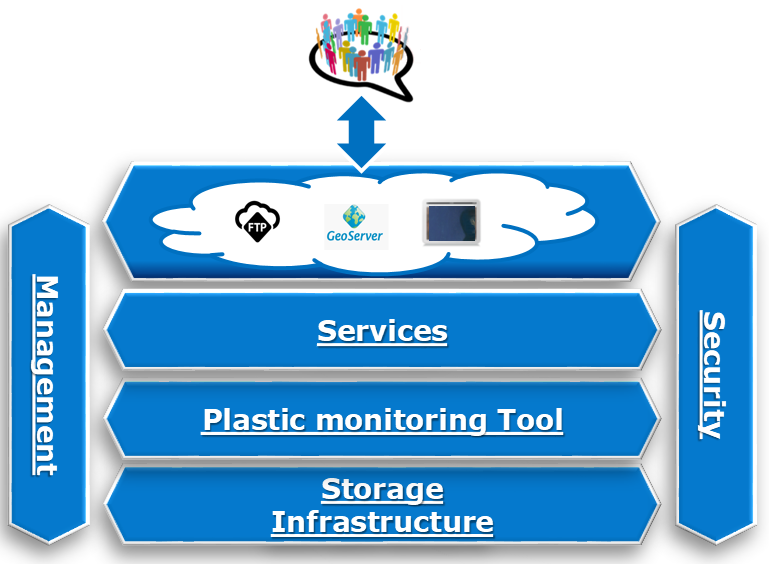
The system will be developed around a plastic monitoring tool that combines satellite data and oceanographic models to produce added-value products for the project users. The users will be able to access the geospatial data through different data providers (Geobrowser, GeoServer or an FTP server).
As stated the plastic monitoring tool (Figure below) combines a detection of marine litter model (using satellite imagery) together with Numerical oceanographically models that will allow having a clear picture about how litter travels over sea surface and which areas are prone to get more contamination due to the so-called convergence (areas where solid elements cannot escape) and, on the contrary, the areas where marine litter is not likely to get accumulated, due to divergence effect (areas where solid elements cannot be trapped).
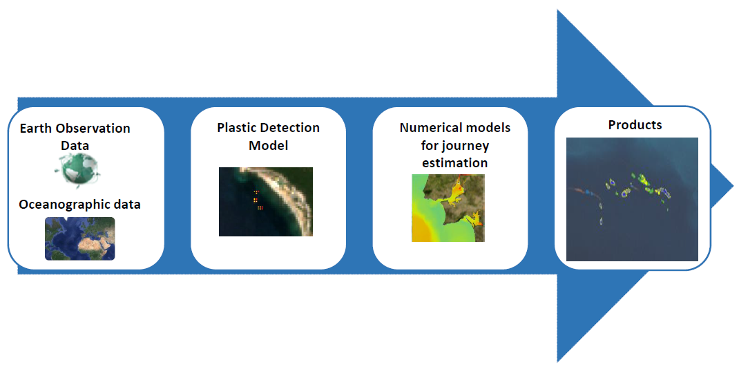
Using the products generated by the monitoring tool will allow the provision of different services based on the user needs:
- Monitoring Services – to provide a continuous monitoring of marine plastic pollution from selected areas and predict short term evolutions (dispersion or concentration) of floating debris.
- Single order request Services - given a specific Area of Interest, locate areas with almost no potential and/or very high potential to concentrate plastic coming from diversified origins.
Two different areas (Port of Vigo and Honduras) that can provide different challenges/conditions to the system were tested.
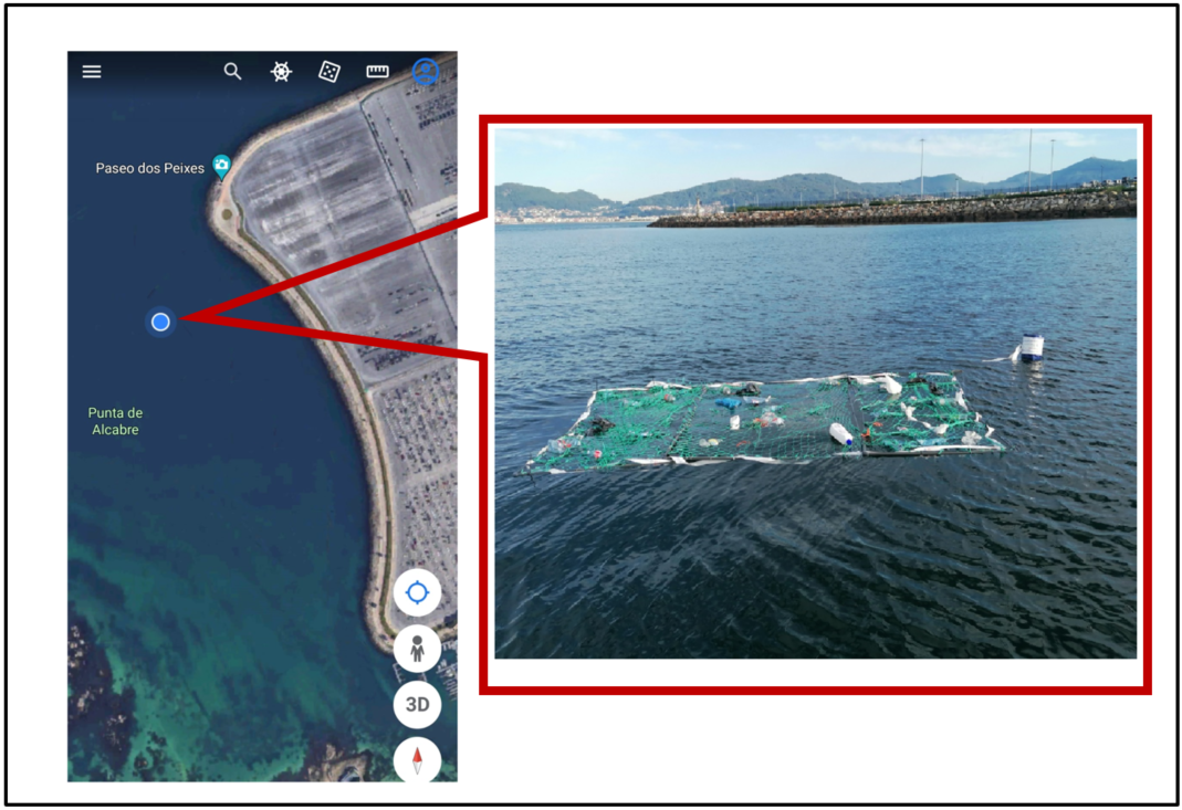
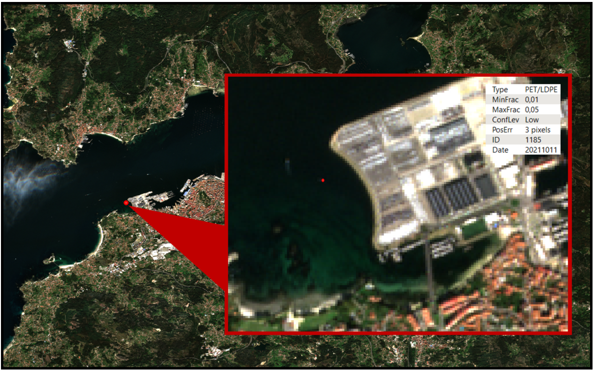
The figures below shows an experiment performed in port of Vigo where an artificial plastic target was placed in the water and the plastic detection tool was able to detect it using a sentinel image acquired.
Space Added Value
This project will run based mainly in Earth Observation imagery, as they offer, in the scope of this project activities, a number of benefits:
- Evidence retrieval that verifies waste journey as well as traceability to the ultimate origin.
- Possibility to generate multispectral compositions from various spectral bands allowing to distinguish the most common types of plastics
- Possibility of temporal analysis, allows monitoring of changes occurring in the places of interest, as well as the ability to analyse data from the past
- Digital image processing allows the production and analysis of results in a fast and automated way
- Reduction of monitoring costs when compared to traditional monitoring methods (e.g. vessel surveys)
Current Status
The consortium achieved the Final Review milestone. The Feasibility Study is nearly completed with users and customers successfully consulted to test the Proof of Concept dataset.
System and services architecture has been tested and the commercial sustainability was analysed which has produced feedback and recommendations, which could be built into an upcoming Demonstration Project and furthermore into deployment of a sustainable operational services.


