Objectives of the service
The PLESS demonstration project aims to further develop Earth Observation-based services and assess their commercial viability for detecting floating marine plastics, thereby supporting efforts to reduce the environmental impact of marine litter.
The consortium behind Plastic-Less Society is enhancing services focused on marine pollution by combining satellite data with oceanographic models to generate added-value information on plastic pollution at sea.
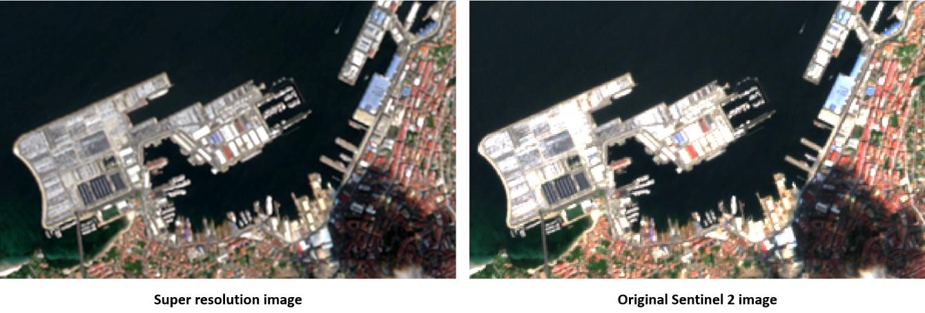
Current developments are centred on implementing a super-resolution algorithm to improve the spatial resolution of Sentinel-2 imagery, with the ultimate goal of enhancing the project’s ability to detect marine plastics more effectively.
Users and their needs
A distinct set of users and customers from various sectors has been engaged to support the consolidation of requirements, which are now guiding the tailored development of the services.
The most relevant user needs identified include:
-
Surveying floating marine debris and supporting plastic collection initiatives
-
Monitoring marine plastics in port areas and establishing early warning systems
-
Assessing the environmental condition of areas of interest (e.g., tourist destinations, protected zones)
-
Determining the origin and potential destination of floating marine plastics
-
Identifying areas prone to the accumulation of floating plastic debris
The engaged users come from Portugal, Spain, and Argentina—covering both sides of the Atlantic Ocean:
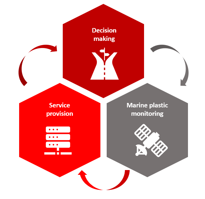
Service/ system concept
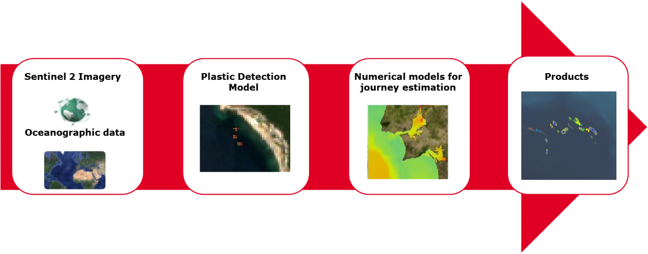
The PLESS demonstration project builds on an Earth Observation (EO)-based marine plastic identification service that GMV has been developing over the past few years. The PLESS service integrates satellite data, ground-truth observations, and oceanographic models to generate value-added products tailored to the needs of the project’s users.
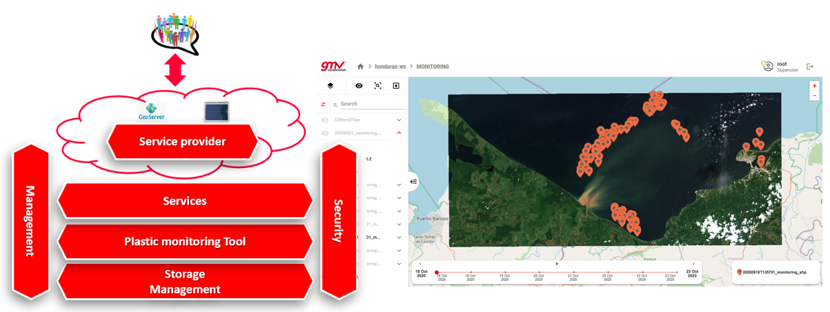
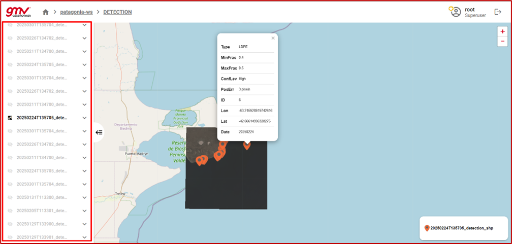
In addition, the PLESS services are being implemented in an a Geobrowser to which the project users have access, and that allows them, in a fully autonomous way, to request and get access to the outputs of the project services.
The PLESS services are:
-
Marine Plastic Detection based on satellite data - providing continuous monitoring of floating marine plastics on users’ selected areas of interest (image below)
-
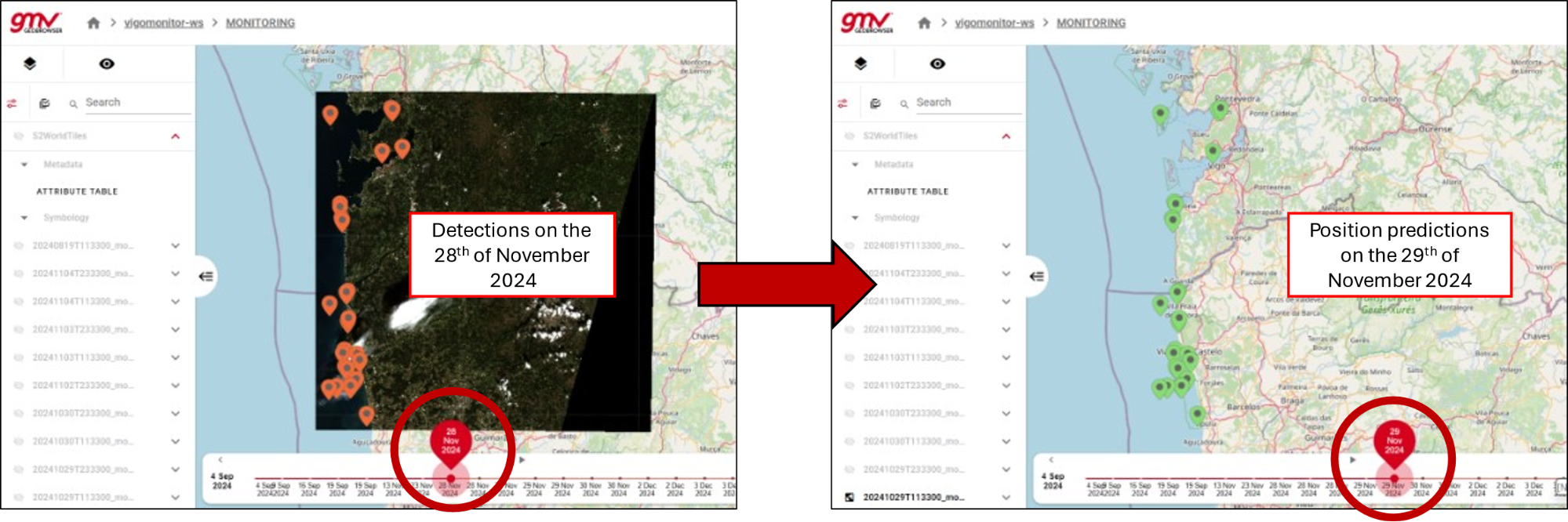
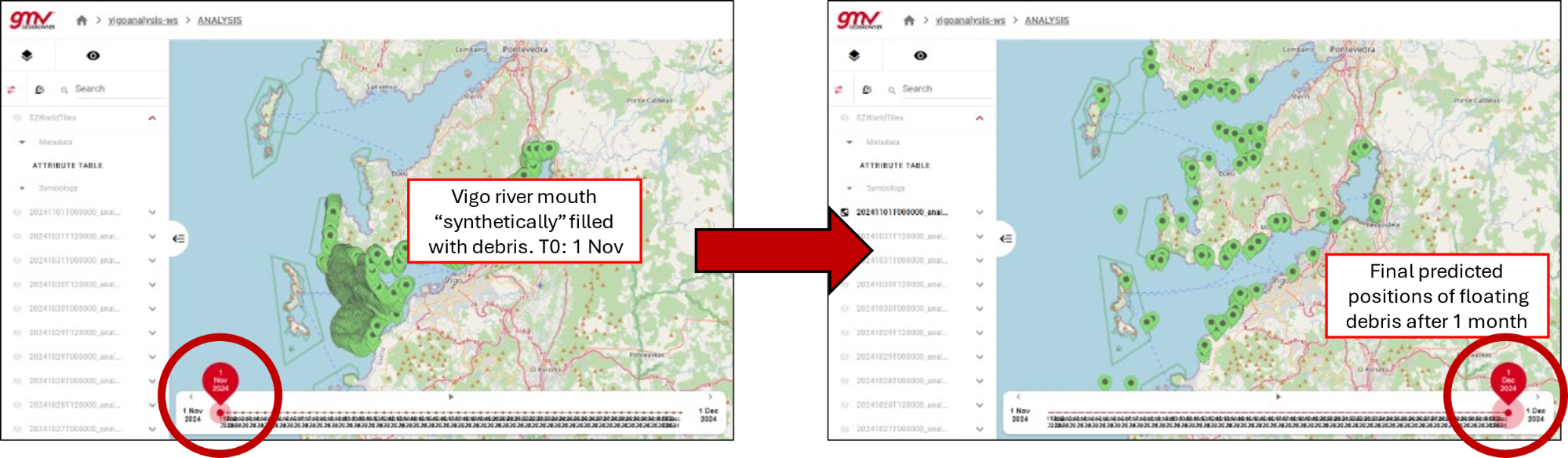
Marine Plastic Tracking based on detection service - providing continuous monitoring of floating marine plastics on users’ selected areas of interest together with ocean circulation models, aiming to understand where plastics are headed and where they can come from (image below)
-
Single order request service - to identify areas prone / not prone for floating marine plastics accumulation (image below)
These services are leveraged by a service chain (image below) that has been developed by GMV, which combines various types of data (earth observation imagery, ground truth data, ocean circulation models) to output the location of patches of marine floating plastics
Space Added Value
This project is built upon Sentinel-2 imagery, which offers several key advantages:
-
Multispectral capability: Enables the generation of composite images using various spectral bands, allowing for the identification of the most common types of plastics.
-
Temporal analysis: Facilitates the monitoring of changes over time in areas of interest and provides the ability to analyse historical data.
-
Automated digital processing: Supports rapid and automated production and analysis of results.
-
Cost-effective monitoring: Significantly reduces monitoring costs compared to traditional methods (e.g. vessel-based surveys), particularly as the project relies solely on freely available Sentinel-2 data.
Current Status
The project has now reached its Final Review stage, marking the conclusion of the pilot phase.
During these final stages, both Service 2 and Service 3 were tested by the Port Authority of Vigo (see Figures 2 and 3), offering additional insights into marine pollution dynamics in the area.
Furthermore, super-resolution images were generated for all users. In the final stages of the project, these enhanced images—such as the one shown in Figure 5 for the Vigo port area—were used for presenting all detections, replacing the original Sentinel-2 imagery.
A final mention goes to the PLESS DEMO Geobrowser, which proved to be an essential component of the project by facilitating access to, use of, and management of geospatial data for non-expert users across the various project stakeholders.