
Objectives of the service
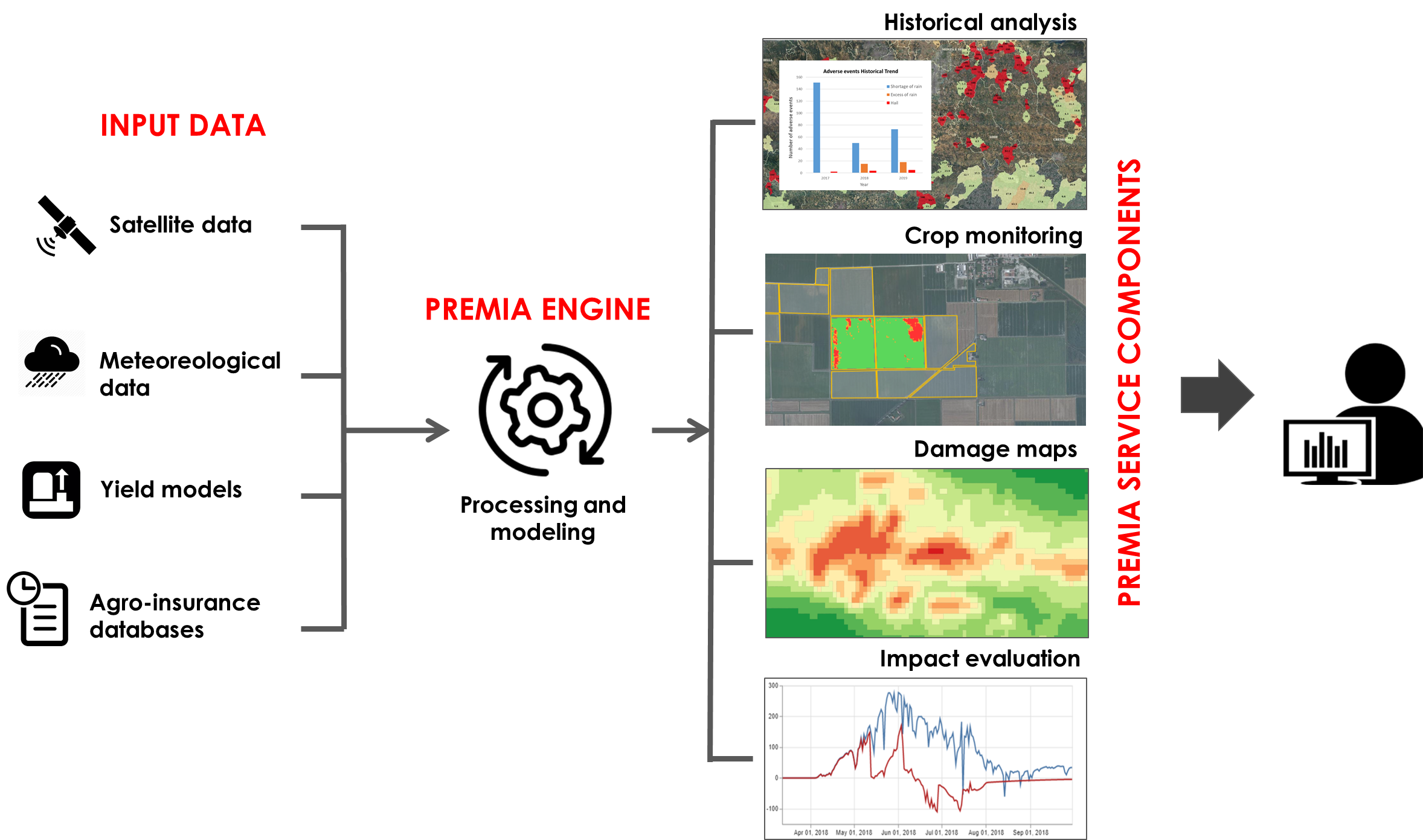
The overall objective of PREMIA is to set up and demonstrate the technical and operational potential of specific services able to support risk management and insurance activities. This has been achieved through the development of a prototype new service platform. The platform is easily accessible through a web interface and supplies specific services based on the integration between Earth Observation (EO) data and other relevant datasets (such as meteorological and other ancillary geo-data) to provide new contents and innovative information able to optimize the risk management and insurance activities and support innovative insurance products.
Users and their needs
The objective of PREMIA is the provision of operational services for agriculture risk management and insurance market, addressed to all key players in the risk management industry (from insurance local players to national authorities), through a dedicated service platform. The platform easily accessible through a web interface, supplies innovative services based on the integration among EO data and other relevant datasets. Leveraging on Copernicus data availability, the common target for all the services is to improve the assessment of indicators, maps, parameters relevant for the historical analysis and monitoring of crop status enabling the provision of pre- and post-damage services. The services developed increase the available information for risk estimation also in areas without historical insurance data and allow to couple these information with already existing data not available at geographic level.
Service/ system concept
The PREMIA product portfolio is based on two categories of services accessible through the PREMIA platform, according to the user selection:
-
Risk assessment support services:
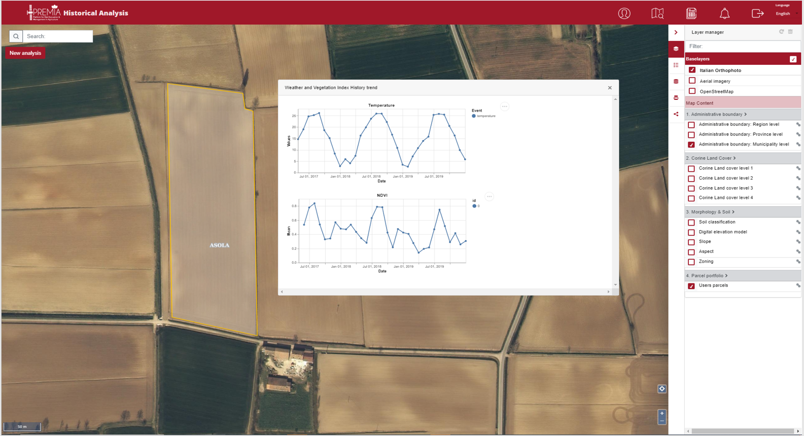
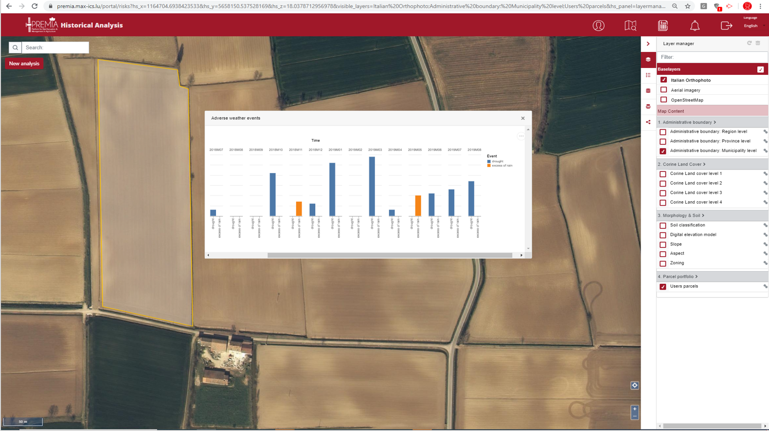
PSC1 - Historical analysis: the service provides heterogeneous historical information over a specific area, by selecting the following ‘buttons’:
-
Weather and Vegetation Indices History trend
-
Adverse weather events
-
Site characterization
-
Yield stats
-
Policy stats
-
Damage stats
-
Crop failure
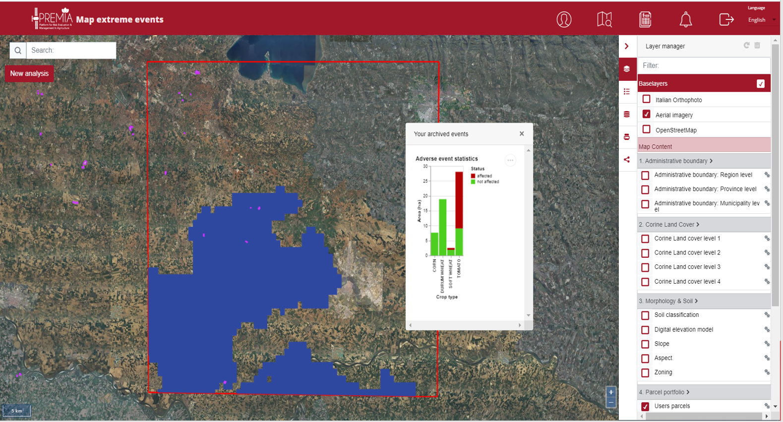
In the picture, an example of Historical Analysis selecting the “Weather and Vegetation Indices History trend” (1) and “Adve
rse weather events” (2) choice for a given parcel in Northern of Italy (yellow contour), enriched by context information, provided by selectable layers.
-
Damage assessment support services:
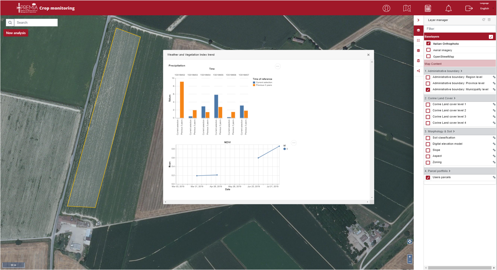
PSC2 - Crop monitoring: Analysis of weather conditions and spectral features during crop growth, with provision of indices for enhancing crop status of the season with the previous 5 seasons and individuate possible crop loss at an early stage. The following sub-services are selectable:
-
Weather and Vegetation Index Trends
-
Inter-field analysis
-
Yield analysis
PSC3 - Extreme weather event extent map - Map of the extension of the extreme weather events, with identification of affected agricultural parcels or part of them. The following sub-services are selectable:
-
New event
-
“Your events” archive
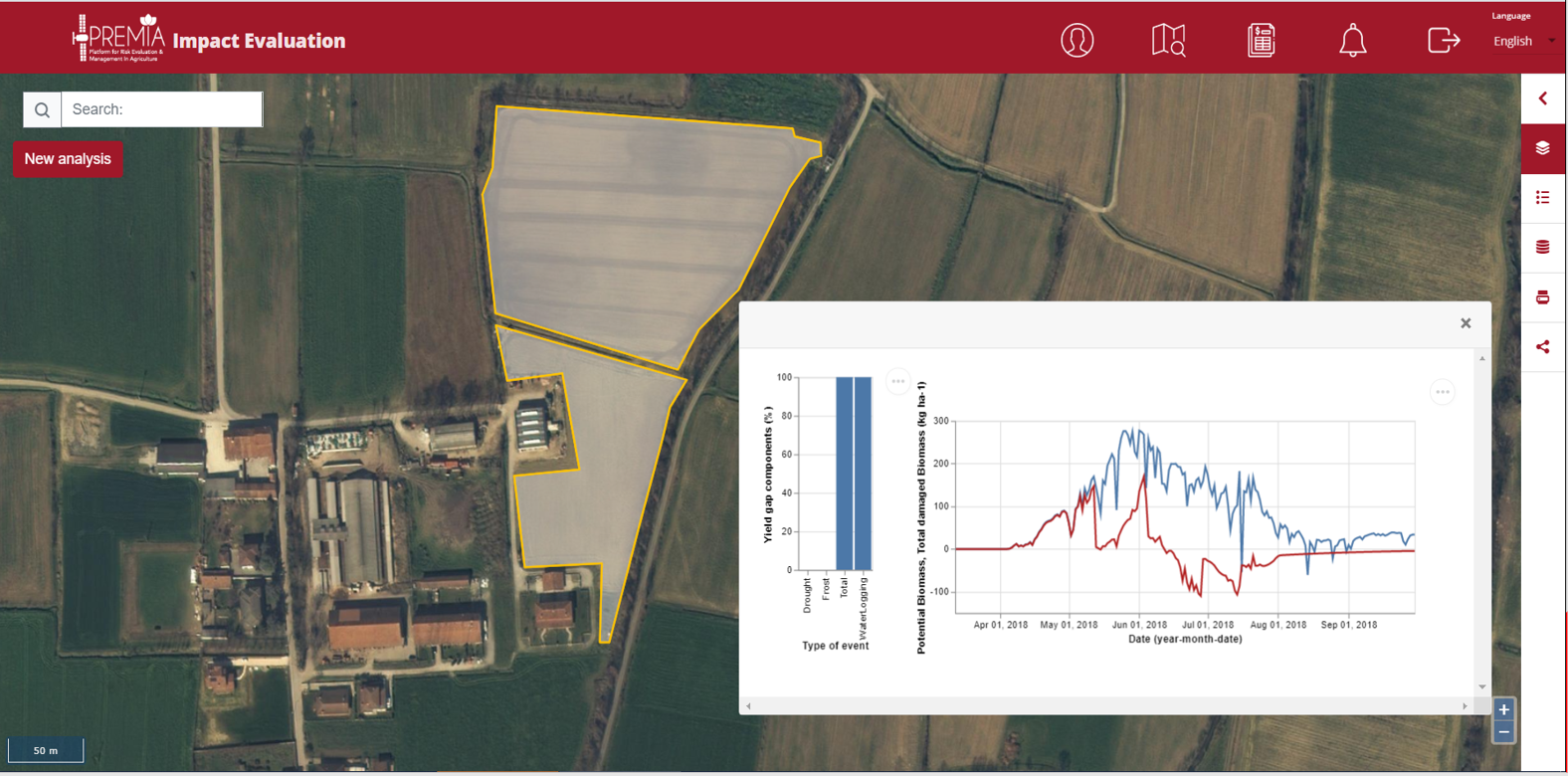
PSC4 - Crop extreme event impact evaluation - Identification of possible crop yield losses on agricultural parcel following the extreme weather event.
Space Added Value
Each Service Component is based on the provision of pure information extracted by processing data from Earth Observation satellites together with other ancillary information, avoiding the interaction of end users with images and their processing. Therefore, the approach is not based on the provision of satellite data or products, but on the provision of an information service in support to end users’ workflow.
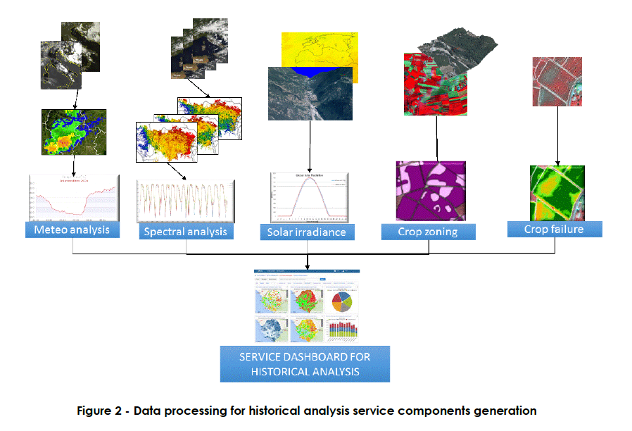
The previous image is a sample of space assets for historical analysis.
Credits: e-Geos
Current Status
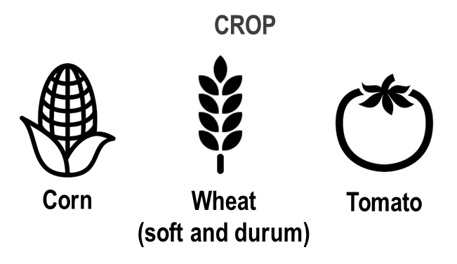
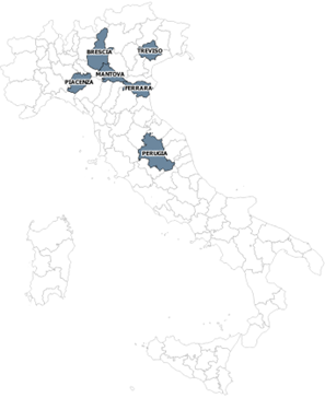
The pre-operational PREMIA platform has been demonstrated on 6 Italian Provinces and in a selected area in the Czech Republic, for 3 crops: wheat, corn and tomato.
Crop parcels over which demonstrate Service Components were distributed in these areas.
PREMIA project has demonstrated the technical and economic feasibility of the service portfolio to be provided through the PREMIA System.
The services are quite consolidated and can be enhanced further, by:
-
including more crop types and yield modeling
-
scaling the services to a wider European coverage
-
using the best meteo information available to better identify the size of impacting events (e.g. hail, flood, etc.).
-
using commercial EO data for a better spatial details and timeliness, assuming their costs as additional to the service fees presented.
Further push is ongoing to disseminate results, through the widening the customers network and involving them in webinar and direct presentation.