
Objectives of the service
Ground deformation poses a hidden risk to our environment. Differential settlement can damage infrastructure and real estate, while land subsidence can increase flood risks. Over the past years, InSAR technology has unveiled this hidden threat by mapping surface deformation with millimeter precision over large areas. However, even 30 years after its introduction, the uptake of InSAR data remains limited.
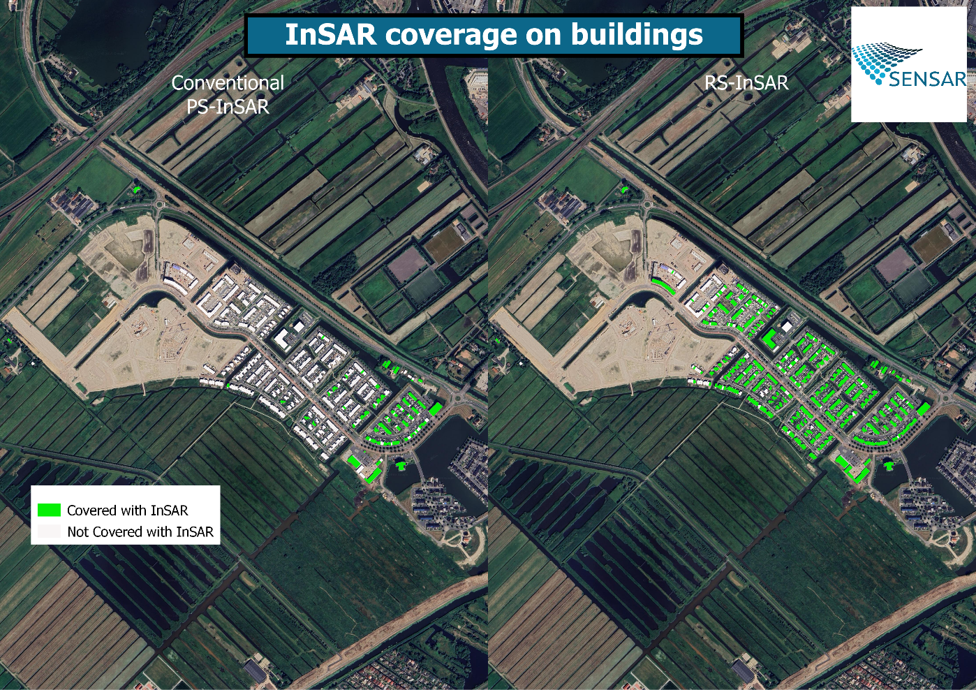
A significant reason for this limitation is that InSAR requires a static scene. Conventional PS-InSAR relies on 'persistent scatterers (PS)': stable and consistent reflections over time. Yet, in an ever-changing world, nothing remains persistent forever. In a typical city, PS-InSAR loses about 7% of PS measurements per year, resulting in only 50% of the original PS measurement density after nine years. Locations with new infrastructure or significant ground activity remain uncovered.
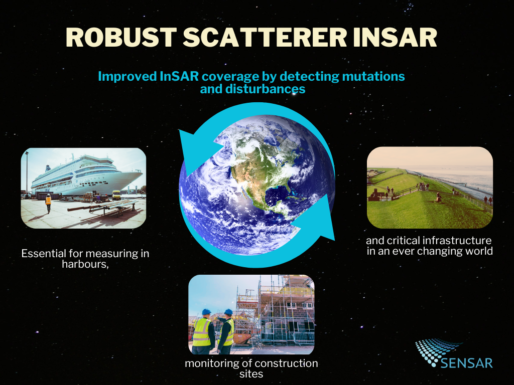
In this project, we challenged the assumption of persistency by integrating mutation detection into the processing chain. We refer to these as 'Robust Scatterers,' which can be temporarily persistent. This approach leads to unprecedented data coverage in dynamic scenes, such as harbors and construction sites, and also accounts for solar panels on houses and traffic jams on highways.
Users and their needs
The RS-InSAR service is developed with and for users that are dealing with risks resulting from ground deformation, typically consisting of domain experts such as asset managers, civil engineers or policy makers. The InSAR-technology is employed in monitoring of natural resource extraction, civil infrastructure, natural hazards and general land subsidence. Users are triggered by the fact that InSAR allows for frequent and precise monitoring of wide areas and, with an existing archive, allows for a retrospective analysis.
Yet, the biggest fear of an asset manager is not a high risk, but an unknown risk. Therefore, the effectiveness of using InSAR for monitoring depends entirely on the coverage of the user's assets. Uncovered assets or objects require additional means to be monitored, there by hindering the uptake of conventional PS-InSAR as a monitoring tool for many users world-wide.
RS-InSAR can become a game-changer for areas which are subject to mutations on the ground. For instance, ship detection for quay wall monitoring or construction site monitoring by detecting new build-ups.
Service/ system concept
With RS-InSAR, users will have insight into surface deformation in dynamic areas. RS-InSAR will automatically detect ground disturbances or new build-ups, thereby adjusting the algorithms to a changing scene. This will increase data coverage for dynamic scenes. The raw measurement points are converted to easy-to-use products that provide insight rather than an overload of data. Additionally, users can see locations that were subject to change.
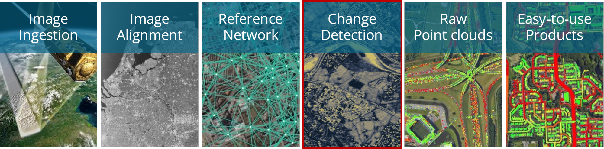
The detection of mutations is done by a data-fusion of temporal and spatial detections. The algorithms are able to adjust to various kinds of scenes by employing machine learning and artificial intelligence techniques.
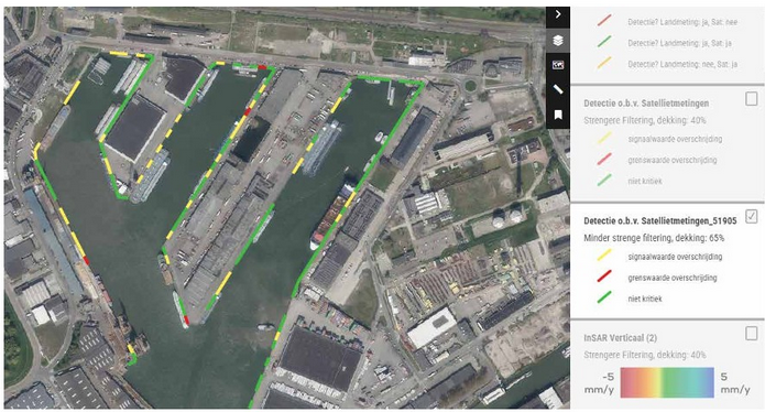
In the Port of Rotterdam, the RS-InSAR technology allows for monitoring quay walls that are occupied up to 90% of the time, meaning only 1 out of 10 SAR-acquisition can be used.
Space Added Value
RS-InSAR utilizes SAR data acquired from spaceborne radar instruments. Typical satellites used include Sentinel-1, RadarSAT-2, and TerraSAR-X. A crucial condition is the use of a stack of images to achieve sufficient precision, preferably covering multiple years.
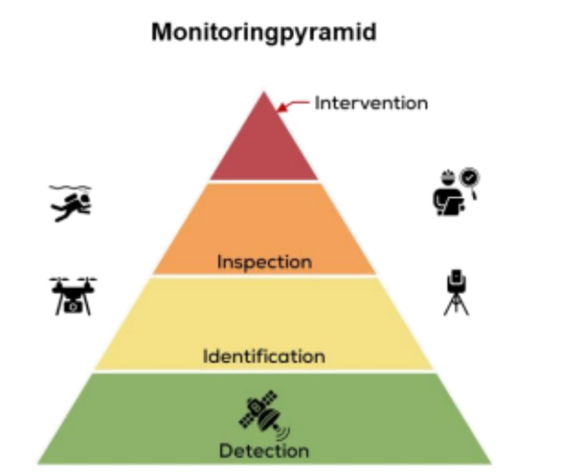
Satellite-based monitoring has the potential to enhance the efficiency of conventional resources, such as in-situ surveys and inspections, rather than replace them. Since satellite imaging does not interfere with ground activities and requires no physical presence, it can serve as the backbone of a monitoring pyramid, facilitating follow-ups. Conventional monitoring resources are generally small-scale, reactive, and require locations of interest to be blocked to perform measurements. However, these conventional resources are often essential for verifying risks and gaining a deeper understanding of the root cause.
By employing large-scale satellite observations to prioritize the deployment of more localized measurements and inspections, a risk-driven monitoring strategy can be achieved without blind spots.
Current Status
The current status section should be updated when major project events are passed e.g. FAT test, SAT test.
RS-InSAR has been successfully demonstrated in 6 pilots with various use-cases and is ready for market introduction. The technology is already integrated into the Sensar processing platform and ready to serve the market.
Prime Contractor(s)