

Objectives of the service
The final product is the web-based service with full support to help the clients with necessary data acquisition, data processing, analysis and reporting.
Users and their needs
The key user segments targeted by our product are institutions related to environmental monitoring.
The main actual problem is the lack of a unified approach to research and a system enabling long-term monitoring and structured data storage. It is important that the input data is reliable and that its interpretation and analysis are correct. Automatic work tools are essential to improve the work of government institutions and researchers who carry out research. The obtained data have to be consistent and harmonized, which will facilitate comparative analysis and the use of data in the future.
The key innovation point for the costumer is a new approach method in the case of use the satellite data for monitoring the spatial change of the sand Island on the rivers. This method and product approach gives the final users an easy and friendly way to use the web base service, cost-safe and time consumption to fulfil the obligatory tasks.
Service/ system concept
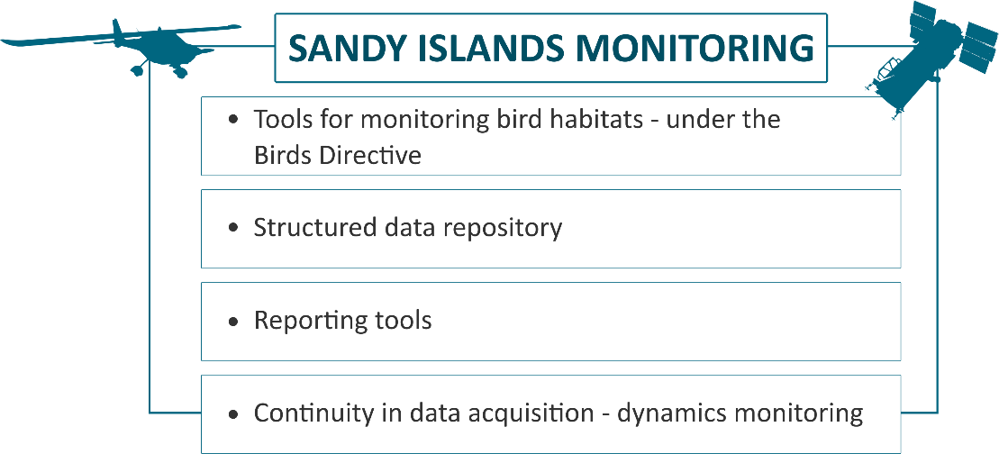
This SBWS service consists of the following segments:
-
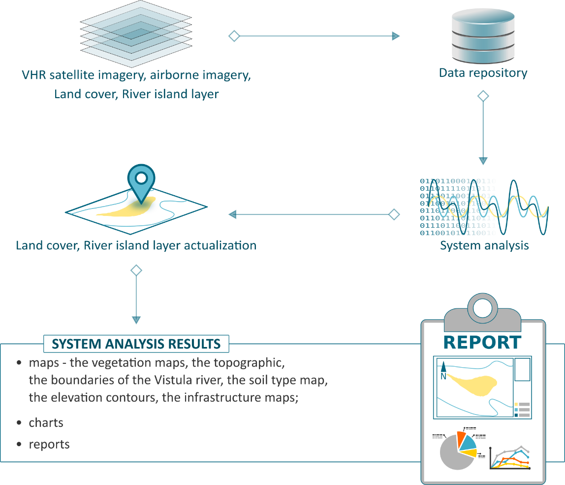
EO Data repository – storing all the collected remote sensing data
-
Metadata server – Provide complete information about spatial data
-
Spatial data repository – storing the data collected during the field measurements by the end users
-
Access security – permission access to the service (rules, levels etc.)
-
Analytic tools – the set of the toolbox that let the users to fulfil the obligatory task regarding the Bird Directive.
-
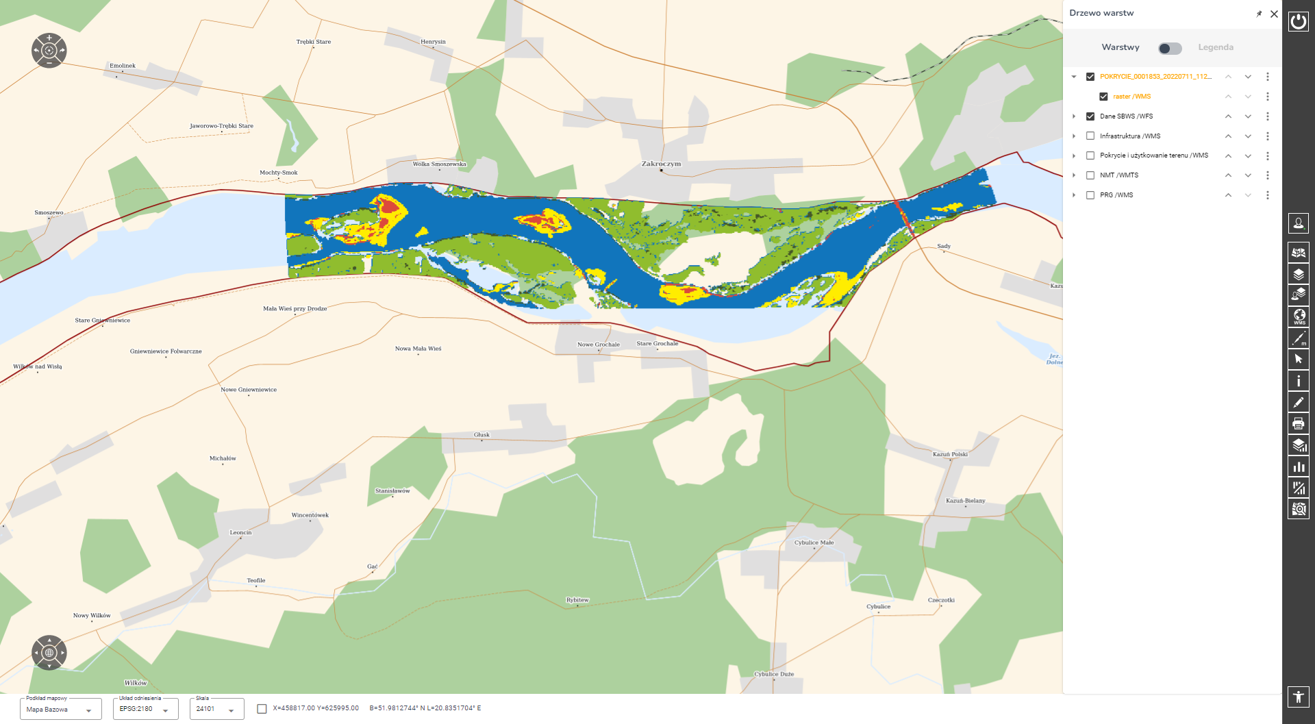
WEB Client – web interface for the end users
Apart the up to date satellite collection data and potential aerial images the service stores the processing analytics maps and statistics, ancillary data. Those solution keeps in a easy to use way all the spatial information regarding the Birds habitats.
The end product is designed as a web service with automated monitoring of the dynamics and distribution of sandy islands, landfills and shoals in the river current for the purposes of protecting the breeding habitats of protected bird species. The end user has an access to a portal where the results of the analysis are presented (including the current ranges of potential breeding habitats) and tools for searching, navigation, data visualization and analysis are available. The system can be equipped with additional analyzes based on external data processing algorithms choosed or provided by Client.
Space Added Value
Mainly the satellite imagery was used, but database was also supported by aerial photogrammetric images, registered in 4 spectral channels (RGB and NIR).
Aerial photos can be obtained directly by SmallGIS, thanks to having an air base (3 ultralight planes) and appropriate sensors (RGB NIR, Hyperspectral VNIR and SWIR cameras, LiDAR).
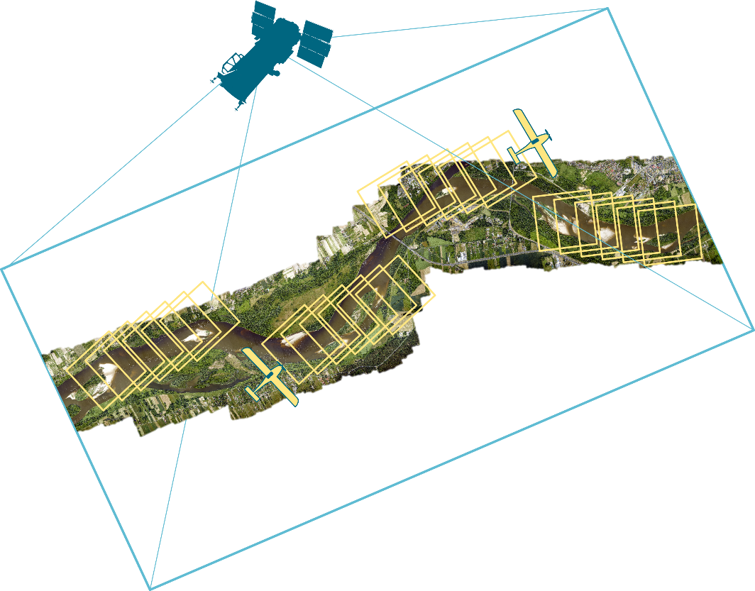
Collecting Data. Image credit: SmallGIS, Project : SBWS
Current Status
The project started in April 2021 and has been completed in March 2023. The final service has been finished and released to the users in February 2023.
At the current stage, the Pilot user uses the system during a number of administrative procedures and, above all, as part of the management and supervision of protected areas, including planning activities in the field of active protection.
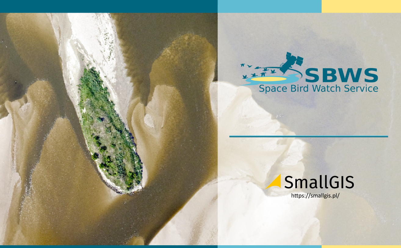
Image credit : SmallGIS, project SBWS