Objectives of the service

Water is one of the most precious commodities we have, and it is fundamental to human and societal needs for good living. With the effects of climate change and an ever-growing global population, the pressure on the water resources has increased dramatically in recent years. Even in countries like the UK, where rain and hence water resources never seemed at a shortage, a severe drought like experienced in 2018 can cause issues with water supply and distribution consistency.
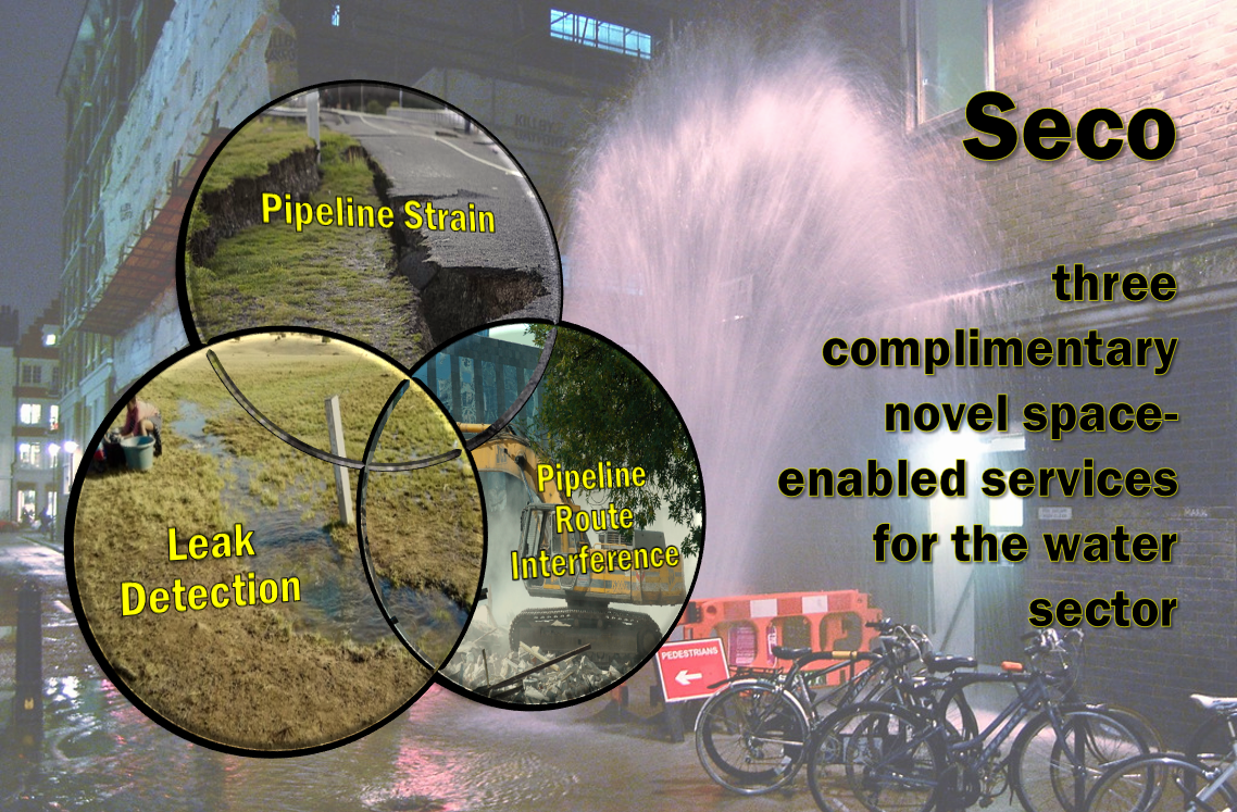
Space for clean and safe management of Pipelines Water Leakage using satellite data to provide new services, or simply SECO, is the provision of services to the water industry utilising the benefits that satellite technology can give in remotely monitoring assets.
SECO service objectives are as follows:
- Identify leaks that would otherwise go unnoticed with wide service coverage
- Improve accuracy of water leak detection via independent methods (radar and optical)
- Reduce size of leak-finding teams
- Identify critical areas subject to changes including higher risk ground motion behaviours
- Prioritising water leak locations via an alert system
- Optimising use of expensive acoustic leak detection devices
- Reducing size of leak-finding teams
Users and their needs
The proposed services aim to deliver better informed and effective protective services than are available today by:
- Providing water companies a service into their operational framework for managing their strategic water leak reduction targets at or above 15% by 2025 (OFWAT).
- Allowing focused infrastructure upgrades based on greatest needs prioritisation, hence better management of maintenance cost and capital investments.
During the project, 7 water companies and 3 in sector provider engineering companies collaborated and provided support. They are as follows:
Water corporations: There are over 20 different water corporations in England and Wales, looking after fresh water supply and in some cases also incorporating wastewater services. Following the water industry act of 1991, most have been privatised. In Scotland and Northern Ireland, they still exist as state services and are run by the regional government. These companies needs are focused on: minimise their water losses; finding leaks faster; better coordinate response teams; identify small / hidden leaks and prevent leakage.
Engineering companies: Water companies may be responsible for running and upkeep of a water pipeline network but the initial construction, upgrades, and even maintenance, is often carried out by ground construction / engineering companies. Their main needs are as follows: identify leakage zones and better coordinate response teams; act as an in-sector provider of this service.
Additional stakeholders: Regulators (Ofwat), Government Agencies and Consumers.
Service/ system concept
Service A-PSS: Pipeline strain service
Intended as a preventative maintenance service, this element focuses on an EO-derived parameter of strain - differential ground movement - that can be detected and observed on a section of pipeline using satellite data (PSP-IfSAR derived from SAR data). The output of this service is the identification of areas of dynamical risk for the pipeline network using Point Behavioural Cluster Analysis of InSAR data for long periods.
Service B-PIS: Pipeline interference service
Also intended as a preventative maintenance service, this focuses on identifying interference and/or encroachment along the pipeline route, based on use of change detection methodologies applied to satellite imagery. This is an ongoing monitoring activity involving both SAR and optical imagery derived detection algorithms, independent of each other, but complimentary. The service will deliver an integrated radar and optical change detection dataset indicating areas with significant structural changes.
Service C-PLS: Pipeline leak detection service
Intended as a targeted repair service, this utilises two independent detection mechanisms: optical imaging to detect anomalies in vegetation vigour, and SAR to detect anomalies in soil moisture, both along known water supply pipeline routes. SAR enhances the visibility / exposure of the potential leakages regardless of the cloud cover and time of the day thus ensuring visibility all year round. Optical data can be collected at higher spatial resolution than SAR thus giving an advantage in busier (e.g. urban) environments. The output of this service is an integrated radar/optical datasets of identified soil moisture and vegetation anomalies that might be caused by water leaks in close proximity to the pipeline network.
Service D: risk map
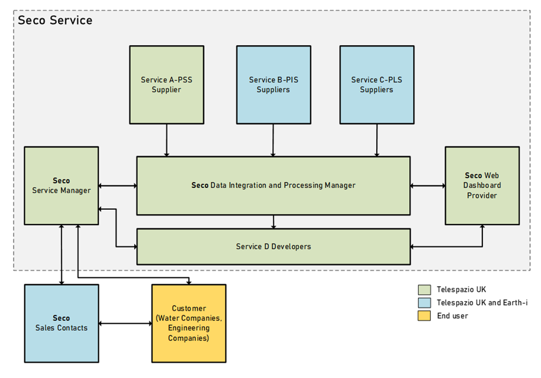
A Data Integration and processing module ingests the outputs of the three services and other datasets to trigger alerts according to specific criteria determined with the end users. The data is stored within a database for delivery via the web dashboard or API depending on the customer.
The following graphic shows the SECO service:

Space Added Value
The following SatEO data are used:
Radar
- COSMO-SkyMed satellite constellation. High Resolution Stripmap Himage (40x40km, 3m resolution) mode.
- Sentinel-1 mission. The data to use is the Interferometric Wide Swath (IW) mode. The orbit has a 12-day repeat cycle.
- JAXA ALOS-2 PALSAR-2: L-band SAR data is acquired in 6 m Stripmap with full polarisation. Temporal resolution ~48 days.
- SAOCOM constellation: consists of two L-band SAR satellites. The best spatial resolution available is Stripmap at < 10 m and critically the constellation has a revisit time of 8 days.
Optical
- Copernicus Sentinel-2 mission: Multi-spectral data is collected across 13 bands - of which, the 10m visible and near-infrared parts of the spectrum are of main interest.
- Planet optical imagery: Planet’s constellation of satellites orbit the poles every 90 minutes to provide continuous high-resolution imagery in visible and near-infrared (3m - 5m). Access to information: no need to visit to identify problem area; non-invasive technology especially important in areas of difficult access.
As a space based technology, SECO has a number of advantages:
- Wide area coverage; one satellite image can cover all or most of the pipeline network and makes hence more efficient than other practices like airborne or drone sensors or in-situ methodologies;
- Continuous remote monitoring: high repeat potential especially with optical satellite coverage as it happens almost daily;
- Complimentary & combined use of radar and optical satellite data. The SAR data is acquired regardless of the cloud cover or time of the day ensuring visibility all year round. Optical data can be collected at high resolution and more frequently than SAR giving an advantage in smaller scale manifestations of water leaks and/or to identify when a leak started and stopped;
- Accuracy improvement: Independent mechanisms to detect leakages, from optical measuring vegetation vigor, and SAR by measurement of soil moisture. Reducing false positives and negatives (opposing answered from both solutions), increasing visibility (observed in one method but no data from the other), or highest accuracy (observed by both methods);
- Identification of critical areas of pipeline strain by identifying critical ground behaviours in sections of the pipeline network;
- Greater range of change types can be detected as independent detection mechanisms with optical and radar datasets.
Current Status
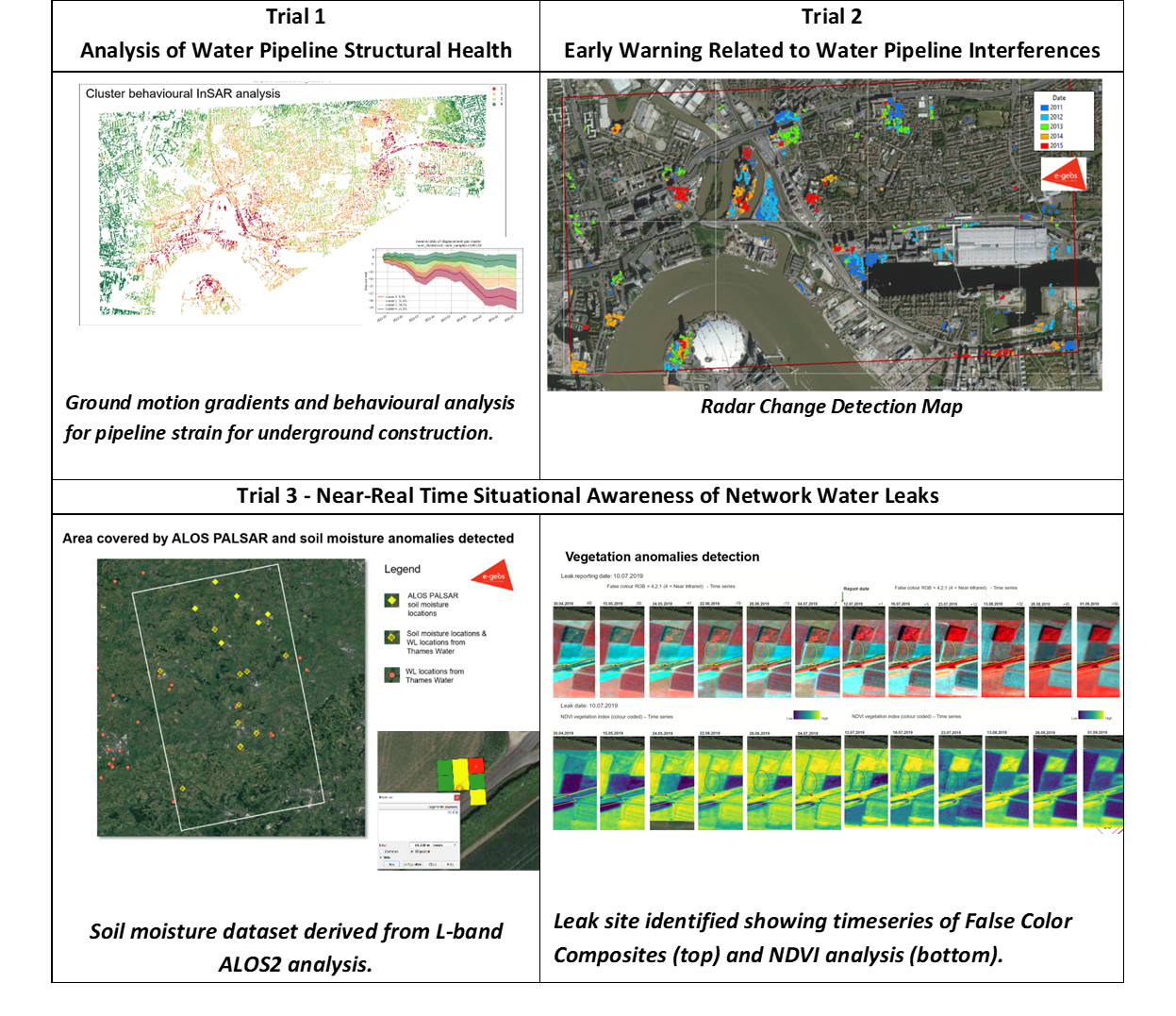
The three proposed services are illustrated in the figures below showing actual case study examples by the participating companies as a proof of concept.

The feasibility study has now been successfully completed. The roadmap is a transition into a demonstration project for development of the SECO service and implementation via a pilot. There are three water companies interested in supporting this new phase to allow a future implementation of SECO into operations.
Prime Contractor(s)
Subcontractor(s)


