
Objectives of the service
The service offers seamless information with the aim of working more efficiently and more securely. While in transit either field teams or logistic operators benefit from the latest information in order to assist them to make informed decisions impacting their mobility. Whilst on site the service enables to share insights throughout the community involved in the operation. With the operation being handling a fire, intervene at an incident, ensuring that goods can be shipped in time,…The increase in efficient communication and a shared understanding between the various teams is achieved through an intuitive access of information. This improves operational elements like safety and efficiency, which reduces wastes in time, resources and pollutants related to travel and transportation.
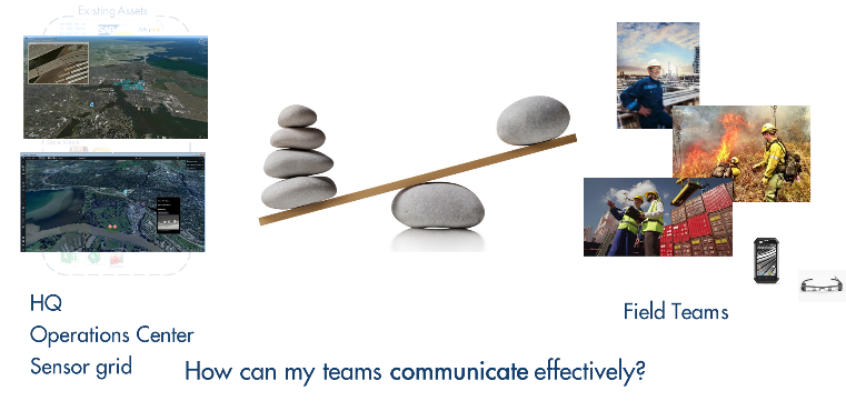
Users and their needs
The proposed service is used by two types of users:
1. Operation managers coordinating the field teams (in dispatch centres or control rooms). The Operation managers can quickly get an overview of the situation by receiving the most recent and relevant information, and rapidly take the decisions and communicate these that best suit the current situation.
2. Field teams, who will rely on mobile apps which are part of the service. Through the location of the teams context-aware information can be provided either manually or triggered automatically by the service. The context-aware aspect is essential in order to provide the right information combining the field staff’s perspective and the organisation’s imperative.
Initial users are 1st responders (firefighters, ambulance, Red Cross,..)
Belgium, Greece
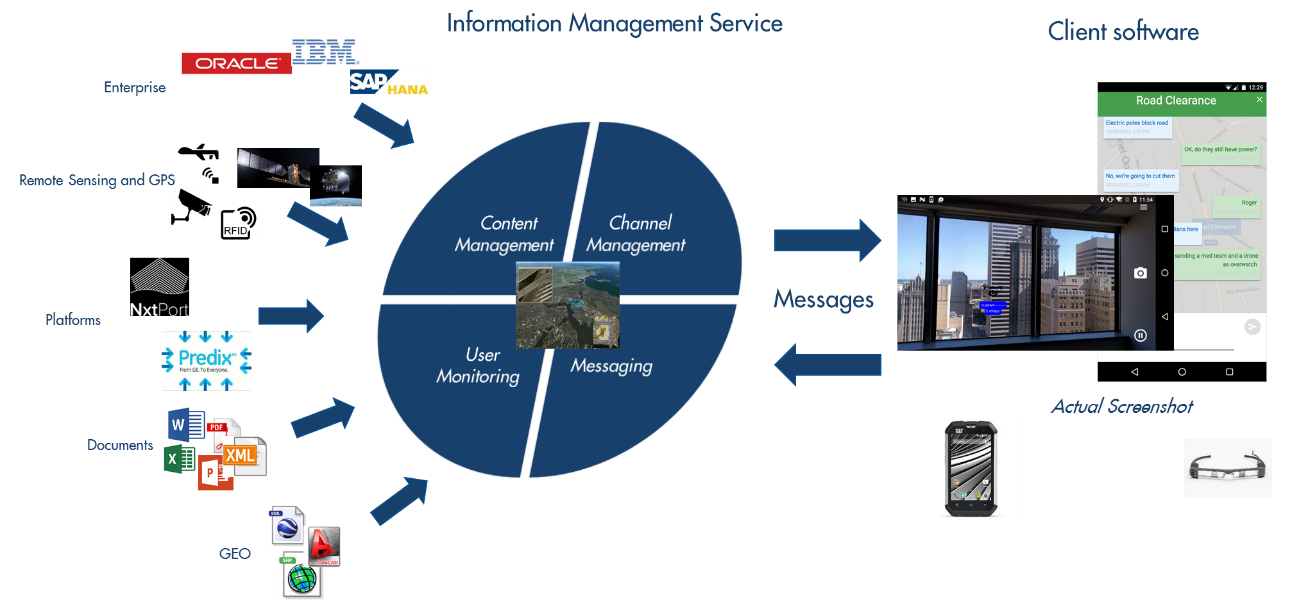
Service/ system concept
The solution is designed as a plug-in platform such that new sensors and data can be easily plugged in. The data collected related to the communication and the location enables to create user profiles which can be used to optimize operations (context aware information channels) and feed into the predictive analytics module.
Having collected all this data, it can be used for further analysis purposes (what happened and why) in particular adding contextual information such as the weather at the time of operations, or the traffic density, or delays. Herewith the service enters into the domain of AI and predictive operational management. One of the outcomes is optimal movement of people and assets, reducing the Co2 footprint and optimising time spent.
Space Added Value
Navigation (GPS, Galileo,): Clearly in view of the proposed solution having access to highly accurate and reliable positioning is critically important. Moreover insufficient availability of satellite coverage will put an extra strain on battery consumption. The more accurate the position, the more relevant data can be provided to the field teams
Weather: Weather data in the context of this services is used in the analysis module to (1) audit what happened during an operation and how it was impacted by weather (2) use as a parameter to look for patterns in operational execution (i.e. if the wind is like that and it rains, then….).
SAR data (Sentinel 1): SAR data is ideal for doing change detection (high vertical resolution). The change detection is used as basis for anomaly detection. For instance at a large facility such as a port or oil facility. This feeds into the platform as an alert which can be shared with the right teams (security, maintenance,). Derive obstacle and building footprint and height. s
EO (Sentinel 2): Visual products are mostly used a contextual backdrop, feature extraction, and geo-positioning building blue prints.
Current Status
Currently a Kick-start feasibility study has been completed, and preparations are underway for a Demonstator/Pilot project.