

Objectives of the service
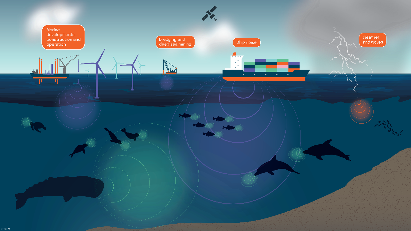
Image credit: HR Wallingford, Project: SEUSS
Construction and operation of marine developments can generate underwater sound which may be harmful to marine live. Underwater sound modelling is an important part of Environmental impact assessments (EAIs) which are carried out to minimise the impact on marine live. SEUSS is a new generation of commercial underwater sound modelling services, incorporating two satellite-enabled enhancements: satellite Automatic Identification System (AIS) services to generate accurate, localised background noise data from ship positions; and satellite observed weather services to infer underwater sound from sea conditions.
Users and their needs
The main user community are regulators and contractors working for the mining, dredging and offshore windfarm industry but are not limited to those. Their needs are improved accuracy of underwater sound modelling and correctly apportioned sources of the noise.
In particular users are looking for the ability to:
-
differentiate ambient underwater noise from new underwater noise sources.
-
assess the level of ship noise prior to a development and anticipate the future level of ship noise once the development is complete
SEUSS available to users world wide.
Service/ system concept
The sound in the ocean is generated by various natural and man-made sources. The sound propagates from each source and interacts with the sound from other sources forming a complex signal. In order to differentiate between sound generated by ships and weather new subsystems are needed for each of the two source types. The new subsystems are combined with HR Wallingford’ underwater noise models to form SEUSS.
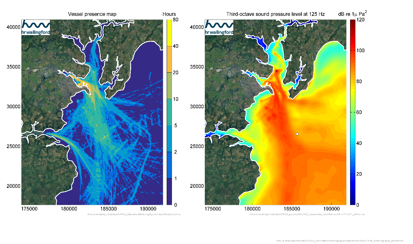
SEUSS produces noise fields for underwater noise as well as potential ecological impact zones. This spatio-temporal data is provided within a user interface in charts, tables and maps as required by the user community.

Space Added Value
The project is using Satellite AIS and satellite derived weather data to improve the background underwater noise levels.
Current Status
Multiple modelling approaches were tested to implement AIS data and weather data in isolation before combining them into one model. A graphical user interface was developed to streamline the processing steps to convert the input data into sound maps (Figure 3). The model results were validated against hydrophone information obtained from literature (Figure 4).

During the development of SEUSS HR Wallingford engaged extensively with the scientific community and stakeholder. Members of the SEUSS project team attended a number ofnumerous workshops and conferences internationally.
More information on SEUSS can be found at https://www.hrwallingford.com/projects/seuss-innovative-modelling-safeguard-marine-ecosystems-worldwide.
Prime Contractor(s)
