Objectives of the service
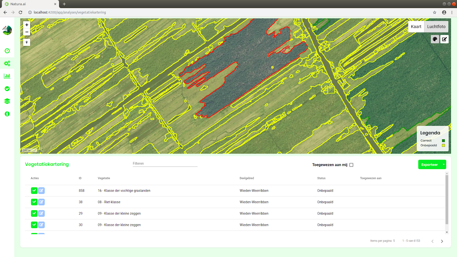
Managing and monitoring nature reserves currently involves many hours of field work and manual labour. Results can be inconsistent between different ecologists performing the surveys, and budgets are a big constraint on the frequency and comprehensiveness of which areas can be monitored.
The application Natura.ai uses Artificial Intelligence (AI) combined with earth observation data (e.g. aerial photography) to improve ecologists’ field analyses and help them work more efficiently. Through the functionalities of Nature Management Planning and Nature Mapping Support we automatize the process of vegetation type classification and boundary delimitation. This service is further delivered through an online tool in the form of a shared working environment for easy collaboration and document storage.
Sentinels for Habitats further improves the extent that our AI algorithm can distinguish between different nature types by incorporating Sentinel-2 data in both functionalities. This results in more accurate mapping and classification of nature reserves, because similarly to humans, the more relevant information provided, the better the performance.
Users and their needs
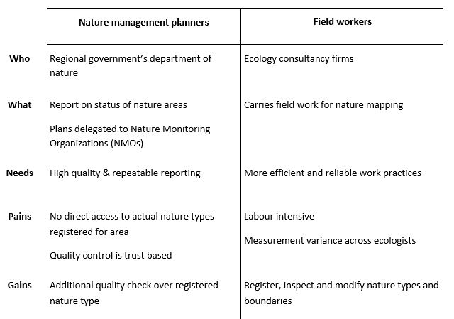
The functionalities of Nature Management Planning and Nature Mapping Support are intended for nature management planners and field workers.
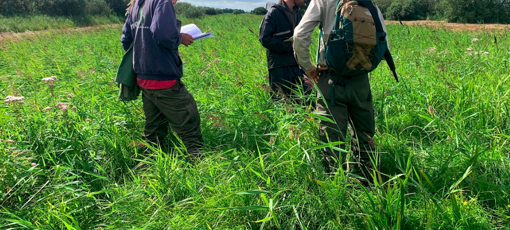
Figure 2. Ecologists at works in the Dutch national park of the Weerriben.
The table below reflects in more detail these users and their needs and how Natura.ai can fit within the service value chain of Dutch nature monitoring. Although the Netherlands was the focus of the KickStart activity, we intend on expanding internationally during the product’s operational phase.
Service/ system concept
The service delivered by Natura.ai consists of the following:
- An online tool with access to remote sensing data as user-interface for functionalities of nature mapping or management.
- Easily adjustable borders and editable attributes.
- Confidence scores for manual adjustments.
- Shared working environment for easy collaboration and storage of documents.
The diagram below displays how these features come together to create an easy-to-use nature monitoring application.
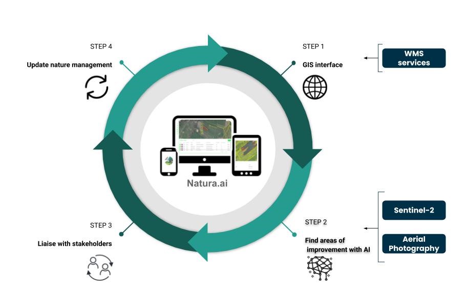
Figure 3. Interaction between the various Natura.ai features.
Space Added Value
Natura.ai uses Sentinel-2 data to improve nature type prediction. The spectral bands of Sentinel-2 are designed for applications in agriculture and implicitly contain a lot of information about vegetation type and its health. The approximately weekly measurement frequency of the constellation captures seasonal information relevant to habitat types, such as crop and leaf development over time. These additional details from vegetation could previously not be extracted from aerial photography alone because of the yearly sampling frequency.
The added value of using this constellation is observed in the figure below. The algorithm can automatically take in a raw image and classify at the pixel level the vegetation type with the help of seasonality effects. This processing allows ecologists to cover large areas in a more efficient, consistent, and affordable manner.
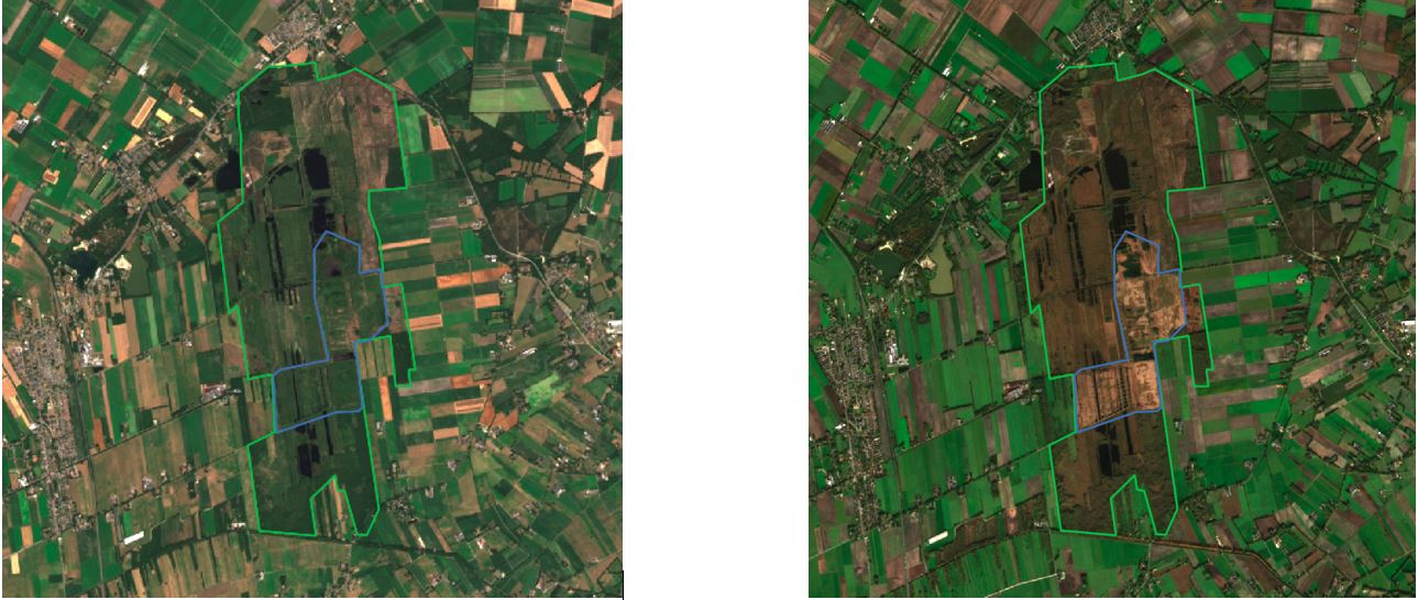
Figure 4. Sentinel-2 products depicting moorland - N06.03 Hoogveen and heathland - N06.04 Vochtige heide during the summer (left) and autumn (right).
Current Status
Sentinels for Habitat successfully concluded its KickStarter. We observe significant improvements in nature type prediction when adding Sentinel-2 data as opposed to aerial photography only. The activity also revealed strong support for Natura.ai, as determined during the 45 interviews with Provinces, NMOs and ecology consultancy firms from across the Netherlands and one pilot implementation for a Dutch regional government.
Nature mapping has proven to be currently challenging in the Netherlands. Natura.ai attempts to alleviate the workload for field workers but the level of detail required to benefit users is too complex for this functionality to be scaled to a national service.
The next steps for Natura.ai include applying for the ESA demonstration project using nature management as main functionality. This would allow us to assess Natura.ai on a greater scale, with the goal of becoming a fully operational service.


