Objectives of the service
SharperSat project dedicated to design, develop and validate integrated solution for TSOs and DSOs aiming at significantly improving the maintenance and recovery of their overhead assets and reducing related operational costs.
The needs defined by end users are:
- rapid recognition of damages after storm
- clearance need detection and prioritization of areas
- supervision of vegetation clearance
- cost efficiency of new methods
To meet user needs Sharper Shape will use SatEO supported by remote sensing and airborne data gathered by remotely piloted aircraft systems (RPAS) and its own software solutions which provide a new level of accuracy and faster time-to-results. Software automatically analyses data and identifies the need for corrective actions in the field. The service integrates with the end users processes and the result of the analysis is the maintenance plan with economic optimization of the actions related to detected issues.

Users and their needs
Target service users are TSOs and DSOs, following reference users have been involved in the study:
Fingrid Oyj – Finnish National Transmission Grid Operator
Elenia Oy – Finnish Distribution Operator
Caruna Oy – in past Fortum Oyj, largest Scandinavian Distribution Operator, with operations in Nordic, Baltic countries, Poland and Russia
Hafslund Nett – largest Norwegian Distribution Operator
The need of electricity transport system operators, based on initial interactions with reference users identified as follows:
- clearance need detection and prioritization of areas
- supervision of vegetation clearance
- component status
- clear cutting nearby power lines
- data integration
- cost efficiency
No single data gathering method can solve all the needs of end users. Therefore the solution of power line inspection problems has to combine several inspection methods that complement each other in way that the inspection results meet the needs of the customers and in cost efficient manner. New technologies and services ideally should meet following criteria:
- Cost efficient data collection
- Automatic data analysis
- Easy data integration to current end user’s systems
- Actionable data with economic value
Primary market is European TSOs/DSOs, secondary market is Northern American TSOs/DSOs including USA and Canada.
Service/ system concept
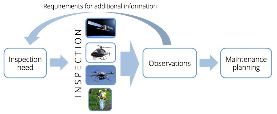
The overall logic behind the service concept is to provide OPEX cost reduction to end users. This is achieved through always using the most economic method for analysis and to determine accurately where more expensive and accurate inspection methods should be used in order to minimize unnecessary cost of inspection and maintenance work.
An example of the logic:
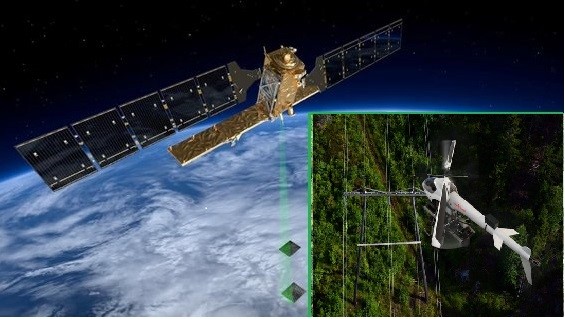
- SatEO data is used to find potential issues near infrastructure assets.
- When a potential issue is found, UAV inspection unit is sent to verify the issue in detail,
- Action plan (for field work) is created based on verified issues.
Services are divided into 3 categories:
Service component | Description |
Satellite monitoring | Whole network of customer is monitored once or twice a year |
Satellite inspection | Customer orders SatEO inspection into selected area so that data is gathered before and after selected time. |
UAV inspection | Customer orders selected area inspection with UAV equipped with LiDAR scanner. |
Deliverable are detected issues and maintenance plans that are transferred to customer systems. Interaction between end users and service provider is executed via web service with online access to data and possibility for end user to review the information.
Space Added Value
The proposed integrated solution includes two relevant space assets, without which the required user requirements and performance cannot be achieved:
- Satellite Earth Observation
- Global Navigation Satellite System
The SatEO is the only inspection method that does not require someone or something to visit the inspection site. It is able to deliver wide coverage, low cost data over the power line network and related vegetation frequently. This enables optimizing the timing and frequency for inspections and potentially replacing partially traditional inspection methods. The opportunity with the SatEO data is to significantly reduce costs for the maintenance inspections.
The dominating remote sensing method will be UAV, based on the satellite positioning system GNSS, due to its cost-efficiency, availability and support for both LiDAR and visual imaging.

Current Status
The study has been successfully completed leading to the definition of two novel service concepts: satellite inspection and satellite monitoring. Both service concepts have been assessed as economically and technically viable. A subsequent ARTES 20 Demonstration Project has been proposed. The Consortium includes Sharper Shape Ltd. as a prime contractor and two subcontractors: Finnish Geospatial Research Institute (Finland) and Mapix Technologies Ltd. (United Kingdom). If awarded, three demonstration campaigns are planned in different European countries. Each campaign will include Satellite monitoring or inspection service and UAV-based inspection.
The initial pre-operational service capability is expected to be available to a selected numbers of users from year 2016. Commercial rollout of the new service can begin in year 2017.


