
Objectives of the service
Conifer forest planting and ensuring optimal growth is costly and time-consuming, the most critical phase for young seedling growth being the 10 years after planting. The main reason for a poor growth or even destruction of the seedlings is the rapid growth of leaf plants, which hamper the vitality and growth of conifer plants.
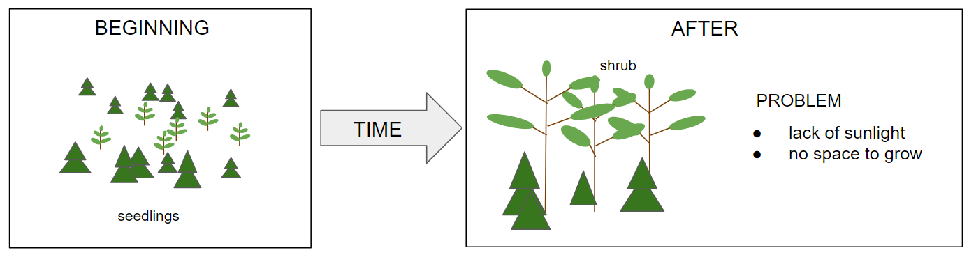
One of the biggest challenges is that the forest areas are huge and forest owners or forest management organisations do not know the locations of these critical areas or the optimal period for forest management work.
Users and their needs
The main user segments are forest owners, forest management companies and system and applications providers for forestry. Potential customers are with large conifer forest assets in the boreal zone in Nordics, Russia and North-America. The secondary market is Eastern European regions and Central Europe, with coniferous forests in countries such as Germany, Poland and Austria.
The detecting and managing the status of the seedling stands is currently done by human labour, which is relatively slow and costly. With Space Data the service can provide a full coverage of the areas annually. It is calculated that the customers save 50% of the time used to detect the shrub status with the service by decreasing the need for unnecessary field inspections. The cost for clearing the unwanted shrubs is from few hundreds to up to thousand euros per hectare. The potential users need a better situational awareness about the shrubs situation to optimize the clearings works more efficiently. The customers can save tens of percentages of the costs by right time treatment which means up to 100 € savings by hectare.
Service/ system concept
The Shrub Mapping service offers up-to-date data about the shrub situation for large geographical areas using satellite data.
The planned service is based on a process where the raw data is collected and processed using a scalable cloud computing infrastructure. This means that the production of the service is tied to low fixed costs.
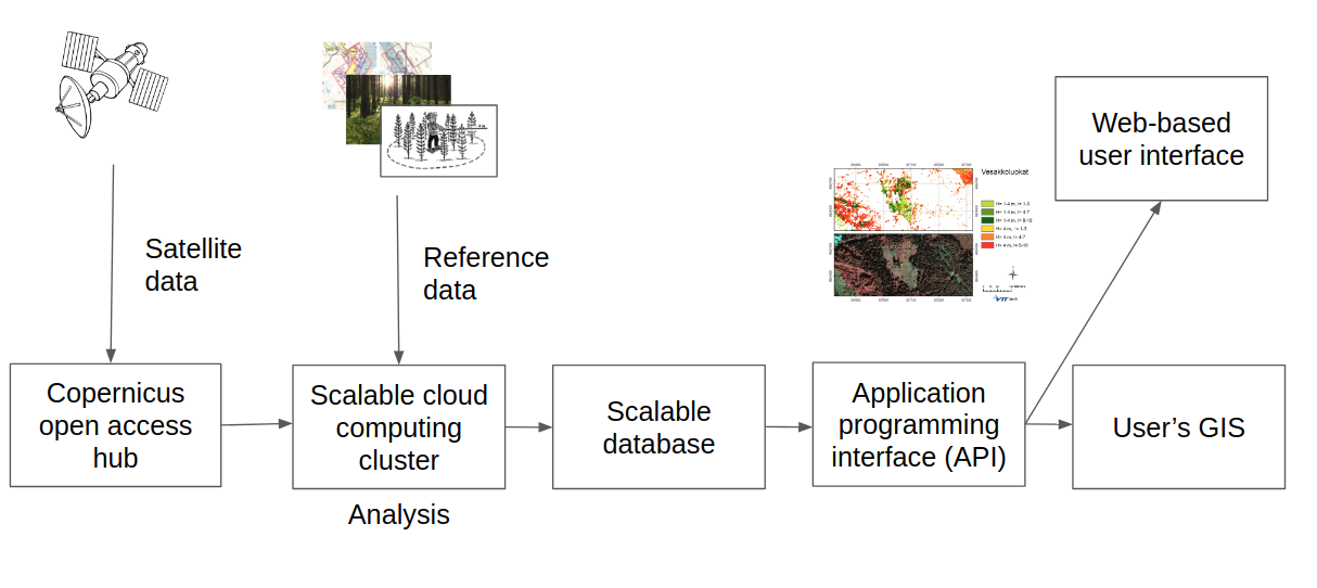
The service is delivered to the customers via an interactive web-based map for browsing the shrub detection results, and an application programming interface for integrating the results into the users’ geographic information systems in both raster and vector format.
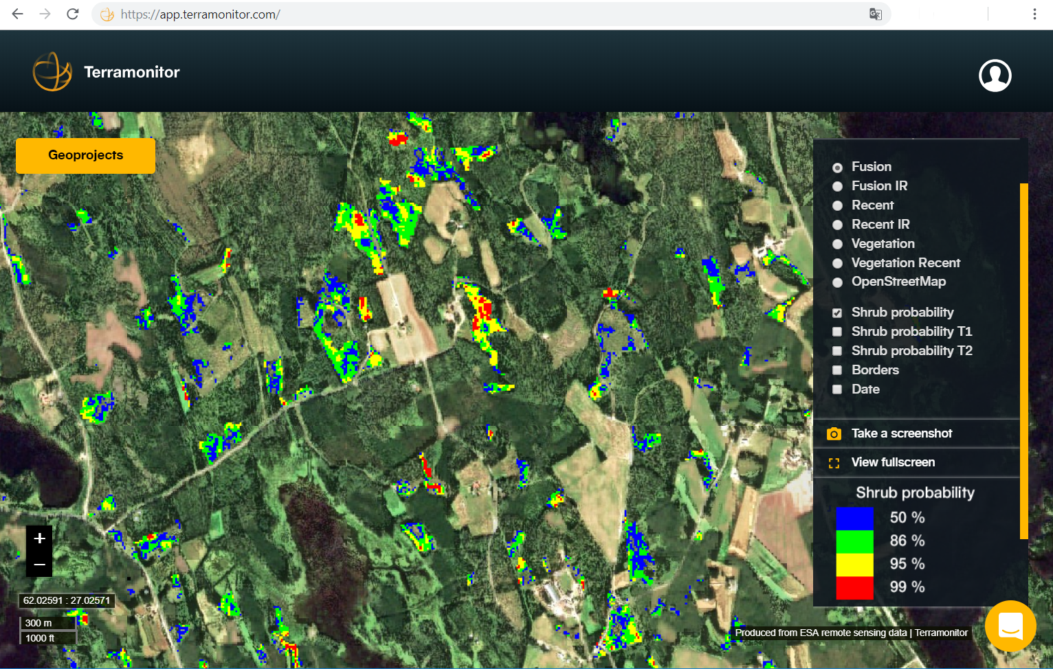
Caption: Example of the web-based interactive shrub map.
Space Added Value
Earth observation and satellite navigation enable the monitoring and positioning of large forest areas anywhere in the world.
Using satellite data makes it possible to scale the business model globally. In addition, evolving space technology, such as new Earth observation satellites, e.g. with higher spatial accuracy, enhances results and opens up new business opportunities.
Current Status
The feasibility study has been completed in June 2019.
The customers provided positive feedback on the resolution and localization performance of the shrub maps.
Further to the basic version of the shrub detection service, envisaged customers expressed a need for additional data features including up-to-date timestamped satellite maps of their forest stands, satellite time series service for monitoring the growth of young forests, change detection for automatic logging monitoring and GeoTiff mosaic service including vegetation indices for analysis. Based on the feedback from this feasibility study, these service modules have become an important addition to the shrub mapping service roadmap.