Objectives of the service
The services aim at providing numerous analyses to the different stakeholders of the Agricultural industry. With the impact of climate change, farming needs to evolve to take into account multiple new factors like water conservation, pesticide ban and a general change of how crops growth periods and speed.
Using gespatial data is crucial to track these changes and provide decision tools to both farmers and agro-industrials at scale. The services that we are developing are doing just that.
Users and their needs
We are targeting two types of customers for our solution:
-
FMIS (Farm Management Information Systems) companies: These companies provide digital solutions to farmers, to help them in all aspect of their job, from inventory management, team tracking, crop health monitoring and decision support solutions
-
Agrobusiness companies: These companies are usually in the middle of the agricultural value chain. They interact with farmers to either buy their products, or to sell them some of the material that they will need to properly grow their crops.
Both these customer categories have a need to know what is going on in the field, either to take decision that will guarantee a better yield, or to know where to invest in terms of sales or operations. Having a full digital view of all agricultural activities is their ultimate goal.
Service/ system concept
We will provide several services accessible through an API:
-
Deforestation and land use detection
-
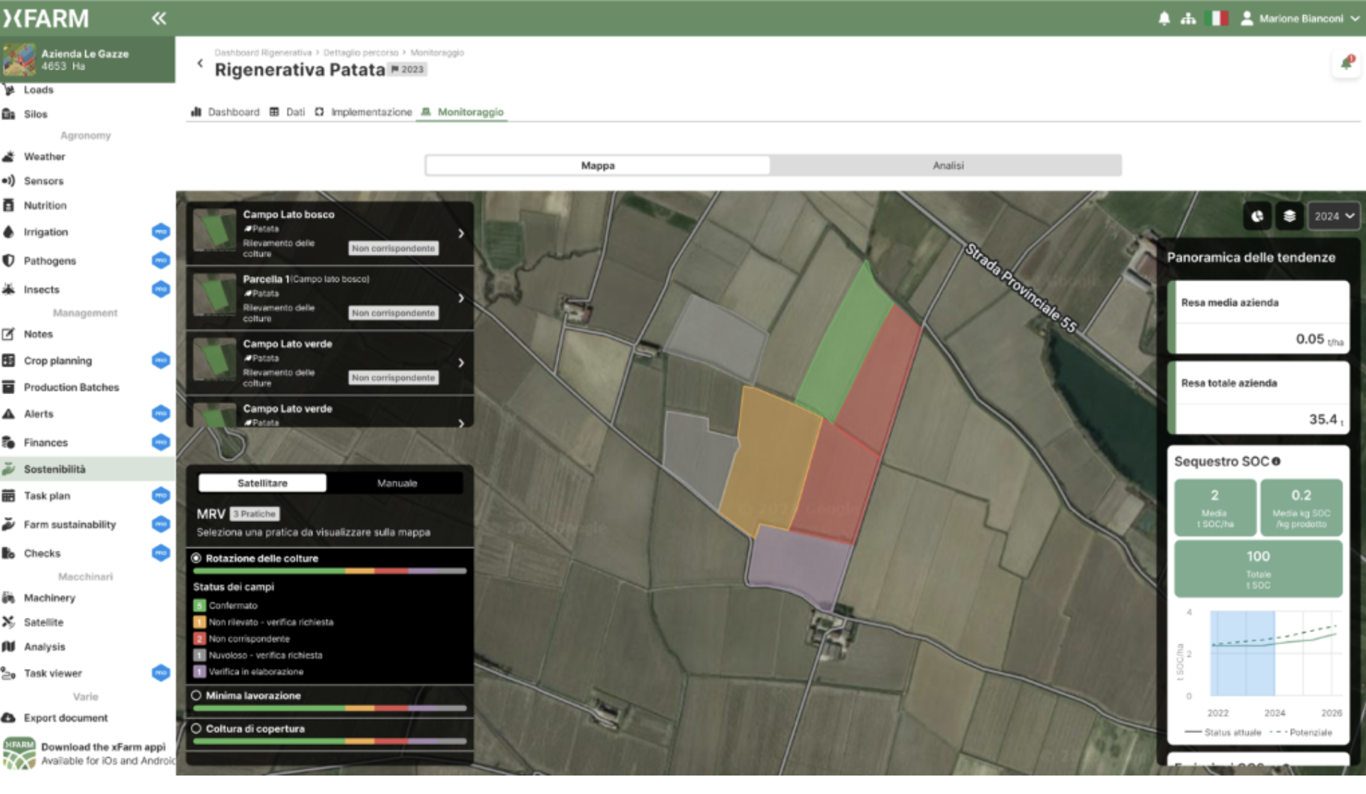
A service for Agricultural MRV
-
Detection of crop type
-
Detection of crop rotation
-
Detection of cover crops
-
Detection of tilling
-
-
A service for cloudless vegetation monitoring
-
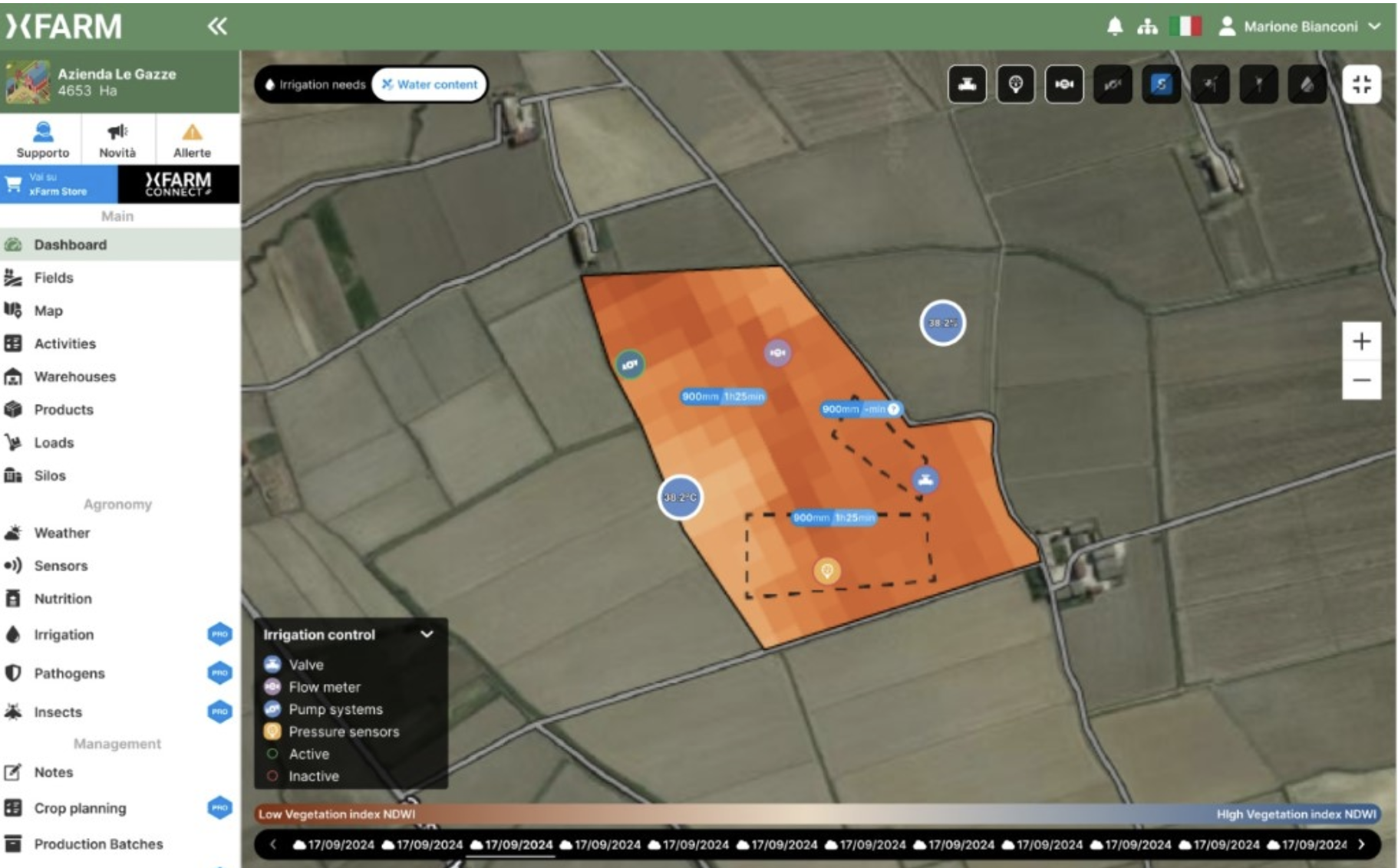
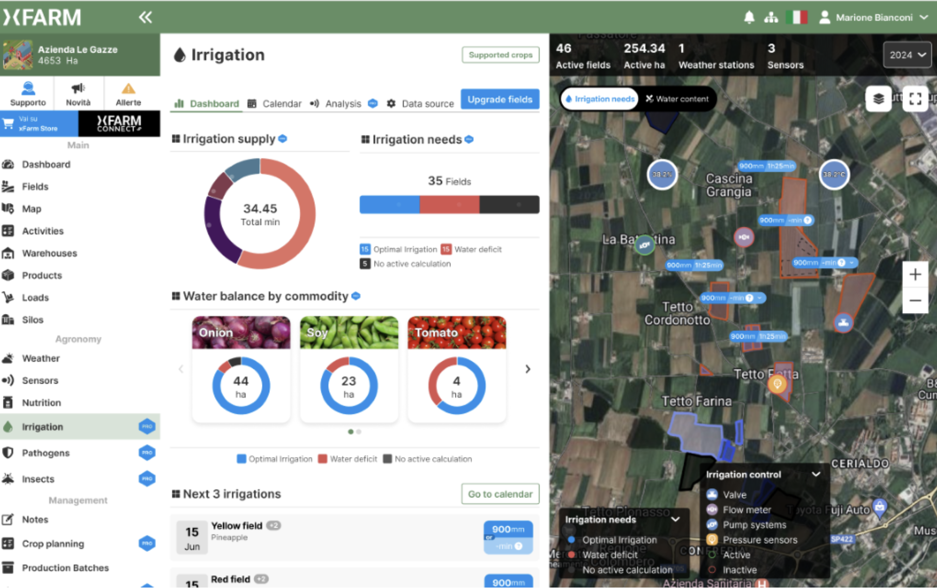
A service for irrigation recommandations
Space Added Value
All our solutions are using satellite data as a core element of our solution
Current Status
Eight pilots took place during SIDPPAI with 5 customers (pilots like the detection of deforestation for EUDR, detecting very specific crop types over France). As an outcome 4 customers are now in the process of being integrate commercially in the customer’s platform and we are under discussions about how to provide It to other customers.