Objectives of the service

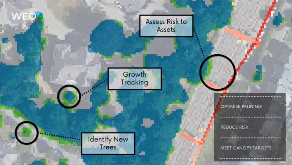
Covid-19 has demonstrated the importance of trees and green spaces in our cities. Governments across the world are trying to plant more trees to fight climate change, improve liveability, lower city temperatures and increase biodiversity. But with tree management budgets stretched, they need new ways to optimise tree management costs. This study sort to test the feasibility a new low cost platform for monitoring the growth and health of trees using open-access satellite data. It utilise Sentinel-2 satellite imagery to locate and track trees on a monthly basis, allowing municipalities and asset managers to optimise pruning and other maintenance, as well as to reduce tree losses.
Railway operators and other linear asset managers, must maintain vegetation along their assets to reduce the risk of service interruptions. Our tool maps this risk with a combination of Sentinel-2 imagery and high resolution Lidar data – to supply risk assessments right along their railways updated on an annual basis.
Users and their needs
The feasibility study tested the service on both municipalities and linear asset managers, such as railways and electricity distributors. The municipalities of Ville de Luxembourg and Ville de Dudelange are primarily driven to reduce maintenance costs, understand how and why trees grow differently and to measure their progress towards tree canopy cover targets. The Luxembourgish National Railways (CFL) want to reduce the risks associated with trees alongside their assets and reduce pruning costs by understanding when those trees need to be cut. Project partners are located in Luxembourg.
Service/ system concept
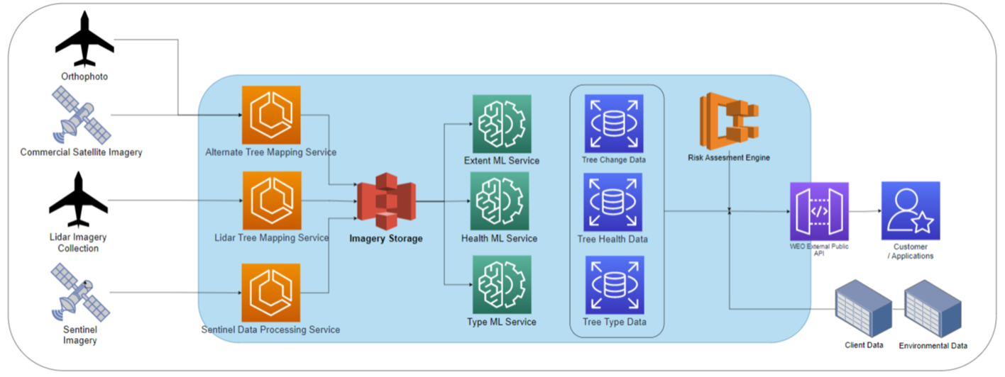
Deep learning techniques are used to leverage the high resolution of Lidar data and the high frequency of Sentinel-2 data to understand the location, health, growth and environmental conditions of trees in cities and beyond. This data is then matched against risk criteria for critical asset owners to understand where trees pose a threat to their infrastructure (such as by falling on railway tracks).

Space Added Value
This tool relies on the Copernicus Sentinel-2 satellites to provide global coverage at a 10m resolution several times per year. Higher resolution insights are then created using deep learning techniques.
Current Status
The demonstration project is well underway, with workshops held with two cities and more than 6 workshops and a track walk held with CFL Luxembourg railways. A prototype has been developed for CFL allowing for detailed feedback which is being incorporated into the design of the pilot solution.
The current focus on the project is developing a cloud data processing pipeline for processing satellite imagery and creating TreeMonitor maps at a large scale.
Final piloting of the product is scheduled for late 2023, with full commercial launch in early 2024.


