
Objectives of the service
Accurate information on the amount of snow and the water it stores (Snow water equivalent – SWE) are crucial information for the hydropower sector as it influences management decisions, especially during spring. However, retrieving information on catchment-wide SWE has been difficult so far in mountainous areas. The goal is to complement existing snow information from in-situ measurements and other sources with the best available satellite-based information to support decision making before and during the melting season in mountainous catchment. Delivering this information not only for single catchments but for whole mountain ranges can be beneficial for users with a regional portfolio of several reservoirs in a region.
Users and their needs
The targeted users are mainly from the hydropower sector. The knowledge on the stored amount of water in the catchment of a reservoir (i.e. SWE) is valuable information for the operation of a power plant in the spring time when the snow is melting. Traditional methods comprise often sparse field measurements or expensive airborne LiDAR overflights (often restricted to one catchment).
The key user in SnowPower was Enel Global Trading S.p.A. is the Enel Group Compan that carries out energy management services of Enel power plants and has a quite large cluster of hydrological power plants mainly located over Alpine and Apennine areas.
Service/ system concept
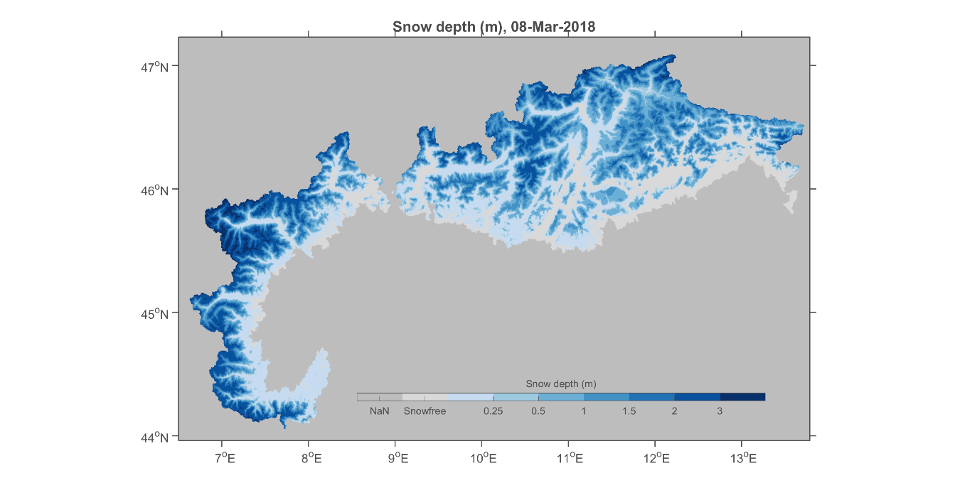
SnowPower used leading technology to retrieve snow depth information from active radar data for mountainous regions, which was challenging up to now. Combining satellite-retrieved information with data assimilation techniques to feed a physics based snow model, daily SWE information can be generated seamless for large mountainous areas at a resolution of 500 m.
This data can also be made available as a merged product with existing SWE information for non-mountainous areas. SnowPower can therefore deliver SWE for all of Scandinavia, for example.
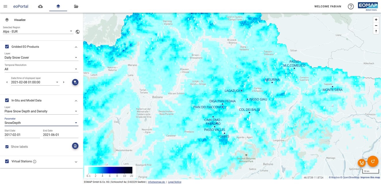
Additionally, the snow data can be displayed in EOMAP’s online app for easy yet secure access for the customers. The app provides visualization, export and analysis functions to support decision making processes.
Space Added Value
The project utilizes satellite retrieved datasets widely. The main utilized EO-data are:
-
Sentinel-1 A/B SAR (SD and SWE for mountains)
-
DMSP F18 SSMIS (SWE for non-mountainous regions)
The project uses satellite-based data to derive snow products:
-
Daily Snow Water Equivalent (SWE) based on PMW data, 5 km resolution
-
Weekly Snow Depth (SD) and SWE based on Sentinel-1 SAR data, 300 m to 1 km resolution
-
Daily SWE from a snow model, assimilated with satellite data to gain maximum data coverage and quality
Current Status
The feasibility study was concluded successfully by the end of September 2022. Steps towards a follow-up project are in the progress.