
Objectives of the service
Genesis provides proof of the environmental impact (biodiversity, climate, water, and fertility) of agricultural sourcing, based on real measurements of the health of the corresponding soils. These measurements are obtained from soil sampling, analysis by partners laboratories, and scoring of biological, carbon, and pollution parameters. They can be used to assess the true impact on soils, and find levers to improve it.
Historical land-use and management practices are known to play a key role in current soil health. Satellite Earth Observation (SatEO) data is a perfect candidate to get such historical perspective for some farming practices, without soliciting the farmer.
The service aims at leveraging this information on plots we already sampled and scored, and at analysing the correlations between these time series and our indicators of soil health status. Our soil database, particularly the information collected on-field as well as the detailed questionnaires filled by selected farmers, is of great value to design, calibrate and validate the satellite time series generated. This study will enable us to provide our clients with personalized levers likely to improve their impact on soils at scale.
Users and their needs
On the French beachhead market:
-
Head of Sustainability in Bio-Based Industries: these customers primarily from sectors like food, biofuels, wines and spirits, cosmetics, fashion, focus on sustainable development. Their main goal is to demonstrate the commitment of their company to improving their environmental impact. They assess the maturity of the agricultural transition of their suppliers using the Genesis Soil Health score. They want Genesis to deliver scalable environmental metrics and provide a user-centric way to understand the impact of the regenerative farming practices on soil health.
-
Agronomists in agricultural raw material production: these users work for companies like agricultural cooperatives, forestry operators, wine growers and serve as the operational implementers of the sustainability strategy. They aim to promote regenerative farming practices among farmers. They want Genesis to recommend best regenerative farming practices to deploy for specific crops, based on established correlations between practices and soil health.
As the users are in touch with farmers, there are two different challenges in this project:
-
The farming practices detected by satellite must be consistent with those carried out by the farmer.
-
The effectiveness of the best practices recommended to the farmer must have been observed in comparable soils and climatic conditions.
Service/ system concept
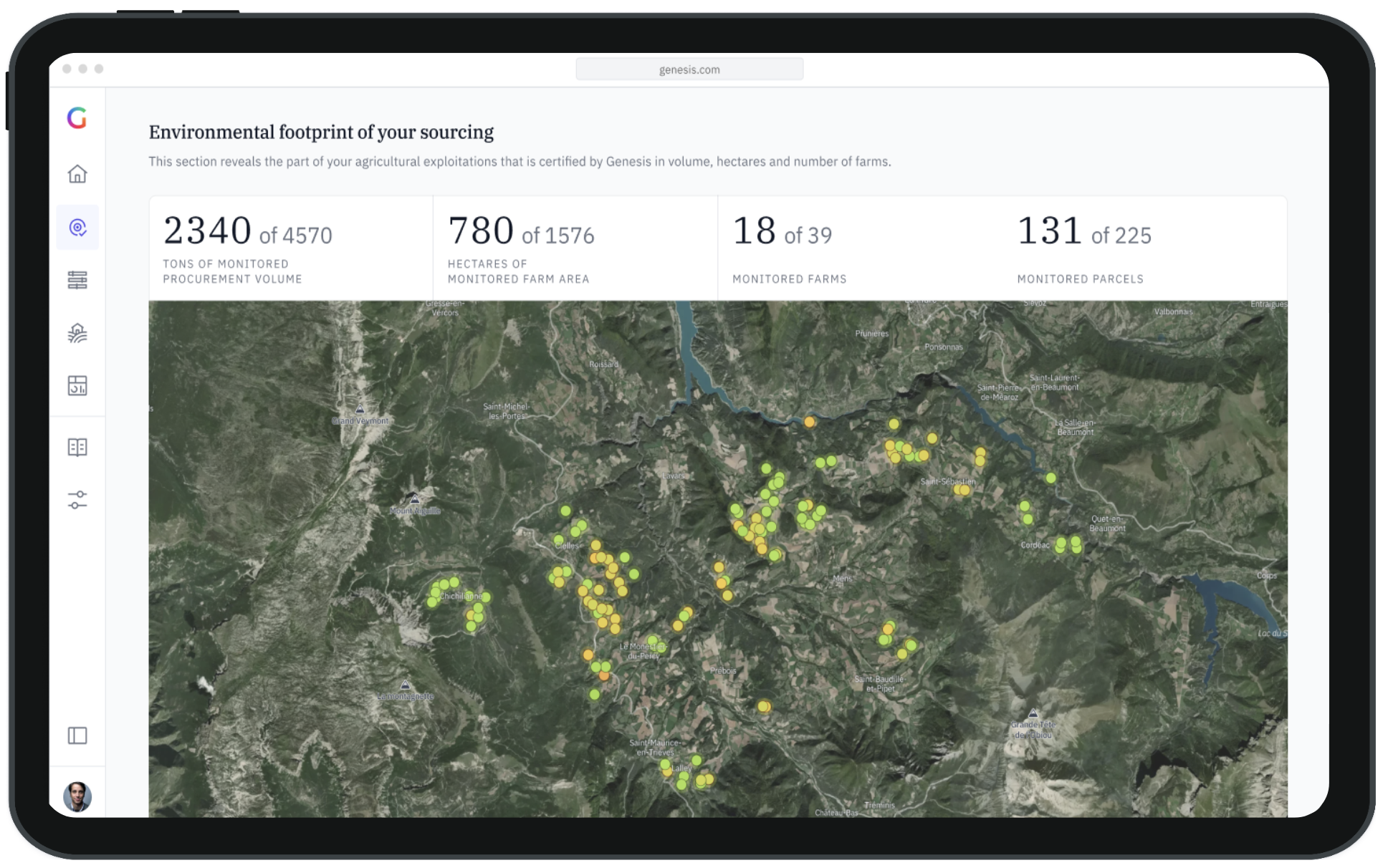
Genesis’ SaaS platform provides in-depth reports on the environmental impact of the sourcing of companies, both at the plot and company levels.
We collect the farming practices carried out by the farmers for each plot of land monitored. This enables us to make correlations between farming practices and soil health and recommend to our customers the most virtuous practices according to their soil type.
The users can personalise their platform view, find relevant information depending on their profile, generate reporting compliant with the regulation standards, set targets and monitor their progress over time, and identify improvement levers based on comparison with a larger referential.
Space Added Value
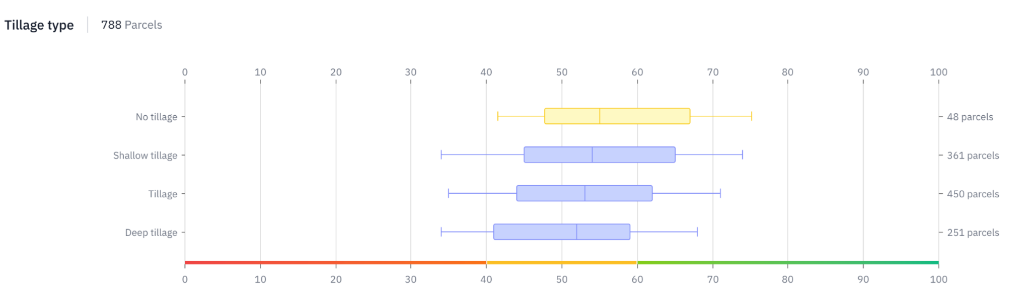
Historic land-use history and management practices data is rare but it has a huge impact on the plot’s current health. SatEO data is a perfect candidate to get this information, more specifically time series of land cover, tillage, cover cropping, or crop residue management.
The service we are building consists in generating time series from SatEO capturing these historic land use and practices on plots we already sampled and scored, in order to analyse their correlation with our indicators of soil health status.
Currently, this practice data is collected using a form that farmers fill in for each plot. We can obtain richer information from satellite derived indices and avoid a declarative data collection that is heavy for farmers.
Ultimately, this information is used in conjunction with other contextual data (geology, climate, topography, crop rotation history) to train predictive models able to estimate indicators on plots that have not been sampled. This allows us to produce our proof at a larger scale, building on the accuracy of our ground-truth measurements.
Current Status
Fifteen people from our core business segment were interviewed to conduct a qualitative study.
We established two partnerships and benchmarked three providers for the detection of crop cover and tillage.
We developed a pipeline to efficiently gather and process historical Sentinel-2 data and we are currently developing a tillage detection solution.
We built and validated a dedicated business model, enabling the deployment of this service at a large scale, once fully operational.