Objectives of the service
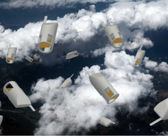
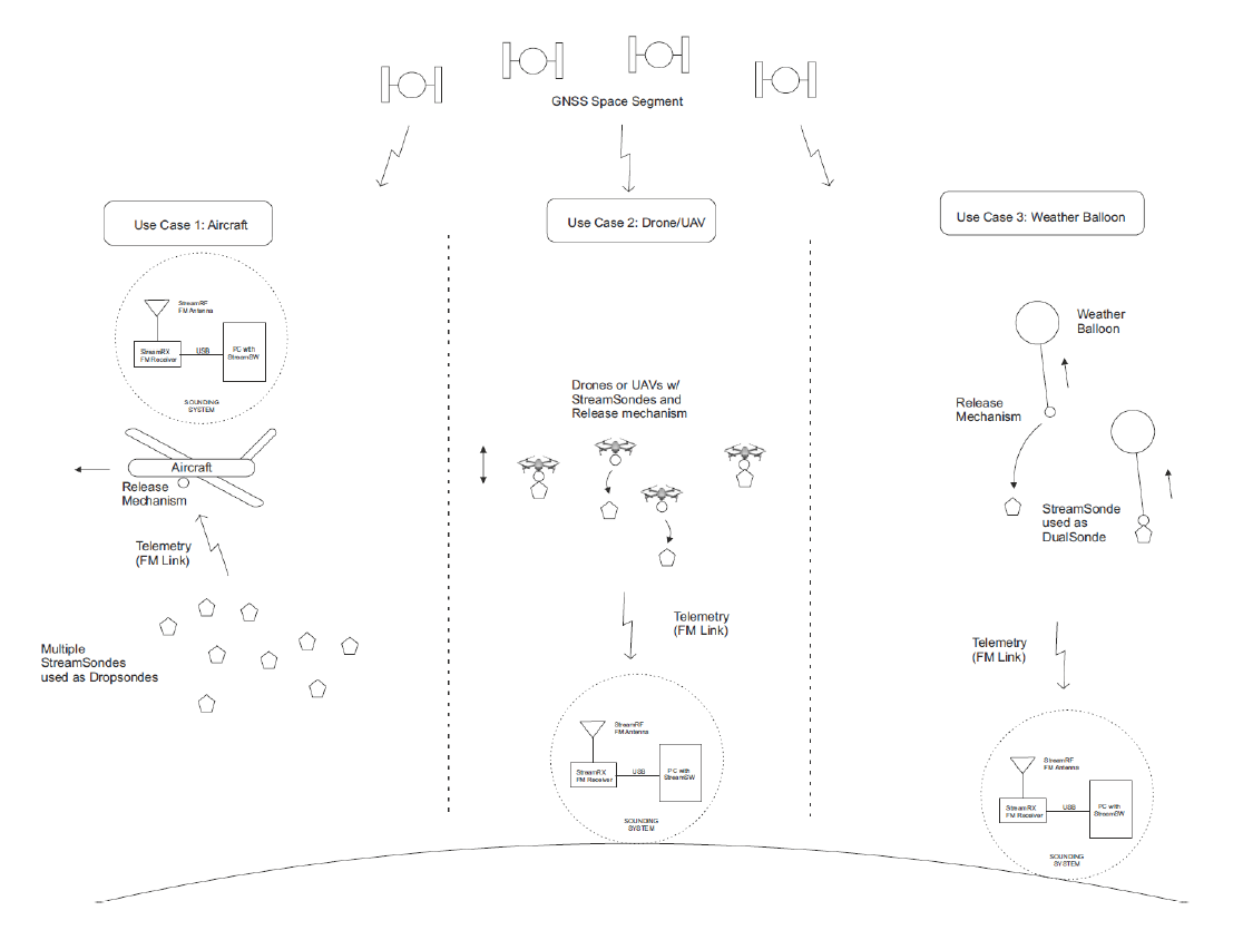
The Company believes less is more when it comes to weather measurements. Rather than to try to fight forces of nature, the ultralight StreamSonde, here attached to a drone, can be launched into the atmosphere to record the atmospheric flows and other weather parameters in great detail while it floats around with the natural winds. Its position is accurately known all the time due to a proprietary GNSS solution and IMU sensors. Both government agencies and private companies are showing great interest in the technology operating according to the new paradigm.
Users and their needs
Weather is measured and forecasted in practically all of the world’s about 200 countries by national weather services, other government agencies and private companies. In addition to weather stations constrained to the ground and satellite measurements with wide coverage but lower accuracy, the vertical direction of the atmosphere needs to be measured with sondes on-site at altitudes from ground all the way up to the lower stratosphere. These sounding data are needed for understanding extreme weather such as storms as well as any other weather for input data in computer model based weather forecasting.
The more detailed and accurate sounding data fills a gap in the users’ needs.
Service/ system concept
The StreamSonde measures standard meteorological parameters: wind, pressure, temperature, relative humidity and new parameters in the context: turbulence, vorticity and air quality parameters.
The StreamSonde transmits data over FM radio to a receiving antenna, that is coupled to a receiver at a base station, that can be either fixed or mobile. Before launch, a ground check unit is used for turning the sonde on and reading its calibration coefficients.
Accompanying data processing and visualization software provides data to the end users in an easily digestible format.
Space Added Value
The low-power, high-performance dual-band L1/L5 GNSS navigation module of the StreamSonde allows the sonde’s position to be determined with the needed accuracy based on positioning satellites to measure wind at a much higher accuracy than done by similar existing solutions in the market.
Current Status
The Final Review took place in November 2022 and the demonstration project successfully concluded.
The StreamSonde is used by top-level government and research customers around the world.
During summer and autumn 2022 the StreamSonde was launched over 100 times in the context of the ESA Demonstration project. Breakthrough measurement accuracy according to World Meteorological Organization metrics was demonstrated in several use cases. The usefulness of the data for improving numerical weather prediction accuracy was also proven.