Objectives of the service

Credit: Murmuration
The objective of the activity is to explore the feasibility of using satellite earth observation data, complemented with in-situ information, to assess the environmental impact of the tourism activity. This problem is a new challenge for the local authorities, the rise of the middle class globally and the increase of the world connectivity, either physical connectivity thanks to advanced transportation means or virtual connectivity through the development of telecommunication capabilities are putting significant pressure on popular destinations. Pushing the local authorities to intensify their medium to long term planning and preparation activities. Today, no efficient tool, beyond the ground surveys that are costly and lack accuracy, exists to perform the required assessment of the environmental impact of the tourism activities.
Users and their needs
The project has 3 user categories: Governments, Tourism professionals and Independent Organizations
The developed tools can help Governments:
• Preserve economic activity and jobs linked to tourism
• Support environmental preservation projects,
• Help foster the sustainable tourism industry,
The developed tools can help Tourism professionals and Independent Organizations:
-
- The preservation of the neighboring landmark is not only the responsibility of the decision and policy makers but also to the private entities benefitting from its existence. The ones at the frontline of the hospitality industry are the hotels and their managers. The number of hotels is estimated at 300,000 hotels (2 stars and more) worldwide. Knowing the environmental condition of their geographical area and having the capacity to act on it, is essential for their activity as it protects their activities on the medium to long-term.
In the project the following stakeholders are involved: regional decision makers represented by the “Region Occitanie” in south west of France, private business owners (two travel agencies from Maurice Island and Brazil) and an international tourism coordination bodies (the European Travel Commission). All share the same fundamental needs with different action and implementation capacity:
-
- Obtain reliable and quantified information regarding the environmental situation
- Understand and identify the stress areas
Service/ system concept
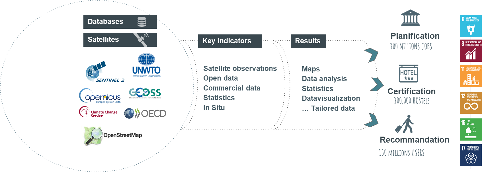
The overall system concept starts from the aggregation of Space Earth Observation data from the Copernicus program (either Sentinel data or Copernicus core services data) with non-EO data sources. The service then transforms all of these datasets into indicators that are delivered to the user communities as follows:

Credit: Murmuration
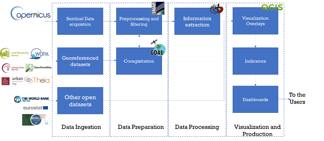
The generic data flow is as follows:
-
- [Ingestion] Earth observation Data collection from Copernicus repositories (CollHub and relevant Copernicus services distribution portals)
- [Ingestion] Download of non-EO data on local storage
- [Preparation] Coregistration of available datasets
- [Processing] Ingestion in the processing chains
- [Production] Output and visualization
The data flow is common to the ensemble of target users, the difference will be in the final visualization and dashboard that will differ as a function of the user needs and requirements.
Space Added Value
Space Earth Observation data, especially the Copernicus program, is a significant leap ahead of competition who mostly rely on local surveys and measurements. Earth Observation data is fundamental as it enables the service to:
-
- Apply the same approach on any point on the globe
- Have a clear pricing strategy with no unforeseen costs
- High frequency updates inline with the users’ needs
- Capacity to scale and deliver
EO data will be integrated with other data sources, for instance, Open Street Maps data regarding the road networks and the hotel locations, Eurostat data regarding tourism statistics in specific areas and so on.
The final aim is to use space data to enable users to obtain a quantitative, scientific measurement that explain environmental sustainability and support decision making.
Current Status
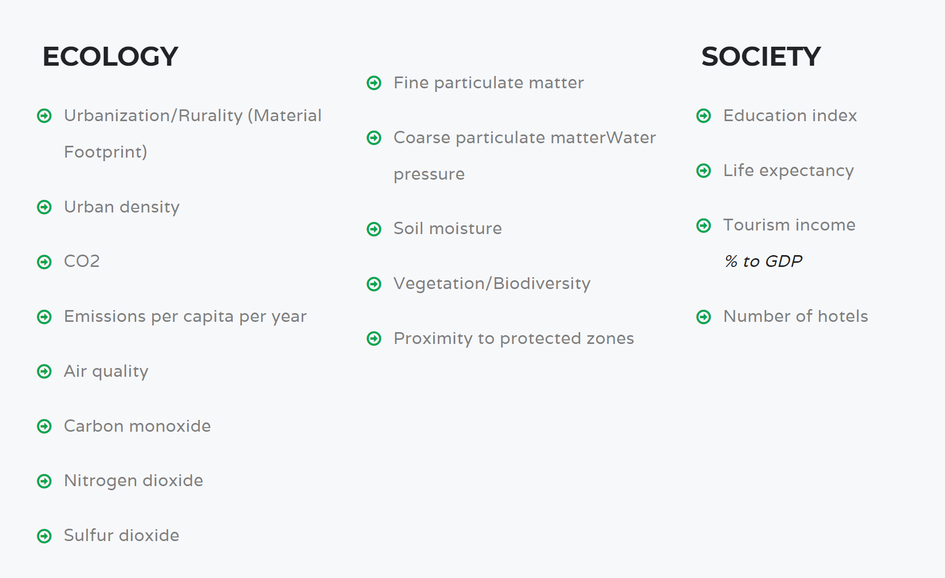
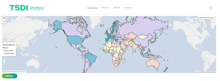
The project has put in place a unique Tourism Sustainable Development Indicator on national, regional and local scales, available here: https://tourism-sdi.org . This index quantifies the sustainability of tourism all over the globe. The index combines earth observation data with statistical data to provide a global common ground into assessing the sustainability of a geogrpahical region and its correlation to the development of the tourism activities. The parameteres integrated in the computation of the index are shown below:

The TSDI enables to show in a concrete manner the efforts that countries are performing towards sustainability and how they are progressing over time:

The feasibility study is concluded and the website is regularly updated with new data and information.


