Objectives of the service
Population growth and migration in emerging countries is one of the major issues that humankind has to face in a very next future. Classical solutions: censuses and civil registration are inefficient and outdated, every ten years at best.
TeleCense evaluates population distribution and trends with efficient, up-to-date and accurate results, at low cost compared to in-situ studies or census campaigns.
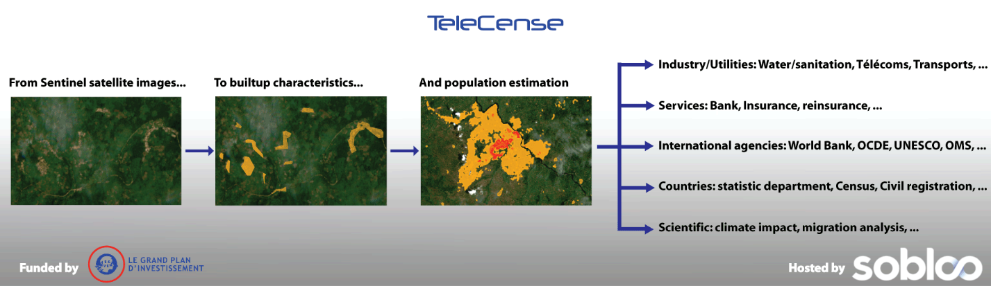
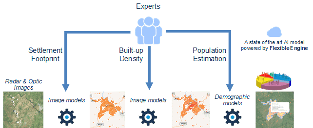
Copernicus data is the core input of the TeleCense service: by leveraging Sentinel-1&2 satellite images and merging radar and optical data, we can provide regularity and high accuracy in detecting settlements.
Knowing where people live is a fundamental element of many decision making processes such as urban development, infectious disease containment, evacuation planning, riskmanagement, conservation planning, and more.
Users and their needs
TeleCense could be used by:
-
Industrial companies to evaluate the opportunity and where to invest in a country,
-
Energy & Utilities to propose the right service: where to implement mobile antenna or bank agencies,
-
Insurance and reinsurance to make an accurate risk assessment
-
Governments and NGO to anticipate population needs in infrastructures, schools, hospitals, transports, water and sanitation
-
International agencies to allocate right budgets at the right place to provide people a better life.
Moreover, TeleCense is designed for use in connection with climate impacts, human crisis management, public health, migration, and more.
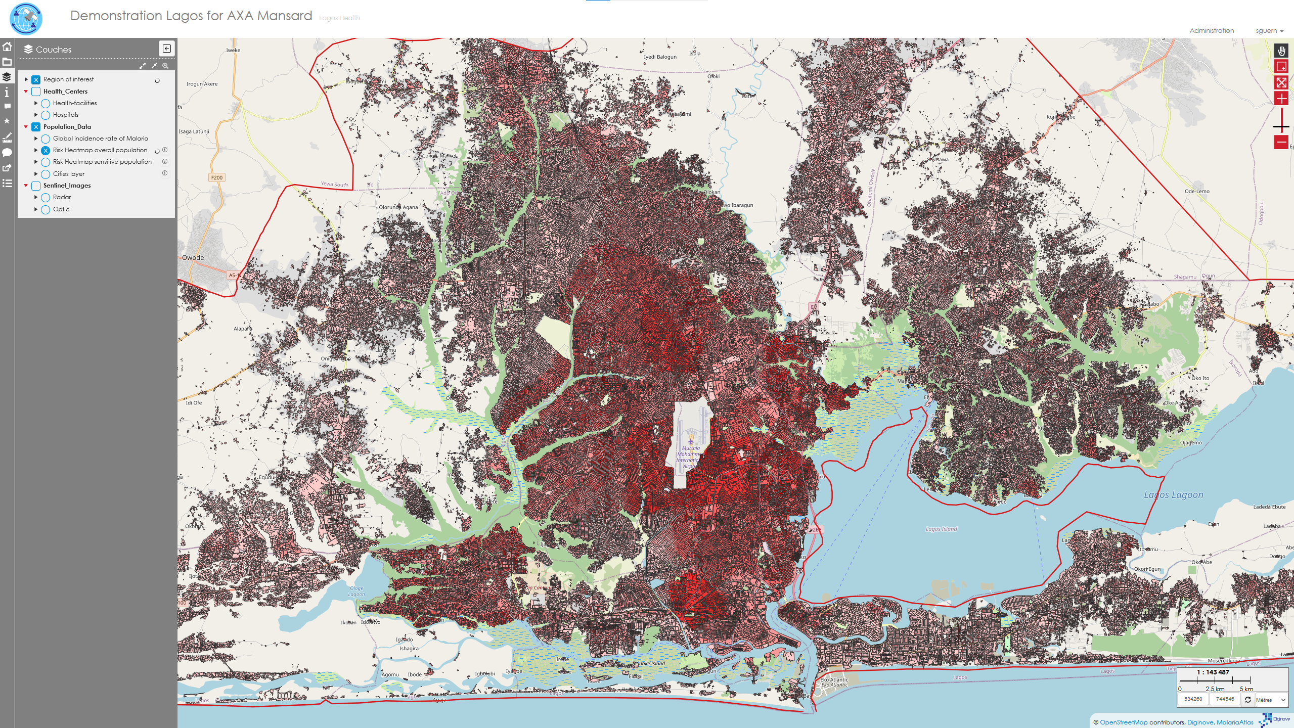
Example of application can be found here : https://astriumgeo.maps.arcgis.com/apps/Cascade/index.html?appid=137236e917b44bf78279eb7b3e85b8c2
Service/ system concept
On a geographic or administrative area, TeleCense services provide:
-
Settlement footprint & built-up characteristics
-
Population estimations
-
Regular updates
-
Evolution trends
Previous demographic census data are not required.
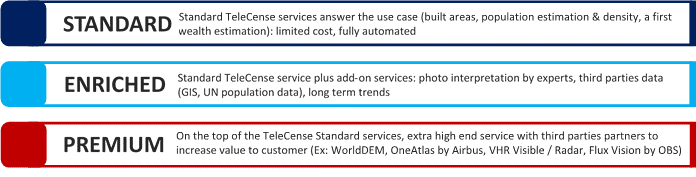
Three levels of Products / Services:
Space Added Value
To generate the built-up footprint, existing solutions use high resolution images. These images are expensive and they are not regular, in particular in tropical areas where you can have several years without any picture of the ground because of the cloud coverage.
Diginove however uses free Copernicus satellite images. It allows to provide a more affordable service to emerging countries.
Moreover, Copernicus satellites provide a new image every other week, solving the cloud issue.
By stacking 6 months of data, Diginove is able to provide a precise and up-to-date built-up footprint.
Finally, by merging optical and radar images, Diginove is able to characterize the built-up density, allowing a better estimation of the population.
Current Status
The project has been completed in June 2023.
The three level of services of Telecense are now completed and used in production.
It can be accessed on http://www.telecense.com/telecense/ and in case you are interesed in having more information, don’t hesitate to contact us at info@diginove.com or nhusser@diginove.com