
Objectives of the service
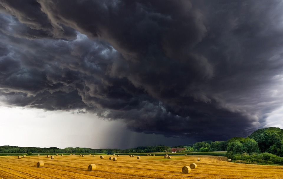
The frequency and severity of natural disasters is rising over time, hand in hand with their economic cost. In the agriculture sector, climate-related economic losses have reached €73bn/year on average. It is, hence, of utmost importance to build a climate-resilient agriculture now, by forecasting and adapting to the future climate risk. Agriculture insurance plays a crucial role in promoting the resilience of agriculture to external shocks. But, for a climate-proof agriculture, insurance needs to evolve. Offering traditional coverage is becoming insufficient, with climate change unfolding its impact on the severity and frequency of extreme events.
At present, medium and large insurance companies have limited access to climate information and normally operate with a standard set of historical data and risk models that are obsolete in the context of climate change. TERRA democratises the available knowledge and improves the insurance sector effectiveness in mitigating climate risk, by providing a one-stop-shop to access climate data and satellite information. TERRA is the first-of-its-kind commercial climate service combining satellite-based vulnerability assessment and medium-term climate risk assessment into a user-friendly visualization platform delivered as SaaS.
Users and their needs
Insurance companies operating in the agricultural field have the following needs:
- Collecting and selecting optimal datasets from sparse and heterogeneous sources.
- Defining and monitoring innovative climate indices linked to parametric insurances.
- Assessing changes in the risk landscape to manage the policy portfolio in an informed manner.
TERRA provides ready-to-use information to design and manage innovative products, including quasi-real time monitoring and issuing payouts to insured clients, and adjust policy prices according to high resolution maps (1 to 5 km resolution) of the forecasted climate risk of the upcoming season.
To make TERRA effective, the main challenges are: (1) integrating complex and diverse data in a seamless and meaningful manner; (2) visualizing the data to effectively convey actionable information. Co-design is employed to ensure that the solution meets the user requirements. In its development phase, TERRA focuses on the business case of forage. Forage is the cornerstone in the dairy and meat production systems. As such, it is a considerable concern of Sompo International. Focusing on the Italian segment, TERRA is collaborating with the insurance agent A&A - a subsidiary of Sompo International.
Service/ system concept
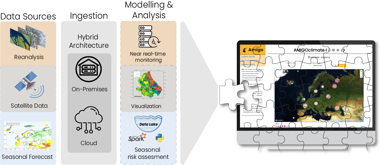
TERRA is designed to be plugged into AMIGOclimate, a groundbreaking SaaS developed by Amigo, which offers a comprehensive portfolio of climate services accessible through individual dedicated access for each customer. With AMIGOclimate, taking climate-smart decisions is as simple as a click. It is a one-stop shop to access, explore and download pre-processed data through a user-friendly SaaS. You can check the climate risk for your business for the next season as well as for the next decade, all in a unified platform.
As a result of the TERRA project, AMIGOclimate SaaS will include an innovative plugin for agriculture risk monitoring and assessment. Its architecture entails: (i) a module for the ingestion and manipulation of data, implemented with a hybrid architecture using both on-premises resources and cloud computing to enhance scalability; (ii) an analytic engine for calculating the climate-enhanced vulnerability index, with a quasi-real time data stream processing, and forecasted risk, executing batch analysis; (iii) the visualization of the results through the AMIGOclimate dashboard.
Space Added Value
TERRA exploits the data of Sentinel 1, 2 and 3 to estimate the vulnerability of a given area. Earth observations are the added value of TERRA with respect to any other application based exclusively on reanalysis products and seasonal forecasts. In particular, this state-of-the-art data will enable us to:
- account for the vulnerability of a region that is an information not included in climate models;
- provide high-resolution information about the vulnerability and associated climate risk, moving from 100 km to 1 km resolution;
- assure continuity in the service for decades to come, given the long life ahead for the SENTINEL instruments;
- contain the costs of the solution since the data are free to use and the exploitation of level-2 greatly reduces the time needed for row data processing.
Current Status
Data ingestion module has been developed.
Preliminary pre-processing analysis was started on satellite data