
Objectives of the service
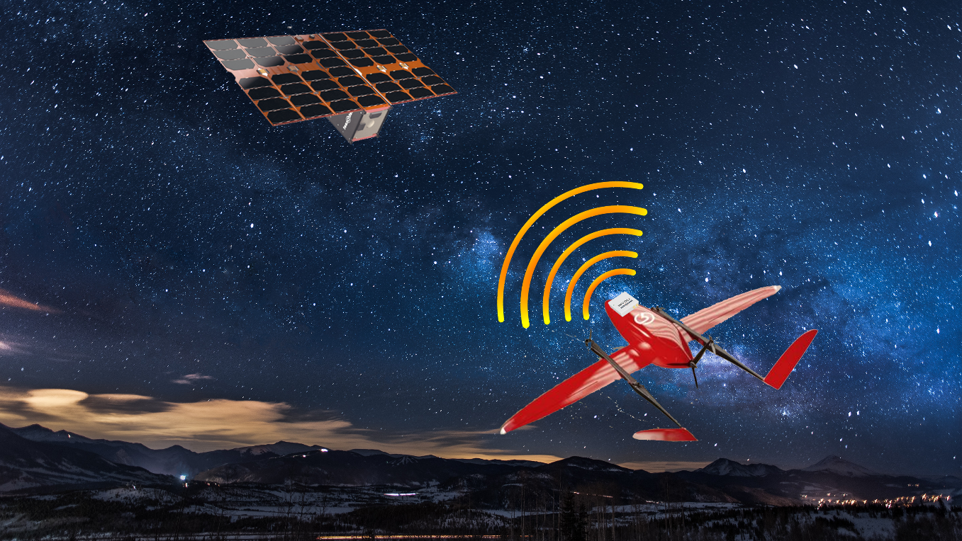
Delivery drones are more and more flying in areas which are not covered by telecommunication networks. Because of that, it could be really difficult to retrieve them in case of trouble. TrackSat aims to develop and commercialize a lightweight independent drone tracking service that, when installed on a drone, provides its position over 4G network. Then, in case the drone encounters a problem in an area without 4G coverage, the tracker will send its last position over satellite.
Users and their needs
A drone crash or a drone lost is a major cause of economic expense for a drone operator. Not only the operator won’t be able to finish the drone’s mission (and be paid by the final customer), but also the drone and its precious payload would be lost. Their recovery is often a very long and tedious process and virtually every drone operator has to face this situation at least once. The satellite drone tracker aims specifically to solve this problem, by allowing a fast and easy recovery of the lost drone. The satellite redundancy allows to use the tracker everywhere on the globe allowing also operators flying in an area with scarce connectivity to retrieve its drone.
Service/ system concept
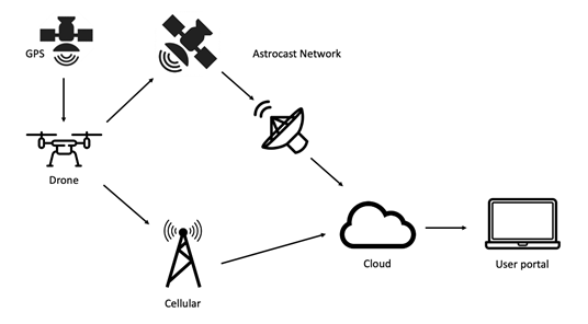
The drone tracker developed in TrackSat will allow to follow the drone during its mission in real time on INVOLI’s web application. The connection for live-tracking is established over the local LTE network. In addition to that, the position is broadcasted over WIFI, following the drone remote identification standard. The implementation is compatible with both US and EU regulations. Furthermore, the tracker allows to locate the drone over a satellite connection. This is very valuable in situations where cellular network coverage is not available and allows to recover a drone in case of emergency such as an unexpected landing a crash in any location.
Space Added Value
Drone delivery is more and more used in rural areas around the world. Although it is expected to have 4G coverage at least at the departure and arrival areas of the drone mission, it is often not the case on route. The possibility to use satellite communication in case the drone has troubles and has no access to 4G communication is a major advantage that will allow drone operators to mitigate way better the risk they are taking when performing a flight. The worldwide coverage provided by satellite communication is an advantage that cannot equal ground-based telecommunication network.
Current Status
The team has finalized the design of the tracker which is composed of two modules:
a) The tracker that incorporates the GNSS receiver, LTE modem, Satellite modem and the WIFI radio.
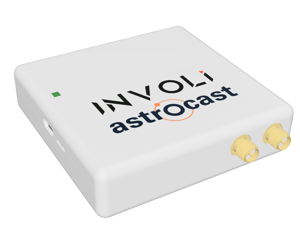
b) Satellite antenna modules that are connected to the tracker using RF cables allowing their ideal placement on the drone fuselage.
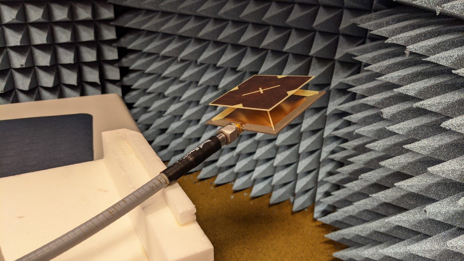
The Team manufactured and assembled prototypes to be tested in the laboratory and in the field.
Tests in the laboratory and in the field with the drone manufacturer and operator Rigi Tech have been performed in France. Feedback has been received from them and the drone manufacturer Swiss Drones.
We have assessed the real need for this product (especially for drone operators flying autonomous BVLOS drones) and we are preparing the next phases of development and commercialization of this product.