Objectives of the service
Trees have numerous functions. They provide oxygen and shade, but also filter fine dust, reduce noise, and protect us from heat and rainfall. For a modern city tree management invokes also significant costs and risk management (by dropping branches, falling over, hampering traffic, shedding leaves, etc.).
Tree information is an important element in rational tree management. It is not easy to keep this information up-to-date, also given the fact that trees grow, die, are hit by cars, etc. Once tree information has been collected, frequent updating is necessary.
Satellite earth observation may help tree specialists in collecting information effectively on tree presence, height and crown size. Also satellite positioning can be of value in field inspections. Both techniques can be of value in producing a first version of a ‘tree register’ but just as well in keeping the information in the tree register up-to-date. The objective of this feasibility study was to design, test and validate a service and system, using satellite data to demonstrate its capabilities in providing tree information.
Users and their needs
Several potential customer organization have been contributing in providing field data and user requirement information. Their interests are:
- To learn the ability of satellite Earth Observation data to update or to populate the cities’ tree register, in particular in measuring tree height and crown size;
- To learn if and how this data can be used in mobile devices to support ground officers;
- To evaluate whether satellite services can compete with existing alternatives and or how they can be integrated with each other;
- To understand how an information service can be of value to other stakeholders, and how its financing and governance can be arranged;
To learn whether an information service can help to increase transparency, accountability and involvement of citizens in ‘green city management’.
Service/ system concept
The service and system have been derived from the user needs. Three groups of services have been identified during the study:
- From satellite stereo imagery to detect tree height and tree crown.
- Make use of field inspections to provide stem position and other information using GNSS-based positioning. Other tree information refers to species, age, health, diseases, risks and habitat conditions.
- The possibility of adding more value to the data by trying to identify tree species from the imagery e.g. when invasive plants need to be identified and mapped.
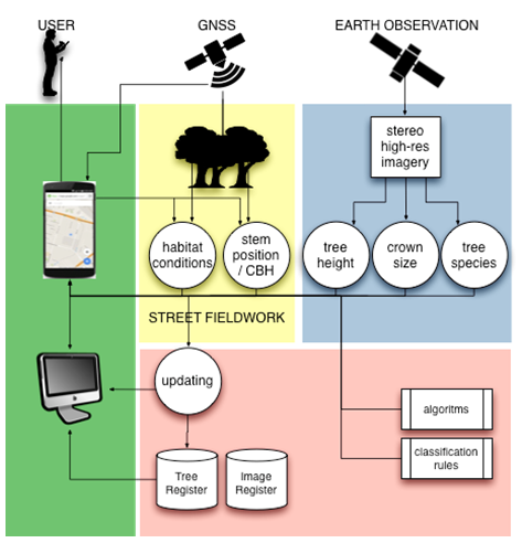
Figure 1. TRISS Service and system design.
Space Added Value
The principal space added value is that by looking from above an overview is obtained that can be processed into relevant tree information. The overview enables efficient field data collection. To obtain a second overview a year later is easily repeatable, which enables efficient detection of changes. The fact that satellite derived information can be provided quickly after collection immensely enhances the relation between fieldwork and imagery.
GNSS-positioning permits to match the tree identified on a satellite image and collect field data on the correct tree.
Current Status
The feasibility study ran between September 2015 and May 2016. The conclusions on TRISS feasibility are generally positive on their potential for so-called “Smarter Cities.” The project showed that by processing the stereo satellite images that a good proportion of trees can be geo-located from space. This technique cannot totally replace fieldwork (e.g. the need to positively identify tree type or survey small trees) but the overview and detail as well as the visual nature of the result can be very valuable when carrying out fieldwork and enhance its effectiveness.
A demonstration project will be defined in the coming months. In the Figures below an example is given of identified tree crowns in Amsterdam and of fieldwork carried out in Ireland.
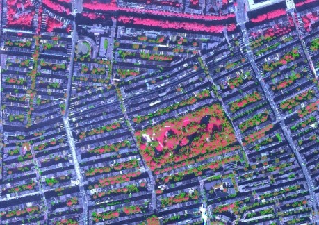
Figure 2. Automatically extracted tree crowns in green projected over the satellite image. Vegetation has been coloured red to enhance visualisation (false colour combination). © NEO
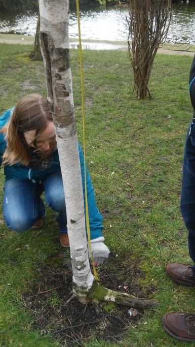
Figure 3: Checking Breast-Height © ICON
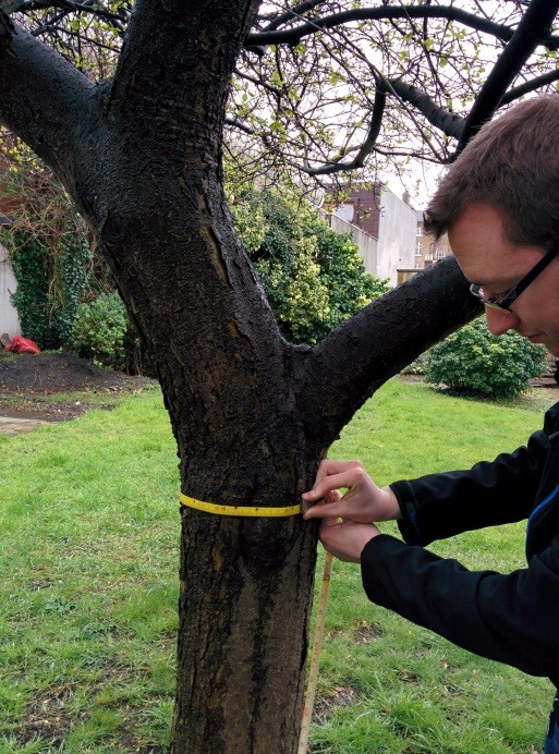
Figure 4: Measuring the diameter at breast height (DBH) of the tree © ICON