Objectives of the service

Klarifi exists to provide wastewater solution providers with top quality market intelligence. This entails letting our clients search the 150,000+ wastewater facilities on our platform based on a long list of search criteria and provide relevant details about each facility. Understanding the wastewater structures at each facility (clarifiers, aeration tanks, cooling towers, biogas digesters and anaerobic lagoons) adds a valuable data layer to the platform which is not available anywhere else.
The objective of the study is to test the feasibility of identifying these 5 structures from above and incorporating that data in Klarifi’s existing platform.
Users and their needs
Klarifi target the sales/marketing/business development teams at wastewater solution providers, particularly in North America. They need to generate high-quality leads, which is what we help them do.
Service/ system concept
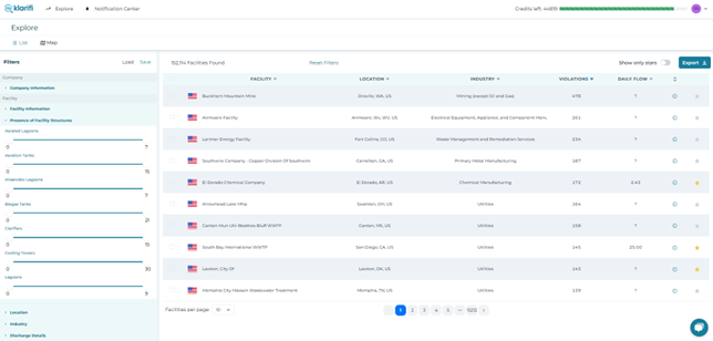
Users access Klarifis wastewater market intelligence platform via the web app. They apply relevant filters, peruse the information on the platform and may download data about specific facilities and contacts.
Klarifi’s base level of data comes from publicly available environmental permits and discharge limits, and the reporting that goes into such permits and limits. Aerial/satellite imagery and the object detection data resulting from are used to enrich the data about each facility in Klarifi’s database.
Space Added Value
For the study, Klarifi makes use of Earth Observation data (satellite imagery), because that provides access to images “from above” of the facilities on Klarifi’s platform, adding a unique competitive edge.
The Wastewater Structure Detection from Satellite Imagery (WSDSI) study uses space assets such as satellite imagery to detect wastewater structures. WSDSI lets Klarifi provide a wholly unique data layer of detected wastewater structures (clarifiers, aeration tanks, cooling towers, biogas tanks, wastewater lagoons) to their customers, distinguishing it from competitors. This innovative approach delivers accurate data, enabling wastewater solution providers to effectively target their offerings and enhance decision-making.
Current Status
The study is completed. We have demonstrated that it is indeed technically feasible to detect clarifiers, aeration tanks, biogas tanks, lagoons and cooling towers using aerial and satellite imagery.
Our interactions with 20+ users indicate a strong demand for especially data about biogas tanks and lagoons at wastewater treatment plants in the US, where we have 10+ clients indicating they would subscribe to the service if we had this.
The service is in production and all features are operational on www.klarifi.io.


