
Objectives of the service
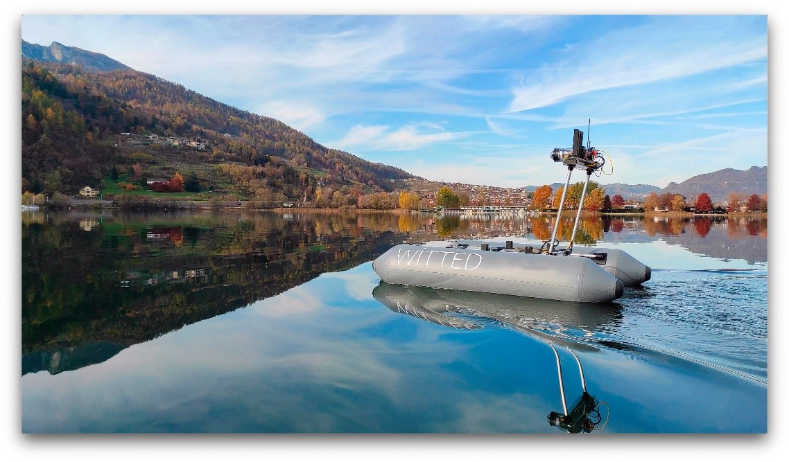
Image credit: Sea surface vessel prototype, Italy Project: Zephyrus
The aim of the project is to give MPAs, National Research Institutes, NGO and as well as marine operators access to advanced technologies as artificial intelligence (AI), robotics and space technologies, that could help, favorite and accelerate marine conservation.
In particular the project will allow the data mining of coastal marine habitats through embedded AI on satNav localized underwater explorer-class drones and surface vessels whose autonomous survey are optimized by cloud AI and Earth Observations (EO), creating web dashboards for MPAs to access all the marine habitats data, trends and alerts, and share them all within their community.
At a local level, the proposed AI empowered data mining solution will permit MPAs to effectively and cost efficiently analyze key marine habitats factors over time as seagrass coverage and erosion, specie populations like corals or fishes, native or invasive ones, plastic pollution and trends. Furthermore, at a national and international level it will allow National Research Institutes to quickly deploy best practices to the MPAs and coordinate actions to reach the aimed conservation goals.
Users and their needs
Through focused interviews with the various stakeholders of the marine protection (MPA, GO, NGO, etc), we have so identified in particular the following main need for the underwater drones and sea vessels:
- Customizable underwater drone with different choice of setups and data mining capabilities
- Extreme drone usability for non technical users
- High resolution vision capabilities for benthic documentation
- Georeferenced data mining capabilities
- Underwater localization
Target areas: Mediterranean Sea and all EU countries.
Service/ system concept
We propose an AI based continuous monitoring and analysis service aimed at MPAs, in particular for the benthic composition analysis through artificial intelligence, leveraging semiautonomous satNAV-localized explorer-class sea drones with satEO companion analysis service to provide digital twins of the natural reserves, alerts, and actionable insights to efficiently preserve MPAs and act at needs.
We split the proposed innovation in five subservices which could be developed, tested and deployed to the clients almost all in parallel.
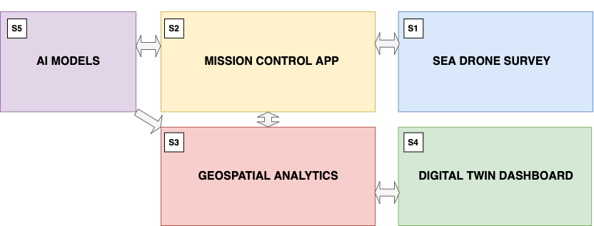
Image credit: full-service architecture, Zephyrus Project
Space Added Value
The space added value to the service is twofold: one the satNav localization of the surface vessels via RTK positioning down to few cm levels which allows to precisely geo-localize and time stamp the data mined at sea; EO to produce automatic change alerts over large areas for some key applications related to marine conservation like monitoring seagrass coverage or anthropogenic pollution.
Current Status
We completed the feasibility study achieving all the initial objectives of the project. We estimated the user needs via interviews with end-users, from which we defined the service requirements. Given those, then we successfully identified an overall service architectures, by splitting it in five sub-services ranging from AI model generation, to drones, vessels and supporting app for MPA data-mining, to the companion EO AI analysis, to the end-point GIS and data dashboard. We then de-risked most key components of the service from AI and EO to the vessel and drone hardware which has been successfully tested in indoor and outdoor scenarios.
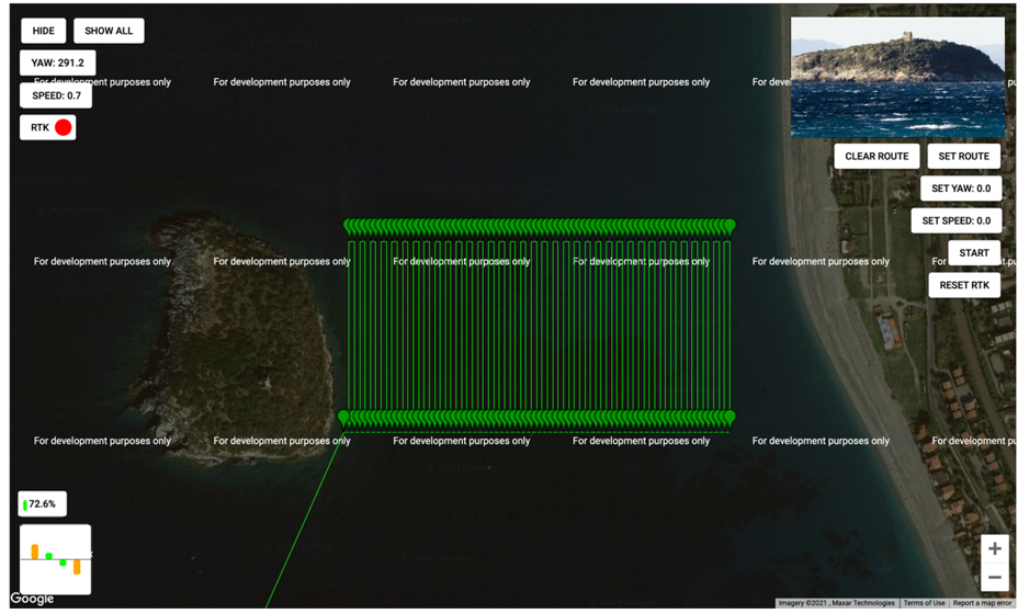
Image credit: Screenshot of control dashboard for a simulated data-mining mission, Zephyrus Project
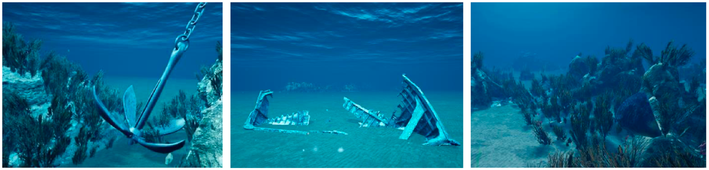
Image credit: Synthetic Data for AI training needs, Zephyrus Project
We identified a grow business model and key partners with which develop further the project in the next months.