
Satellite monitoring halves the number of bird strikes
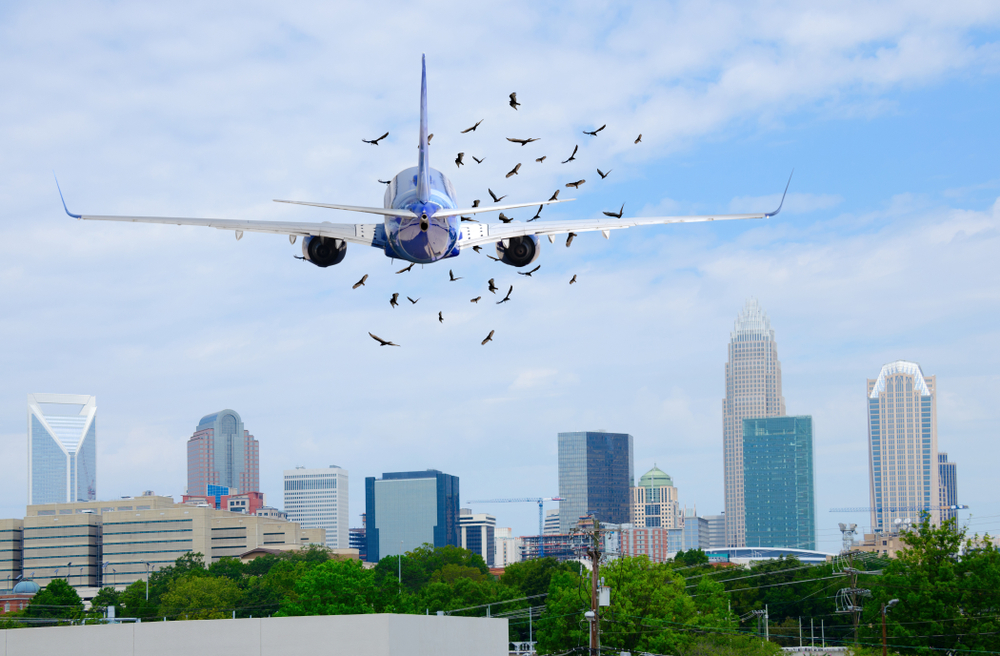 Many will remember the dramatic moment in January 2009 when US Airways Flight 1549 struck a flock of Canada geese not long after take-off from New York City, with a total loss of engine power. Unable to reach any airport, pilot ‘Sully’ Sullenberger performed a forced landing on the Hudson River, which the National Transport Safety Aviation Board described as “the most successful ditching in aviation history”. All passengers and crew survived.
Ten years on, aviation stakeholders are acutely aware that bird strikes are on the rise. Increased global passenger traffic, lower noise levels from airplanes and climate changes all affect wildlife behaviours. Danish company, AscendXYZ, has been working with the support of ESA on a novel solution that integrates bird radar with Earth Observation data to tackle this problem. The system is currently in use at Aalborg Airport in Denmark, where it has more than halved the number of annual bird strikes. Many large international airports are monitoring the results of this project, with the prospect of implementing the radar system and related services.
Wildlife preventive activities to reduce risks
Airport operators need to monitor and manage many things in order to secure aviation safety. What the current approaches have in common is that they are labour intensive, involve standalone systems, or demand specialised human resources.
Project ‘WAMMO’, which grew out of a previous ESA project using satellite data for obstacle management, adds ground radar data to the system. This brings a real-time element and provides on-line knowledge about the airport surroundings to all stakeholders, including Airport Operators, on-the-ground workers, Civil Aviation Authorities and wildlife management.
Synthetic Aperture Radar (SAR) and multispectral images (enabling detection of things not visible to the naked eye, such as infrared and ultraviolet) help to monitor changes in the ecosystems and landscape, while Very High Resolution (VHR) satellite images monitor the airport’s surroundings and habitats. Satellite navigation (e.g. GPS or Galileo) is used in a tablet-based solution to guide bird controllers to areas with identified bird activity.

Arnaud Runge, Technical Officer of the project at ESA explains:“Changes in bird activity are relayed to wildlife crew and actions taken in the field by the bird controllers are registered with geolocation information. With the radar data we can superimpose changes in bird behaviour on updated satellite images and use this information for analysis.”
Arnaud holds a commercial pilot’s license, which helped him understand what the company were trying to do. He has also experienced a bird strike first-hand and so was ideally positioned to support the project aims. “The idea was to move from visual observation to real tracking – you have radar on the runway and feed real-time bird activity information to the pilot,” he says. “This is already so successful that it was starting to be sold even before the end of the project. Airline companies are now requiring airports to get equipped as this has an insurance impact.”
Peter Hemmingsen, CEO of AscendXYZ says: “By combining the radar tracing of birds with satellite monitoring of the airport surroundings, Ascend offers a new and unique solution for airport wildlife management.
“With analysis of historical radar data, weather forecast and other factors, we can quite accurately predict bird behaviour over the next 9-18 hours. From an operational perspective this means you can now focus staff in high-risk periods. You can relay information to pilots to use in their pre-flight checks.
“Radar systems have created a lot of interest; we have created a whole company on the strength of our contracts with ESA. Before ESA we were a three-man company, now we have a strong position in the industry as the technology has been validated through the ESA IAP programme.
“The Business Applications programme brings a huge amount of value, owing to the detailed feedback and dialogue with the technical officers at ESA.”
AscendXYZ Avian Radar System from ascendxyz on Vimeo.