Deep Blue Globe
Deep Blue Globe
Zimmermannweg 10
64289 Darmstadt
Germany
ESA Business Applications Final Presentation Day
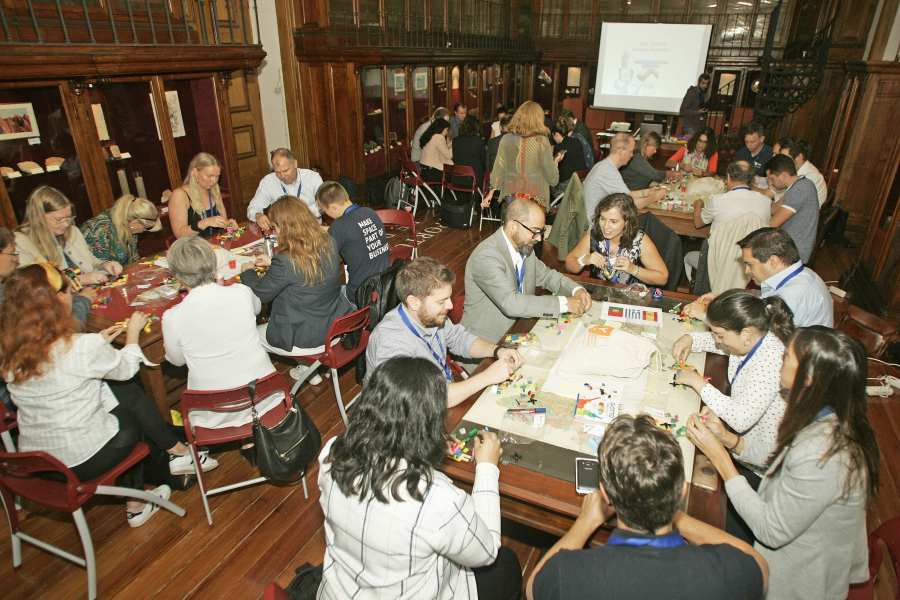
The ESA Business Applications Final Presentation day took place this month at the DLR’s Headquarters in Germany, showcasing activities that have achieved outstanding results in the areas of energy, maritime and communications.
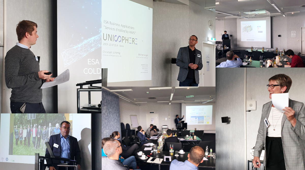
The event was opened by Dr. Gerd Kraft (DLR Director) who introduced the role of DLR as a German research and development organisation, major contributor to the European space programmes (e.g. EO, SatNav, SatCom), and promoter of innovation through a number of initiatives in several domains (e.g. artificial intelligence, competition INNOspace Masters, the initiative SpaceMoves, networks Space2Motion, Space2Agriculture and Space2Health).
Dr. Rita Rinaldo, Head of Institutional Projects for Downstream Business Applications at ESA, presented the scope and objectives of the ESA Business Applications and Space Solutions programme (BASS) and introduced upcoming initiatives and future tenders. Among these, the Kick-Start scheme was highlighted as a successful instrument attracting SMEs and new entrants to ESA, supported by DLR.

The seven teams presented their projects and engaged in inspiring discussions. With an efficient use of innovative technologies (e.g. artificial intelligence, High Altitude PseudoSatellite, machine learning, concentrated solar power systems, microgrids), they have all provided valuable service propositions along specific business verticals, such as communication in deep sea, smart fishing, services for electrification in developing countries, communication for off-shore, snow forecast dynamics and hydropower assessment.
Anke Freimuth, Coordinator for ESA Business Applications of DLR, said: “Thanks to this event we were able to show a number of interesting projects addressing a very diverse range of topics at a different stages of maturity, such as Kick-Start-activities, feasibility studies and demonstration projects”.
“The day gave us the possibility to show the multiple possibilities within the German Space Agency offered by the ESA Business Applications programme and how we can give newcomers the possibility to get in contact with the Agency and its different directorates,” she added.
Dr. Rita Rinaldo said: “The event showed how the investment made by ESA and DLR in the projects gave a high return in terms of socio-economic impact, with companies being able to reach the market and commercialise the services developed from what had been at the beginning just an initial idea."
“We are proud that ESA has helped them reach that stage and we look forward in the future to a higher number of companies through schemes like kick-start, through dedicated initiatives to be undertaken together with users/stakeholders operating in specific sectors and through the BASS network”.
Industry presenting:
COLDSUN “Communication reLay for Deep-Sea for Deep-Sea Underwater Networks” by D3TN
GLAUCUS “Smart Fishing and Route Planning System” by Deep Blue Globe
VIDA “Village Data Analytics” by TFE Energy
“Service enabled by HAPS” by Unisphere
COM4Offshore “Interactive communication and monitoring system for offshore wind energy ” by OHB
SnowSense “Integrated Service for Runoff and Hydropower Assessment and Forecast related to Snow Cover Dynamics in Remote Areas” by VISTA
CSP-FoSYS “Concentrating Solar Power Forecast System for Participation in the Spanish Electricity Market using EO and Communication Technologies” by TSK FLAGSOL ENGINEERING GMBH
Community reference
Posted to Hero article section
No
STRA, S.A.
Rua Pedro Nunes
3030-199 Coimbra
Portugal
INFEO
ul. Czerwonego Kapturka 3
10-696 Olsztyn
Poland
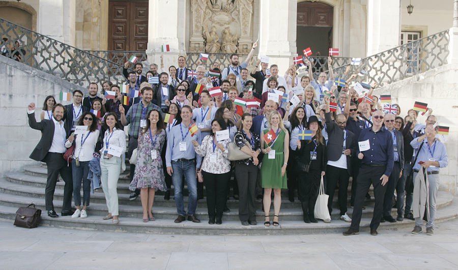
Portuguese Space Solutions celebrates their 5th anniversary at the 1st joint ESA Business Applications and ESA Space Solutions meeting
During the first three days of October, the European Space Agency’s (ESA) team of Business Applications and Space Solutions (ESA BASS) had their first joint meeting, in Coimbra, Portugal, gathering its network of partners. This event was also the perfect opportunity to celebrate the 5th anniversary of the Portuguese Space Solutions Centre.
Inaugurated in late 2014, Instituto Pedro Nunes (IPN) was the first European Space Solutions Centre to host within the same entity and team the three ESA elements promoting downstream businesses: ESA Business Incubation Centre, ESA Technology Transfer Brokers, and ESA Business Applications Ambassadors. The aim was to foster synergies between programmes and initiatives, and IPN has been a case study of how these tools can better foster national economies by the use of space technologies and satellite data.
In the past years, the results of combined efforts have been positive:
- 30 incubated companies which allowed the creation of approximately 100 new jobs, with a total turnover of around 5 million euros and an export capacity of over 75%.
- More than 30 space technologies identified with potential to be commercialized in non-space markets.
- 16 ESA Business Applications small feasibility projects directly supported to create new products and services in terrestrial markets with an investment of 2.5 million euros.
“The entrepreneurship new space ecosystem is there, alive and kicking”, said Carlos Cerqueira, Head of the ESA Space Solutions Portugal, and “ESA Space Solutions Portugal was the spark that boosted it and made it a truly vibrant community”.
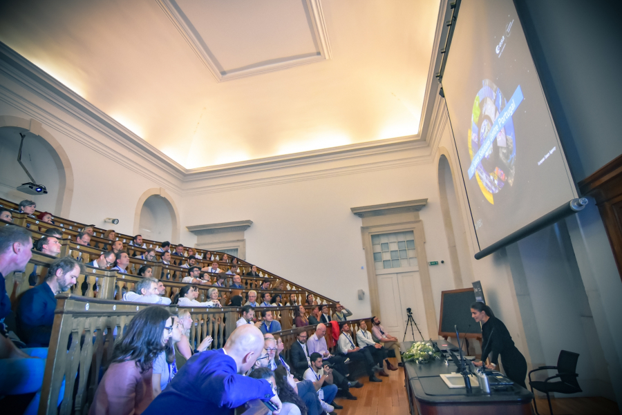
During three days, representatives of 20 ESA Member States, from ESA BIC managers, Technology Transfer Brokers and Ambassadors, as well as ESA staff gathered in the Portuguese student’s city of Coimbra to discuss the future of the network, share experiences, learn with each other as well as to identify the key success factors to foster downstream businesses, and align future join efforts.
In the words of Frank Salzgeber, Head of Innovation and Ventures Office at ESA: “The power in Europe is that we work together. We have different nationalities, different ideas and different skills in our network, and by working together we know are more powerful.”
The programme included plenary sessions to the overall network; ideas exchange; hands-on collaborative workshops to discuss the future challenges of the network; sessions on ESA patent portfolio and available funding tools, optional programmes that could be of benefit for the Member States economic development; and parallel sessions to each profile expert (ESA BICs, Brokers and Ambassadors). Ultimately, all agreed that the newly joint teams have the power to promote key activities in 20 ESA Member States fostering innovation, entrepreneurship and new scalable downstream businesses.
“In this room you could find the key experts from almost all Member States to support your business, within the plethora of ESA funding opportunities” said Nick Appleyard, the Head of ESA Downstream Business Applications.
Beyond the joint meeting the event also brought industry and space tech providers / brokers together to discuss and match the needs presented by companies such as Ansell Portugal, Eletrolux, Martifer Renováveis, The Navigator Company, Prio Energy, Sellafiel, Sonae Inovação, Valeo and the Portuguese Centro Region Intermunicipal Community. This session provided the network more than 45 potential space to non-space tech transfer opportunities.
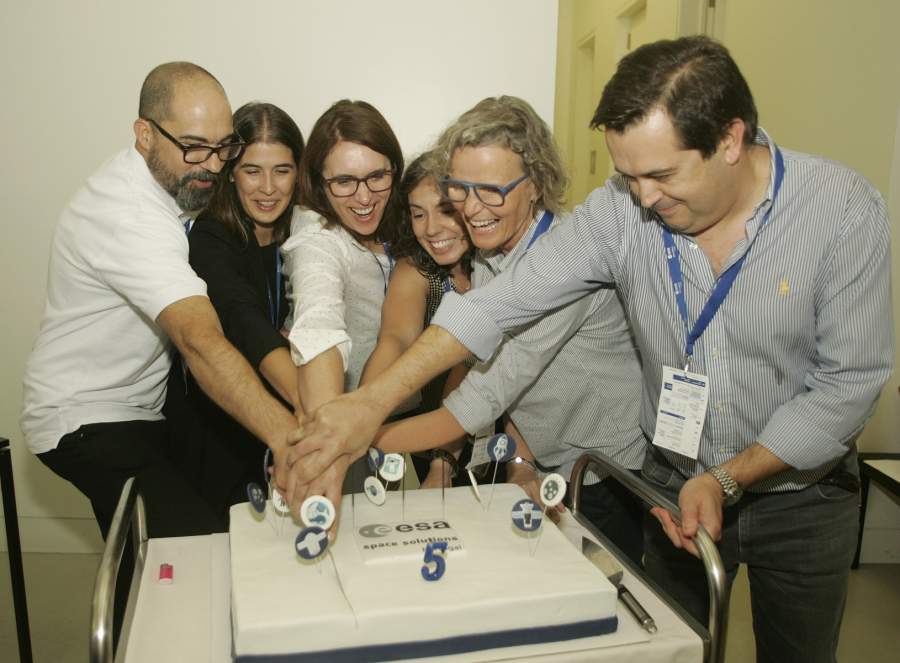
IPN also celebrated its own achievements and milestones of the past 5. New incubates were presented to the network, as well as national projects funded through the Small Business Applications Portuguese call and also success cases of technology developments from space down to Earth. The celebration was completed with an ESA BIC Portugal alumni graduation ceremony.
Overwhelmingly the feeling of the event was the importance of the joint efforts and complementary skills that will help to solve the network challenges in the near future.
Author: ESA Space Solutions Centre Portugal
Community reference
Posted to Hero article section
No