Objectives of the service
AERIUS responds to the growing need of cities for harmonised, spatially consistent, and repeatable evidence on the condition, change, and performance of urban ecosystems. It combines Earth Observation, in-situ measurements, meteorological data, and municipal GIS layers into coherent, ready-to-use indicators that quantify vegetation vitality, tree canopy extent, water quality, soil moisture, and thermal comfort.
The objective of AERIUS is to enable municipalities to plan, operate, and restore urban green assets in a data-driven and transparent way. The service supports evidence-based decisions for climate adaptation, biodiversity enhancement, and public well-being by providing spatial intelligence that bridges strategic planning and operational maintenance.
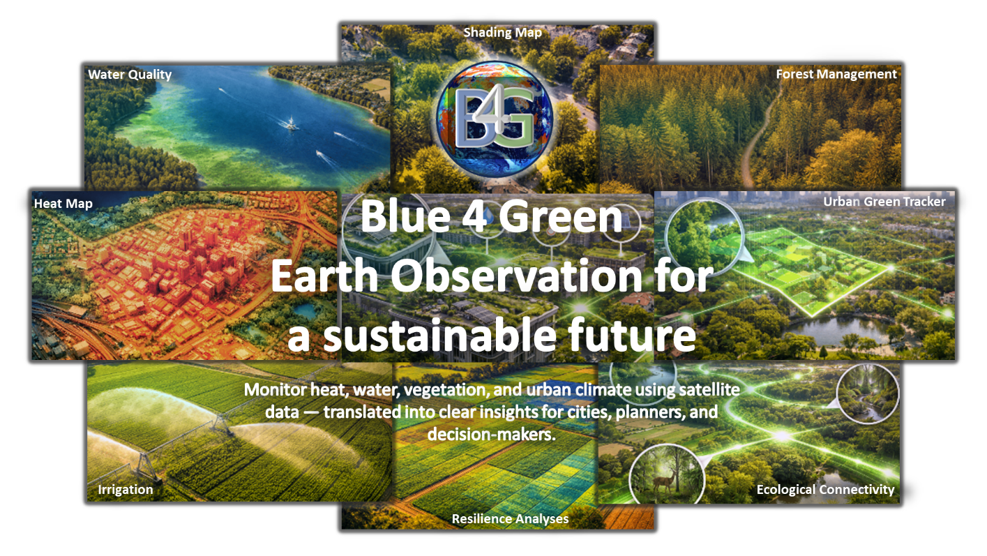
Beyond monitoring, AERIUS delivers annual updates and change-detection maps that quantify “no-net-loss” and “net-gain” of green and canopy cover as required under the EU Nature Restoration Law. The system also provides thematic modules such as Urban Heat Islands and Shading degree, Water Quality, Irrigation Advisor, and Tree Inventory to address broader resilience objectives.
Through its modular architecture and multilingual Blue4Green web portal, AERIUS ensures easy access, comparability, and long-term continuity of environmental information for cities of all sizes — fostering measurable progress toward more liveable, climate-resilient, and nature-positive urban areas.
Users and their needs
Target users are municipal departments responsible for urban planning, environment, green space management, and water management in Germany, Romania, and the Middle East. These users need reliable, scalable, and comparable information to manage urban green infrastructure, respond to climate impacts, and support planning and policy reporting. A key challenge is that relevant data are often fragmented across departments, while many municipalities lack in-house Earth Observation expertise. AERIUS addresses this by transforming complex EO and geospatial data into practical, decision-oriented information products for daily municipal use.
Main user needs include:
-
Monitoring urban green vitality, vegetation stress, and resilience
-
Detecting urban heat islands and assessing thermal risk
-
Analysing shading of playgrounds and public spaces to guide adaptation measures
-
Monitoring water quality and algae bloom risks in urban water bodies
-
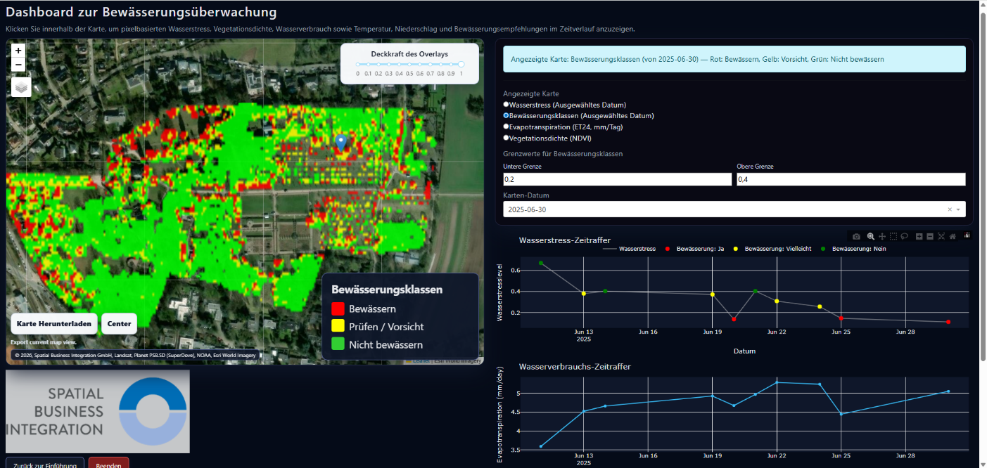
Mapping soil moisture and irrigation demand for managed green spaces
-
Supporting tree inventory and canopy cover assessment
-
Assessing ecological connectivity of urban green areas and identifying fragmentation
-
Identifying rooftop areas suitable for greening
-
Tracking changes in urban green infrastructure for compliance with the EU Nature Restoration Law, including baseline and update reporting
Service/ system concept
AERIUS is delivered through the multilingual Blue4Green Portal, a cloud-based platform that integrates Earth Observation (EO), in-situ, and municipal data into a unified operational environment. The system provides seven modular services: Urban Green Resilience & Change, Water Quality, Urban Heat Islands, Shading Degree, Irrigation Advisor, Urban Tree Inventory, and the EU Nature Restoration Compliance Suite. Each module combines Earth Observation data with meteorological inputs, very-high-resolution imagery, and GIS reference layers to generate accurate, comparable indicators at municipal and district levels.
Automated data ingestion, pre-processing, and change-detection workflows ensure continuous updates, while advanced analytics quantify trends and anomalies in vegetation, canopy, heat, and water dynamics. The Blue4Green front-end allows users to visualise, compare, and download thematic layers, dashboards, and reports in multiple languages (EN/DE/RO/AR).
The system architecture follows open-standards (OGC) principles, supporting interoperability with existing municipal geodatabases and reporting tools.
Space Added Value
AERIUS leverages multiple space assets, including high and very-high resolution Satellite Earth Observation (SatEO) data and Global Navigation Satellite System (GNSS) technology, to provide comprehensive data for urban green space management. The SatEO data supplies detailed imagery for monitoring surface temperatures, water quality, and vegetation health, offering frequent updates and extensive coverage essential for timely and accurate information. GNSS technology is used to geolocate in-situ measurements accurately, enhancing the integration of ground-based data with satellite imagery. This combination allows for precise mapping and monitoring of urban environments.
The added value of using these space assets lies in their ability to provide consistent, large-scale, and high-resolution data, which traditional methods cannot match. Unlike ground-based surveys, which are time-consuming and limited in scope, satellite data ensures comprehensive monitoring with reduced labor and cost. Aerial and UAV imagery, while useful, are limited by higher acquisition costs, restricted coverage, and the need for complex image processing. Utilizing SatEO data and GNSS, AERIUS offers city authorities a more efficient and cost-effective solution for managing urban green spaces, ensuring sound decision-making and resource optimization compared to existing methods.
Current Status
AERIUS has successfully completed its demonstration phase. From April 2025 to March 2026, the Blue4Green platform was piloted with 12 municipalities across Germany, Romania, and the Middle East, involving users from municipal planning, environment, green space, and water management departments. During the project, Blue4Green delivered nearly 800 analyses covering heat, shading, irrigation, resilience, water monitoring, Urban Green Tracker, ecological connectivity, green roof potential and tree delineation. The pilot demonstrated particularly strong user interest in heat-related services, water monitoring, shading, irrigation, and resilience analysis. Current activities focus on refining service packaging, and preparing the transition from pilot operations to commercial service provision. Next steps include market launch preparation, follow-up discussions with interested municipalities, and conversion of pilot experience into scalable service offers.