

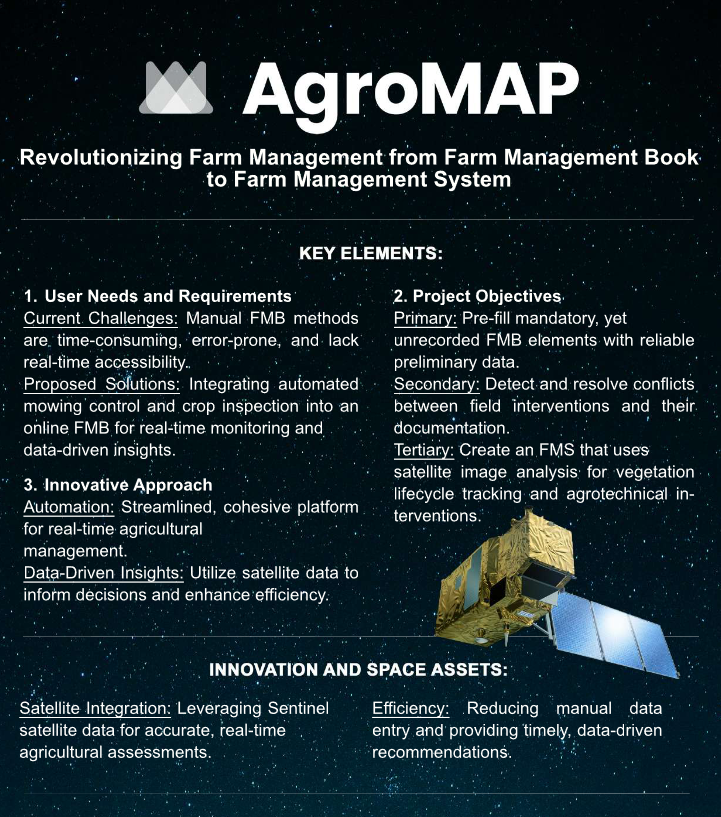
Objectives of the service
Primary objective:
Auto-filling mandatory, yet not recorded elements in the Farm Management Book with preliminary reliable data.
Secondary objective:
Detection of conflicts between field-based agricultural interventions and their documentation. Indicating conflicts between already recorded factual data in the FMB and on-site reality, along with suggested resolutions.
Tertiary objective:
Our final objective is to create an FMS that utilizes the outcomes of processed satellite image analysis, including map layer files. These results will be made accessible to users via diverse map layers, accompanied by user-friendly legends. This transformation will enable the FMS to not only provide corroborative evidence for assessments but also empower farmers by furnishing supplementary insights, thereby facilitating informed data-driven decision-making.
To achieve these goals, after a one-time input of data from farmers (parcel-based), we intend to exclusively utilize the time-series analysis of the Sentinel satellite data for area-based assessments. The focus is on tracking the vegetation lifecycle of major land uses, such as cereal and row crops, as well as permanent grassland areas (identification of crop type and status), and identifying agrotechnical interventions in the areas (harvesting, mowing).
Users and their needs
The AgroMAP Quality Control service targets agricultural farmers and advisors in Hungary. These users depend on precise, and quality checked data for efficient farm management and regulatory compliance.
Users Involved:
-
Agricultural Farmers: Managing crop production, livestock, and other agricultural activities.
-
Agricultural Advisors: Offering consultancy and support for optimizing farming practices and compliance.
User Needs:
-
Efficient Data Management: Automation to save time and reduce manual errors.
-
Insights: Up-to-date information for timely, informed decisions.
-
Regulatory Compliance: Tools to ensure adherence to agricultural regulations.
-
Operational Efficiency: Streamlined processes to reduce administrative burdens.
-
Accurate Reporting: Reliable data extraction to avoid discrepancies and data loss.
Challenges:
-
System Stability: Ensuring a stable Farm Management System free from technical issues.
-
Data Accuracy: Addressing mismatches between recorded data and inputs.
-
User Feedback: Providing a robust customer portal for feedback and data visibility.
AgroMAP aims to meet these needs, enhancing productivity and sustainability in Hungary's agricultural sector.
Service/ system concept
The AgroMAP Quality Control service introduces a transformative Farm Management System (FMS) to alleviate the manual data management burden in the Farm Management Book (FMB). It streamlines agricultural practices using satellite image analysis and map layers.
Key Features and Capabilities:
-
Automated Data Entry: Pre-fills mandatory FMB elements with accurate preliminary data.
-
Conflict Detection: Identifies discrepancies between field activities and documentation.
-
User-Friendly Interface: Provides intuitive, data-driven insights for better decision-making.
How It Works:
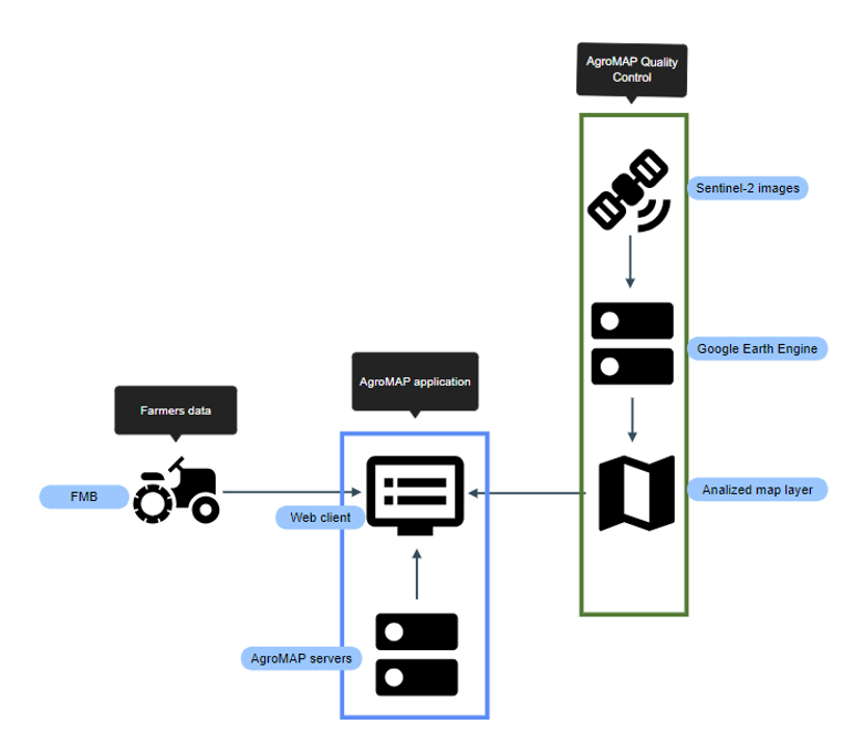
-
Data Collection: Gathers raw satellite images (Sentinel-2).
-
Pre-Processing: Applies cloud masking and creates composites and index rasters.
-
Time-Series Analysis: Uses machine learning and expert models to analyze vegetation and crop conditions.
-
Data Integration: Integrates data into an FMS, offering real-time insights and conflict detection.
System Architecture:
-
Software Tools: Utilizes Google Earth Engine, API-based image retrieval, SNAP, and QGIS for processing and evaluation.
-
Satellite Image Analysis: Conducts time-series analysis with GIS methodologies and validation data from farmers.
Validation:
-
Crop Identification: Identifies major crop categories and landscape elements at pixel level.
-
Utilization Status: Provides status raster indicating condition of agricultural utilizations.
-
Mowing Detection: Marks mowing occurrences on grasslands.
This system supports Hungarian farmers by reducing administrative workload and enhancing data accuracy, thereby improving agricultural efficiency and regulatory compliance.
Space Added Value
The AgroMAP Quality Control service utilizes Sentinel-2 satellite imagery to revolutionize farm management. These space assets offer high-resolution, multi-spectral images that enable precise monitoring of agricultural activities. The key benefits include:
Space Assets Used:
-
Sentinel-2 Satellites: Provide high-resolution imagery for detailed vegetation analysis and crop monitoring.
Added Value:
-
High Precision: The 10-meter resolution imagery allows for detailed analysis at the pixel level, ensuring accurate identification of crop types and field activities.
-
Automated Data Collection: Reduces the need for manual data entry, minimizing errors and saving time for farmers and advisors.
-
Enhanced Decision-Making: Data-driven insights support better planning and intervention, leading to increased agricultural efficiency and productivity.
Advantages Over Competitors:
-
Comprehensive Analysis: Unlike competitors who may rely on manual or less frequent data collection, AgroMAP's use of Sentinel-2 provides a more comprehensive and accurate picture of agricultural operations.
-
Scalability: The system can easily scale to monitor large and diverse farming areas, offering consistent performance regardless of farm size.
-
Cost-Effectiveness: By automating data collection and analysis, the system reduces labor costs and enhances operational efficiency, providing a competitive edge.
Overall, combining Sentinel-2 satellite imagery with advanced analytics significantly improves the precision, efficiency, and effectiveness of farm management compared to traditional methods.
Current Status
The AgroMAP Quality Control service is currently under development. Key achievements of the current study include:
-
Collecting the needs and requirements from the users
-
Pre-processing and analysis of Sentinel-2 imagery.
-
Successful deployment of the prototype Farm Management System (FMS).
-
Conducted pilot tests across Hungarian farms, involving 25 000+ hectares.
The study is now completed and has concluded that the proposed service is technically feasible and commercially viable. DDLA technologies is currently working on the following tasks:
-
Refining the user interface based on pilot test feedback.
-
Enhancing data accuracy and conflict detection algorithms.
-
Ongoing integration of additional satellite data.
The AgroMAP Quality Control service is on track to significantly enhance farm management efficiency and regulatory compliance for Hungarian farmers. In order to launch the AgroMAP Quality Control service as soon as possible, DDLA has identified the following key activities:
-
Expanding pilot tests to include 250+ users in different regions.
-
Conducting training workshops for users on the new FMS features.
-
Preparing for the final system validation phase and large-scale deployment.
These activities are in-line with a follow-on Demonstration Project and DDLA technologies intends to propose such a project to ESA Space Solutions.