Objectives of the service
Farmers often travel long distances to fields, only to find the ground too wet to work on or get stuck in the mud. During harvest, they perform multiple test harvests across fields, discovering that crops are not yet ready. Spraying herbicides presents challenges in targeting the exact areas needing treatment, leading to inefficient chemical use and environmental harm. Disease scouting is labour-intensive, with early infections often missed in large fields. In arid regions, determining the right time to irrigate is difficult, as fixed schedules can lead to over- or under-irrigation, both of which harm crops.
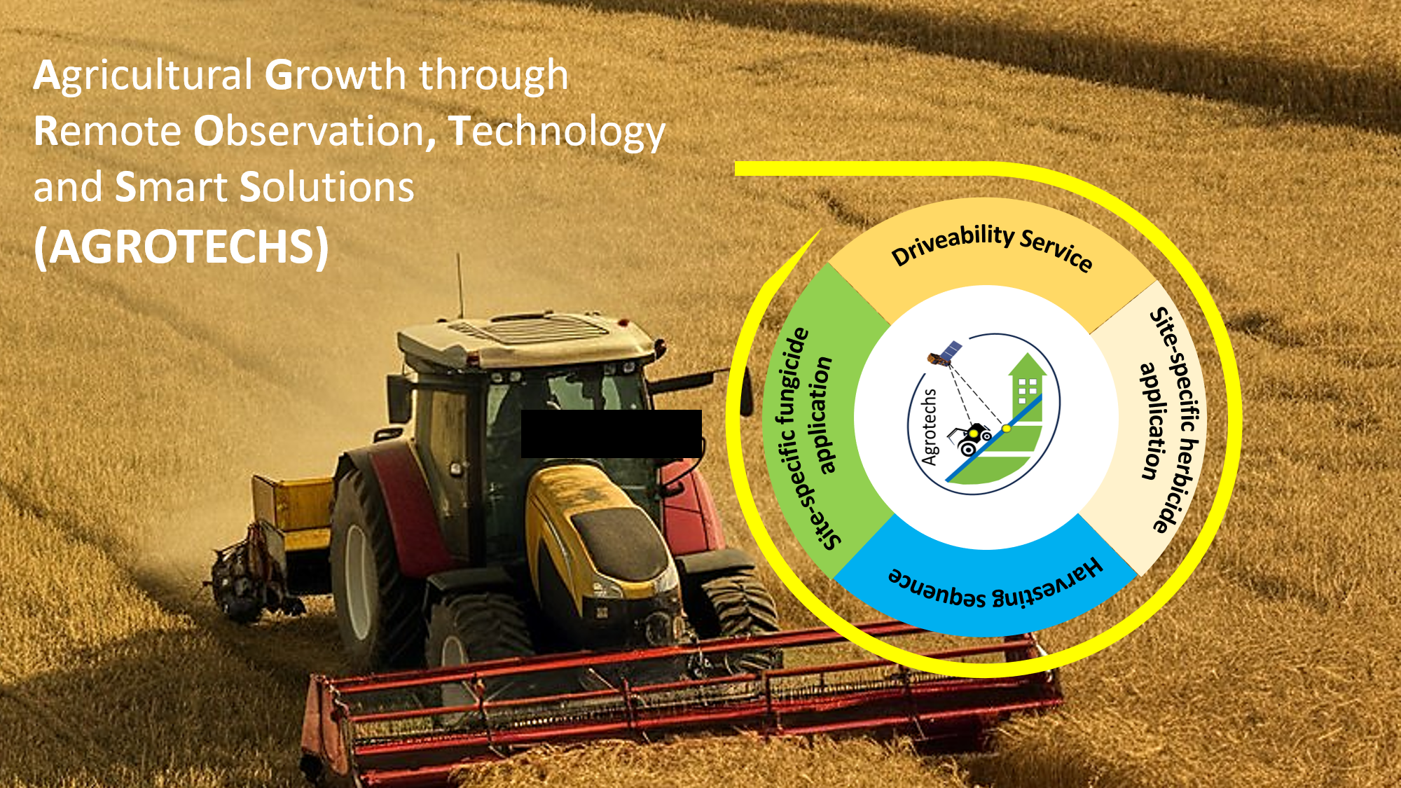
To address these challenges, the Kick-Start activity proposes innovative services: Driveability maps assess soil moisture, preventing vehicles from getting stuck. Site-specific herbicide maps enable precise spraying, reducing chemical use and environmental impact. Harvest sequence maps optimize crop harvest timing, minimizing unnecessary trips. Disease risk maps highlight infection-prone areas for early intervention. Irrigation advice maps provide data-driven recommendations on when to water crops, ensuring optimal irrigation. Together, these services enhance agricultural productivity, sustainability, and operational cost-effectiveness, helping farmers make better-informed decisions and optimize their resources.
Users and their needs
The primary users of the proposed services are farmers and technology providers, both seeking solutions for optimizing agricultural practices. These services deliver essential information on the timing of fieldwork and resource management for weed control, disease prevention, and irrigation. Specifically, farmers need to:
-
Know the optimal timing for operating agricultural machinery to avoid unnecessary field trips.
-
Pinpoint the exact locations of weeds on their farms for precise herbicide application.
-
Address crop diseases and risks early to prevent their spread and optimize yields.
-
Receive timely irrigation advice to apply water efficiently, preventing over- or under-irrigation and ensuring optimal crop growth.
-
Access clear, ready-to-use information without the need for further interpretation.
Technology providers that already serve farmers with digital solutions seek to expand their portfolio of information products. They require technologies that can be seamlessly integrated into their existing infrastructure.
The proposed services meet these needs by offering driveability, site-specific herbicide, disease risk, harvest sequence, and irrigation advice maps, with easy access via a web-based portal and API. User needs vary across regions, as shown by consultations in Germany and the Middle East. Scaling these services to different agro-ecological zones requires addressing these differences. Advanced tools must deliver precise, actionable information tailored to the specific needs of farmers and organizations in diverse regions.
Service/ system concept
Agrotechs services deliver crucial information for optimizing agricultural practices, helping farmers and technology providers manage resources effectively. Users receive maps that highlight soil moisture (driveability), weed locations (site-specific herbicide maps), disease risks (disease risk maps), and optimal irrigation timing. Harvest sequence maps also provide guidance on when to harvest crops for maximum efficiency. Farmers can use these maps on their devices to plan operations like irrigation, herbicide spraying, and harvesting. Technology providers can integrate these insights into their own platforms, enhancing their digital offerings for precision farming. The system operates by capturing data on crops and soil through satellite Earth Observation (SatEO) technologies. This data is processed in the cloud using advanced algorithms to analyse key factors such as vegetation health, soil moisture, crop growth stages, and topographical influences on microclimates. The value-added information products are updated regularly to support timely decision-making. The system is designed to scale, adapting to different farm sizes and environmental conditions, making it valuable across various regions and agro-ecological zones.
Space Added Value
The Agrotechs services leverage space assets such as Sentinel-1 radar, Sentinel-2, and very-high-resolution commercial optical imagery, combined with Digital Elevation Models (DEM), to offer a comprehensive solution for precision agriculture. Sentinel-1 provides consistent soil moisture data, unaffected by weather conditions, while the optical imagery delivers high-resolution, multispectral data to monitor vegetation health, crop maturity, and detect issues like weeds. DEM data adds a topographical layer that helps model microclimates and predict areas prone to disease risk.
A key advantage of space-based assets is the ability to provide cross-farm assessments at a large scale, which is especially valuable for cooperatives managing vast areas. Satellite imagery allows for monitoring across multiple fields or farms, offering a more efficient, scalable approach compared to traditional methods. The availability of time series data enables farmers and cooperatives to track changes over time, identifying trends in soil moisture, vegetation growth, and disease risk. By remotely assessing key factors, the use of satellite imagery significantly reduces operational costs, minimizing the need for on-site inspections. This broad-scale, regular monitoring enhances decision-making for irrigation, herbicide application, and harvest timing, far surpassing the limited scope of manual scouting or ground-based sensors.
Current Status
In this study, the user needs of large-scale farmers, agricultural cooperatives, technology providers, and input suppliers were comprehensively assessed to optimize precision agriculture practices. Based on these findings, five key services were defined using SatEO data combined with advanced algorithms: driveability maps, site-specific herbicide application maps, disease risk maps, harvest sequence maps, and irrigation advice maps. These services offer users crucial insights to optimize field operations, manage resources efficiently, and improve productivity.
The required SatEO data and additional input sources were identified, and the necessary system components for seamless integration and cloud-based delivery were defined. The willingness to pay for these services was confirmed across different user segments, and it was agreed to deliver pilot products during the upcoming growing season. The next step involves implementing the service components in an operational environment, conducting field validation tests, and securing pilot customers to further refine the service and prepare for full-scale market deployment.