Objectives of the service
Saving fuel is key to reducing operating expenses in the shipping industry and meeting increasing regulatory requirements for greenhouse gas emission reductions.
A feasibility study made for ESA has shown that significant fuel savings can be achieved by integrating the best ocean circulation models with satellite data. The DHI Global Seas project has implemented findings from this feasibility study into a fully operational, global metocean forecast system.
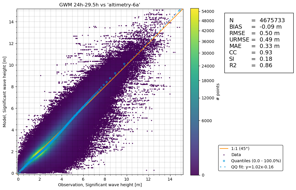
The extension of the DHI Global Seas project, DHI Global Seas Offshore Wind Energy CCN (Contract Change Notice) has focused on the offshore wind industry. Reducing downtime when constructing and when servicing offshore wind farms is an important factor in lowering costs of this renewable energy resource. To achieve this, highly accurate wave forecasts with uncertainty assessment is required, which have been added to the service in this second part of Global Seas.
Together the two parts of DHI Global Seas provided global forecasts of winds, waves, currents and water levels where satellite data enrich the quality of the wave and current models. Furthermore, the accuracy of the models was assessed through a comparison with in-situ measurements and satellite data. The users were not restricted to the shipping industry and the offshore wind industry only, but included all users working at sea.
Users and their needs
The users addressed by the DHI Global Seas service, and their needs are:
-
Shipping companies: Reduce operating expenses through fuel savings, better fleet management and lower risks
-
Software and service providers (to the shipping companies): Provide performance assessment and routing service that can lead to fuel savings and lower risks
The users addressed by the DHI Global Seas Offshore Wind Energy CCN service, and their needs are:
-
Contractors: Designing, planning and executing transport and installation of offshore wind turbines and their substructures as well as associated substations
-
Wind Farm Operators: Managing service, maintenance and repair activities of Offshore Wind Farms during operation
-
Service Providers to 1. and 2.
Service/ system concept
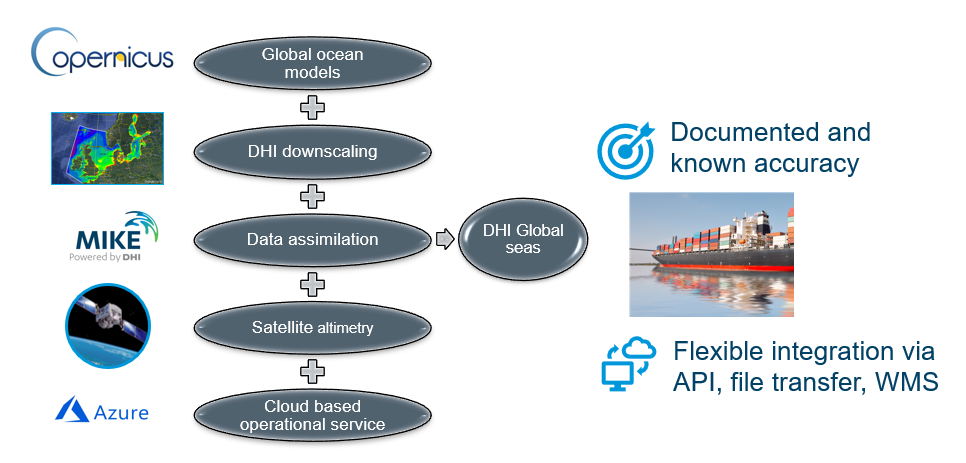
The DHI Global Seas and DHI Global Seas Offshore Wind Energy CCN data is provided from a large set of accurate regional ocean current models enriched through machine learning, calibration and assimilation of satellite altimetry data combined with global wind, wave, oceanographic and tidal models also based on satellite altimetry.
DHI Global Seas and DHI Global Seas Offshore Wind Energy CCN delivers hourly information on ocean current, wave and wind forecasts up to five or 10 days ahead in time globally.
The data flow for the metocean forecasts are illustrated in the figure below, where regional current models are forced with data from the global Copernicus model, satellite data are integrated into the models, and forecasts delivered to the users through e.g. an API.
The data flow for the wave model is a bit simpler as DHI Global Seas Offshore Wind Energy CCN includes a global wave forecast model itself thus not requiring an external global wave model. The forecasts are delivered in a similar way as the current forecasts.
Space Added Value
This solution relies most heavily on altimetry-based sea surface height, significant wave height and wind speed products and scatterometer wind speed data. Sea surface observations are both used for continually updating the tidal water level and current products and it is the most important satellite observation for constraining mesoscale dynamics (most noticeably ocean eddies and western intensification currents like the Kuroshio and the Gulf Stream) in ocean models via data assimilation.
For the wave predictions, the combination of altimetry, scatterometry and in situ will particularly impact swell prediction, which are often critical to predict for offshore wind operations.
The regional ocean current prediction approach from Global Seas already incorporated altimetry data products from e.g., the SRAL instrument on Cryosat-2, Jason 1-3 and Sentinel 3A and 3B. With the newly released data products from Sentinel-6 (Michael Freilich) the data availability for the Global Seas solution is significantly increased, leading to higher accuracies and confidence in the Global Seas modelled parameters.
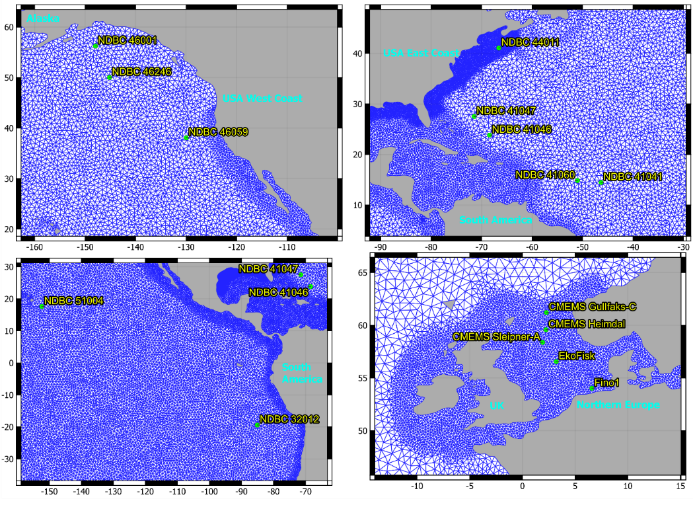
To further assess the prediction skill of particularly wave predictions, the Global Seas EO database was extended by integration of scatterometer surface wind speed data in the North Sea pilot area. This entailed that the following additional data products were evaluated and the ASCAT data added offline to the Global Seas satellite database and used for quantifying the accuracy of wind speed predictions in the North Sea:
| Satellite | Version | Temporal Coverage | |
|---|---|---|---|
| Start | End | ||
| QuikScat | 12.5km | 1999-10-28 | 2009-11-22 |
| ASCAT10 | Metop_A 12.5km | 2009-11-22; | Now |
| Metop_A 25km | |||
| Metop_A Coastal_opt | |||
| Metop_B 25km | |||
| Metop_B Coastal_opt | |||
| OSCAT | 12.5km; | 2010-01-16 | 2014-02-21 |
| RapidScat | 12.5km | 2014-10-03 | Now |
In order to deliver the service, accurate position and delineation of assets, vessel positions during transport operations (installation, O&M etc.) is needed. This is generally obtained based on GALILEO/GPS measured positions for accurate geo-positioning.
Current Status
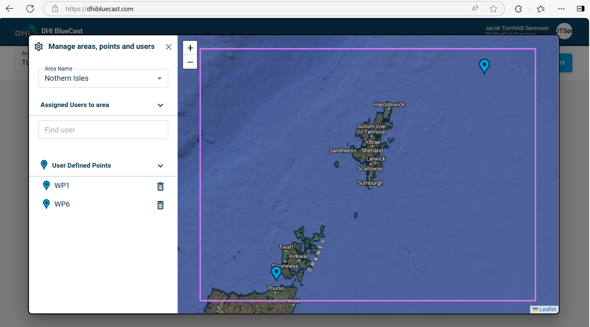
DHI Global Seas and DHI Global Seas Offshore Wind Energy CCN are both finalized. The projects have ultimately resulted in integration of key technology components in the DHI BlueCast forecasting system launched in Spring 2024 and with a high success in the market since.
Prime Contractor(s)
Subcontractor(s)