Objectives of the service
ECO4CO tackles the challenging task of supporting institutions in DSS - Decision Support System – activities by means of Artificial Intelligence, with the main objective being to counter the spread of the Covid-19 pandemic and to provide rapid insights and evidence of geolocalised events, that may impact the evolution of outbreaks.
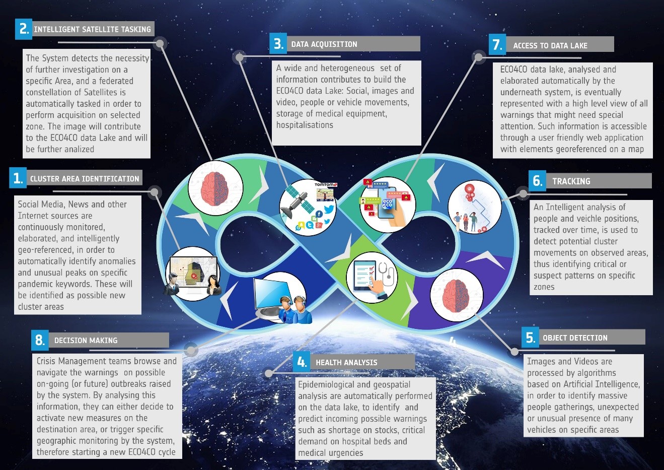
ECO4CO provides a fully autonomous and automated end-to-end system, combining data from satellites (image acquisition, GNSS/EGNOS navigation data), the Internet (social media, news, etc.), traffic (mobile, automotive), and medical data (e.g. medicine stock, hospitalization, infection, fatalities).
By exploiting the functionalities offered by its internal services, the system provides end-users (authorities, civil protection, etc.) with notifications, warnings and timely/geolocalised communication services, covering potential risk areas, criticalities regarding facilities or medical storage and mass movements. The ultimate objective is to provide crucial information in order to be able to effectively prevent new outbreaks, and to react in advance in an upcoming critical situation.
The project is the winner of the prize awarded by UNIDO - United Nations Industrial Development Organization - for "Innovative ideas and technologies vs Covid 19 and beyond" in the Health Emergency category.
Users and their needs
The main users of this project are Italian governments and Civil Protections at regional and local level, as well as all health authorities. In this COVID pandemic situation, the users need a centralised service to access all pieces of information related to the spread of Covid-19, in order to decide and implement quickly an adequate response. In particular, the ECO4CO platform respond to the following needs:
-
Centralised cloud with access to all data gathered (satellite data, cameras and social media, health and medical data)
-
Tools for monitoring the (real-time) Covid-19 situation in selected critical areas
-
Tools for prediction of the evolution of cluster outbreaks, based on AI analysis applied to tracking data (movements of selected group of people), medical data and satellite data and videos acquired by streaming cameras (detection gathering people and crowds)
-
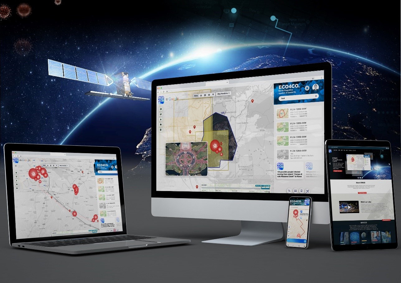
Integrated and interactive dashboard and maps to explore data and outputs of the analysis
-
Tools for integration of data from external sources
-
A user-friendly interface and a transparent process of analysis
-
Interaction and customization of the analysis (selection of areas of interest, time interval, level of detected warnings)

Image credit: Telespazio S.p.A
Service/ system concept
The end-to-end ECO4CO system is based on the following main pillars:
-
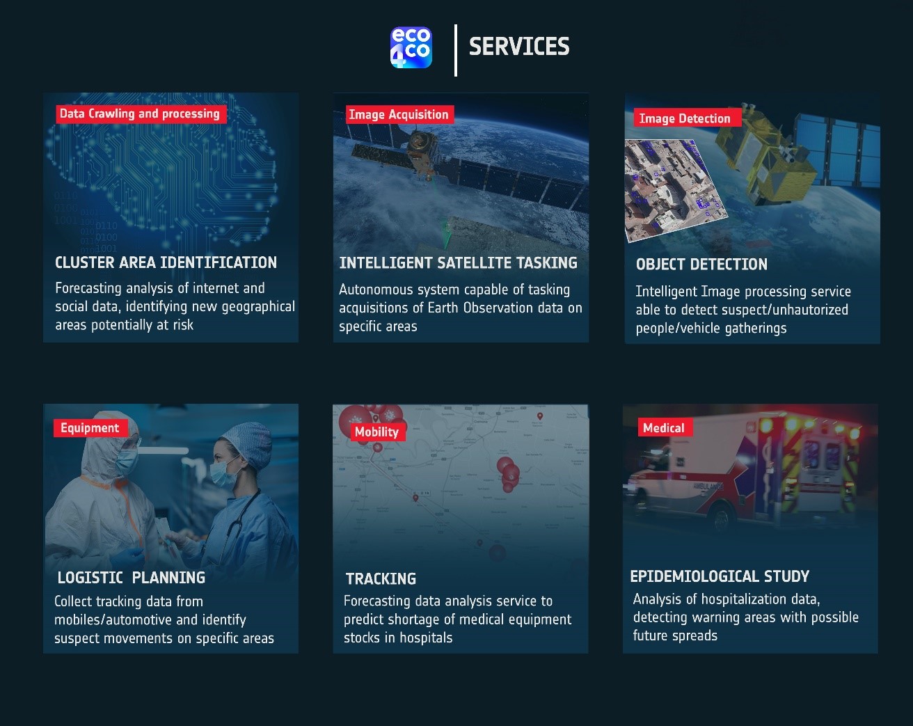
Cluster Area Identification: A forecasting data analysis service identifying new geographical areas potentially at risk by collecting and analysing social media, news and data from Internet
-
Intelligent Satellite Tasking: An autonomous system capable of managing the acquisitions of Earth Observation data coming from a federation of satellite constellations. it allows to have high-frequency revisit times enabling a proper Near Real Time service
-
Object Detection and Business Intelligence: An artificial intelligence service able to detect possible gatherings of people from videos acquired by streaming cameras and vehicles from Satellite Images
-
Tracking: a service capable of tracking the movements from devices or traffic data detected in a given zone
-
Logistic Planning: a forecasting data analysis service to predict:
-
Monthly purchase of regional medical supplies
-
Average accesses to E.R. of hospitals
-
Weekly regional forecasts of Covid-19 related new infections, hospitalization and intensive care patients from which can be derived the colour code switch for the regions.
-

Space Added Value
Satellite Earth Observation: Satellite Image acquisition and Processing are a core element of the system and actively take part to the contribution of ECO4CO data Lake creation. Intelligent Tasking, an autonomous Satellite Tasking module, will prepare and perform automatic Image Acquisition requests, integrating satellite providers acquisition workflow (e.g. Pleiades). Such Images will be handled and processed by Object Detection component, which will identify possible vehicle gathering, raising a warning to the system in case of unusual or suspect detection.
Satellite Navigation: ECO4CO data lake consists of several elements coming from GNSS sources. The connection with EGNOS Navigation System will improve the metadata information of such data by evaluating and possibly integrating the quality, the precision, and the integration of signal received. This will eventually produce more accurate and better defined information.
Current Status

The Project officially started on 1st December 2020, Pilot Demonstration sessions with the end-users have been completed in March 2022.
The following important achievements have been reached:
-
Setup of a fully reliable system serving the needs of players similar to our pilot users (e.g. Hospitals, Regional Authorities) by exploiting the information derived by heterogeneous data, from EO satellites to mobile data up to social data, properly geolocated, during the pandemic;
-
Setup of a set of useful Artificial Intelligence based algorithms able to performs forecast useful to support institutional customers with a Decision Support System appliable in Emergency scenarios;
-
A Field Trials campaign that provided a positive system evaluation in terms of effectiveness and utilisation easiness.


