Objectives of the service

The objective of the planned offering is to provide a commercial service for monitoring, reporting and verification of Carbon Farming.
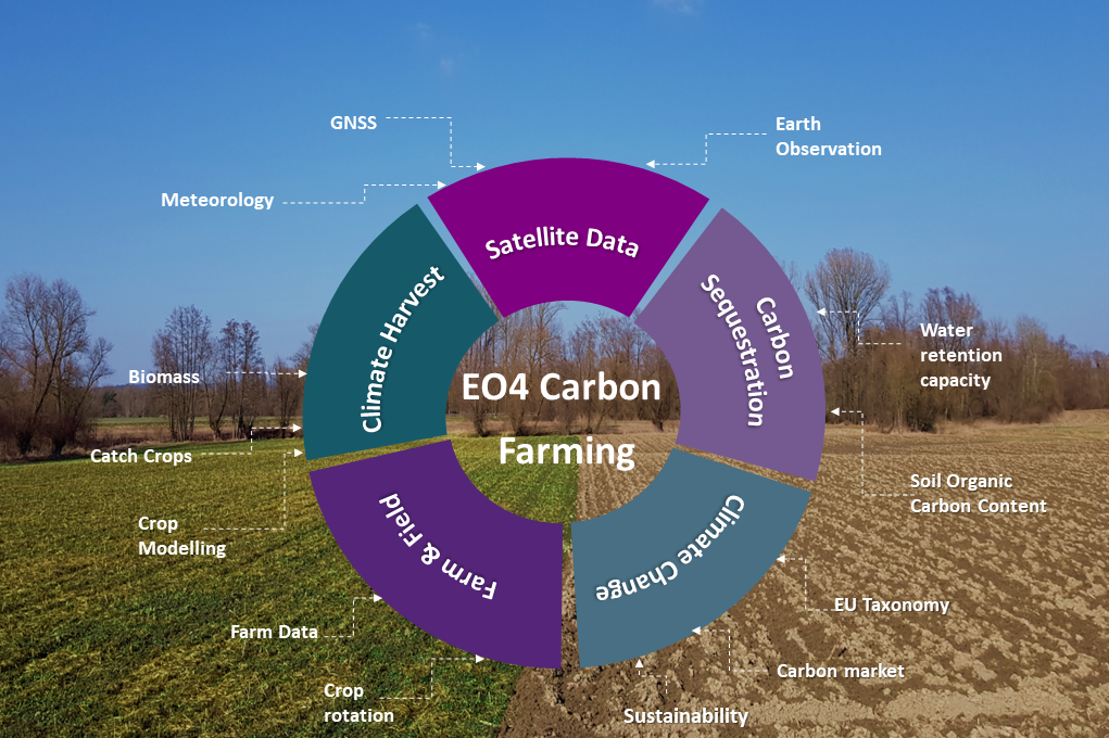
Carbon Farming means all activities agriculture can undertake for sustainable reduction and sequestration of CO2 from the atmosphere. One challenge in Carbon Farming is to independently assess and verify the actions taken as well as their impact on carbon sequestration.
The EO4CarbonFarming MRV Tool includes functionalities to monitor the carbon in plant and soil, to report on required measures like crop rotation and catch crop planting, and to verify them. Additionally, their impact can be evaluated. This enables performance assessment of sustainability measures and more resilient farming practices. Reliable determination of field carbon stocks is key to monitoring the climate impacts of carbon farming and to developing business models.
Users and their needs
There are two main customer groups. Customers with performance-based remuneration for sustainability services, such as carbon certifiers, governmental agencies, NGOs and the agri and food industry, but also agricultural service companies.
Both groups have in common that they need reliable and cost-efficient reporting and verification for the sustainability measures that have been performed by the farmer. The first group additionally needs an independent assessment of the success of the carbon sequestration measures, while the second group needs an objective data source for their service offers and monitoring during the crop growth cycle as input for their decision support. All of these needs can be fulfilled with the EO4CarbonFarming MRV Tool.

The offering will initially target customers in Germany and Austria and can be expanded in the future.
Service/ system concept
At the center of the service is Vista’s MRV-tool, gathering and processing information from different sources. Satellite data are integrated with field data and the sophisticated crop growth model PROMET. The tool receives the data fully automated via API and delivers the outputs via API or visualized in the “EO4CarbonFarming Cockpit”.
The MRV-tool delivers the outputs:
-
soil organic carbon
-
carbon stock in soil and plant
-
catch crop detection
-
proof of crop rotation
-
cover crop type classification
-
detection of harvest and tillage events

Space Added Value
High-resolution satellite imagery is essential to the service and will be integrated with GNSS-located in-situ data.
For the calculation of soil organic carbon content maps, Earth Observation data are used as input, giving a new degree of detail in comparison to soil sampling. Showing the variability of the soil organic carbon content within fields allows to monitor the success of specific sustainability measures e.g. to build up organic material in specific parts of the field.
For the monitoring of crops during the growing season, optical satellite data analysis with a radiative transfer model to derive variables like leaf area, chlorophyll content and fraction of brown leaves is planned. Additionally, coherence and backscatter of radar data will be analysed to derive harvest dates, soil moisture and soil management information.
Current Status
The main phase of the demonstration project was successfully concluded in March 2025.The EO4CarbonFarming solution met all objectives set and has succeeded in achieving first sales already in Europe but also in Asia. Yet, several additional user requirements became clear during the course of the activity. Thus, an extension to the original contract in order to develop all these needed functionalities was contracted and the project has entered a contract change notice phase (CCN#1).
At this stage of the project, the new requirements are captured and translated into system functionalities. The amended system architecture design is in place. The Business Plan including market analysis and competitor’s analysis was updated to include the new service components and their impact on the business case.
At present, the activity has successfully concluded its first CCN#1 milestone. In the next phase of the project, the new technical functionalities will be developed, implemented and tested while all necessary pilot trials will be prepared.


