Objectives of the service
The main objective of the solution is to help lorry drivers to achieve and maintain an eco-friendly driving style. Rapid near real-time feedback allows the drivers to adapt their behaviour accordingly.
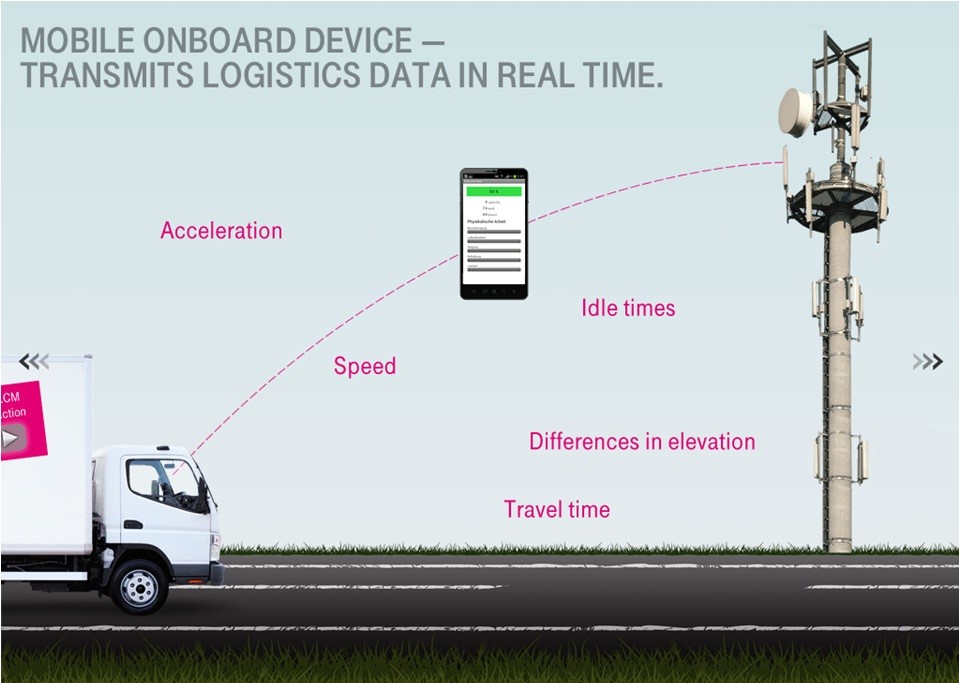
A smartphone app uses GNSS to capture information about location, speed, acceleration and driving times, including breaks and stoppages. Based on the specific freight, vehicle weight and predefined reference profiles, this data can then be used to calculate the exact fuel consumption, which can then be integrated with the specific route parameters. The logistics company and the driver immediately receive these metrics via a T-Systems server.
To enhance the accuracy of the results (especially for mountainous regions), GAF AG created high-quality digital elevation models based on satellite earth observation images, in order to obtain an even more accurate calculation of CO2 emissions and fuel consumption.
This will help reduce emissions and save fuel, which in turn will help to reduce the overall costs for the providers of logistics services. An additional benefit is that an efficient driving style also reduces the amount of maintenance required on vehicles and can thereby help to increase their periods of active usage.
This solution is furthermore combined with an innovative smartphone based tracing and tracking system to run low cost telematics.

Users and their needs
Logistics companies are under extremely high cost pressure with regard to fuel consumption and upcoming CO2 taxes. Several projects in the past have demonstrated the fact that eco-drive training and awareness can reduce fuel and CO2 emissions by 4 to 15 %. As time spent conducting eco-drive training reduces that time that drivers can spend on their daily operational business activities and as costs for eco-drive training lessons are quite high, companies have a need for more cost-efficient solutions. Smart phone solutions bring the competitive advantages of relatively low costs with regards to hardware platforms and also the reusability of software and devices in other vehicles in the fleet. As logistics companies have not always sufficient budgets to roll-out specialised hardware solutions, streamlined apps running on Android or iOS platforms can provide direct benefits to fleet operators.
Service/ system concept
The attached figure shows the architecture of the system that has been developed during the project. In the first step, the static physical parameters of the vehicle, e.g. weight, cross-section, air drag and rolling friction are entered as input in the back-end. Then, whenever the driver starts the App on his GNSS-equipped smartphone, the algorithm uses these vehicle parameters and starts to calculate fuel consumption and CO2 emissions based on the dynamic GNSS speed data. During a trip information on the current driving behaviour are updated every 15 seconds. For calculation, the data are sent via cellular communication (GSM) to the IT backend server. The data are compared in the computing centre to widely used European Driving Cycles (ECE) with defined speed profiles, which are used as reference functions in order to calculate mechanical work in % relative to these cycles. The % value includes acceleration, aerodynamic, rolling friction, standstill and gradients, and can be colour coded in Green (0-100%), Yellow (100-150%) and Red (150-300%) for the comparison of the real speed profile and the ECE. The % value is measured, whereas fuel and CO2 are calculated with a high degree of statistical accuracy when compared to real fuel consumption. The trip data are also made available online for all authorised user groups, including fleet managers and individual drivers. The colour coding is also available on-trip for the driver and can help him/her to drive in an eco-friendly manner, which usually results in fuel savings of between 4-15%, as determined by a large-scale field trial using this type of technology.
The gathered data, by generating periodically post-trip analysis reports, containing statistics on fuel consumption and CO2 emission (per trip, truck, road, or driver), allows the fleet manager to get a much better understanding and overview of driving behaviours, e.g. the use of harsh braking, as well as fuel sensitive road network characteristics, e.g. the influence of mountainous regions. Based on such information, the manager will be in the position to recommend to drivers more eco-friendly roads, define incentive schemes for best practice, or propose further eco-drive training programmes.

Space Added Value
The solution relies on a specific algorithm making use of GNSS derived information, as well as vehicle and routes specific parameters, to compute in real-time the actual fuel consumption and CO2 emissions.
To enhance the accuracy of the results (especially outside cities and in mountainous regions), high-quality digital elevation models based on satellite earth observation images are used, to obtain an even more accurate calculation of CO2 emissions and fuel consumption
The use of satellite communications was also initially considered in the project in order to maintain communications between the drivers’ device and the IT back end server in geographical areas with reduced GSM coverage (i.e. mountainous regions). However, experiments performed did not demonstrate sufficient adequacy with the user requirements.
Current Status
The project started in December 2013 and was completed in January 2017.
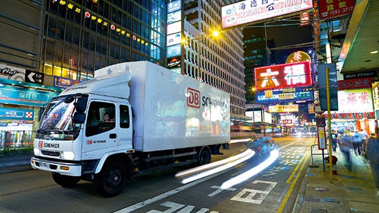
Following the user requirements analysis performed in collaboration with DB Schenker, the service and related system were specified and developed.
The pre-operational service was deployed in the DB Schenker branch office of Lindau, Germany, during spring 2016. After a dedicated training of the test drivers, the pilot phase started in August 2016 for two months and a half. Twenty-five lorries were daily involved in this pilot, driving in Germany and neighbouring countries.
The assessment of pilot results have demonstrated that the usage of the service leads to a considerable reduction of fuel consumption and CO2 emissions for DB Schenker vehicles. In addition, the tracking and tracing functionality of the service was recognised by the logistics service provider as very beneficial for its daily business operations.
The project is completed.


