

Objectives of the service
The service addresses growing challenges in water resource management, such as unpredictable availability, inefficient distribution, and limited visibility into real-time conditions. Public authorities, utilities, and local stakeholders struggle to anticipate shortages, optimize usage, and plan interventions effectively. These issues are particularly critical at the water basin scale, where multiple sectors as agriculture, urban supply, industry, and ecosystems, compete for the same finite resource. Fragmented data and siloed decision-making across sub-catchments often lead to inefficiencies and conflicts, especially during droughts or floods.
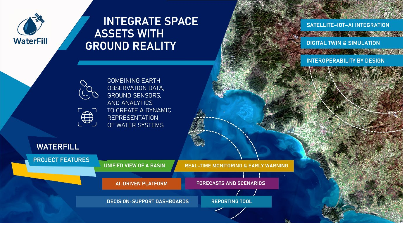
Our solution is a digital platform that combines Earth observation data, ground sensors, and advanced analytics to create a dynamic representation of water systems. This enables continuous monitoring, early detection of anomalies, and predictive insights for drought risk and supply-demand balance.
We deliver this through an intuitive, AI-powered decision-support interface that integrates data from satellites, IoT devices, and existing systems. Advanced machine learning models analyse these multi-source inputs to detect anomalies, forecast water availability, and optimize allocation strategies. The platform provides actionable recommendations, predictive alerts, and interactive “what-if” scenario simulations, empowering users to make informed, timely decisions that reduce waste,
improve resilience, and ensure sustainable water use.
Users and their needs
Primary users are river basin authorities, regional agencies, municipalities, and water utilities; secondary users include environmental agencies, nature parks, agriculture and industrial water users. Initial pilots are in Italy (Autorità Distrettuale di Bacino dell’Appennino Settentrionale, Regione Veneto, Città di Padova), with expansion planned across the European Union, particularly in drought-prone Southern Europe, and Norh Africa.
User needs:
- Integrated, interoperable data from satellites, ground sensors and existing systems in a single operational view.
- Real-time monitoring and early warnings for droughts, floods and pollution events.
- Reliable forecasts and scenarios (flows, storage, quality) to support planning and allocation.
- Intuitive decision-support dashboards usable by both technical and non-technical staff.
- Efficient compliance/reporting with traceable indicators and auditable outputs.
Challenges for the project are harmonizing heterogeneous datasets ensuring data quality, sustaining stakeholder engagement and co-creation, demonstrating tangible impact within strict timelines and complex regulatory environments.
Service/ system concept
The platform delivers a complete decision-support environment for integrated water resource management. It combines real-time monitoring, predictive analytics, and easy-to-use tools to improve planning and operational efficiency. Key capabilities include:
- Unified view of a basin: satellite imagery, in-situ sensors, and legacy systems shown on one map and timeline.
- Live monitoring & alerts: thresholds for drought, floods, quality; notifications and event logs.
- Forecasts & “what-if” scenarios: near-term predictions for flows, storage, and quality with simple sliders for demand, releases, or rainfall.
- Decision dashboards: KPIs, trend analysis, and exportable reports for compliance.
- Data access: export data for offline analysis or integrate with other tools using standard APIs.
How it works
The platform collects data, cleans and fuses it, runs predictive models, builds a digital twin of the basin, and serves insights via web dashboards and reports.
The cloud-native modular system integrates satellite, IoT, and external data through ingestion and pre-processing. A unified Data Lake standardizes and validates datasets. The AI module enables analytics and informed decision support. Data provisioning module offers APIs, streaming, and file transfer. Business Intelligence tool delivers dashboards and a geoportal. All modules are orchestrated through a specific layer that ensures efficient and protected data management.

Space Added Value
WaterFill solution rely on a complementary suite of space assets to power basin scale intelligence. Sentinel 1 radar provides all weather, day night coverage for mapping surface water extent and detecting millimeter scale ground or dam deformation via InSAR. Sentinel 2 optical imagery refines surface water masks and captures land and vegetation signals that drive drought and irrigation analytics. Sentinel 3 adds lake and reservoir dynamics through radar altimetry, plus thermal and chromatic information for water quality proxies such as turbidity and chlorophyll. We further incorporate Copernicus Services to contextualize hazards (e.g. Emergency Management and Drought Observatory layers).
Compared with approaches that depend mainly on local sensors, manual surveys, or static GIS dashboards, this space enabled stack delivers decisive advantages: continuous, wide area coverage across entire basins, including ungauged sub catchments, timely updates for early drought and flood warnings, objective and comparable baselines across borders for fair allocation and compliance, and cost effective scaling that targets scarce field sensors where satellites flag risk. By fusing these assets with in situ data in a digital twin, we provide faster, broader and more reliable decisions than methods limited to ground data alone.
Current Status
The Kick Start phase is now complete. The end-to-end system architecture has been thoroughly assessed, with all de-risking activities successfully carried out. The comprehensive analysis covers every layer of the solution: from data ingestion (Copernicus/IRIDE EO, IoT sensors, utility and user files), through a scalable data lake and geo-catalog, to advanced analytics and AI/physical models, the digital twin core and business logic, robust integration APIs, and a user-focused presentation and governance layer. Market analysis has also been finalized, identifying priority customer segments and shaping a refined pricing strategy that includes tiered SaaS subscriptions, usage-based add-ons for intensive simulations, and enterprise or on-premises licensing options to meet the needs of both public sector and utility clients.