

Objectives of the service
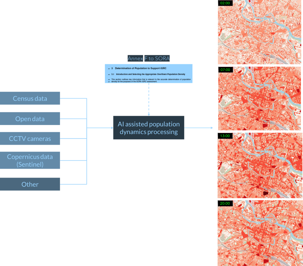
The main objective of the service is prediction of population density distribution using Artificial Intelligence (AI), satellite Earth Observation data & other data sources for the purpose of determining the unmanned flight intrinsic Ground Risk Class. Human safety forms the most crucial element of any regulatory and technical framework in modern world. The ongoing challenges to be solved within U-Space are closely related to introduction of Urban Air Mobility (UAM) as an added value, with minimum negative impact like noise pollution, environmental concerns and most importantly – safety in terms of potential casualties and damages. Accurate population data protects people on the ground but what is also important is it allows (temporary or permanent) opening of more space for the operations of Unmanned aerial vehicle (UAV) based services with safety envelopes.
Users and their needs
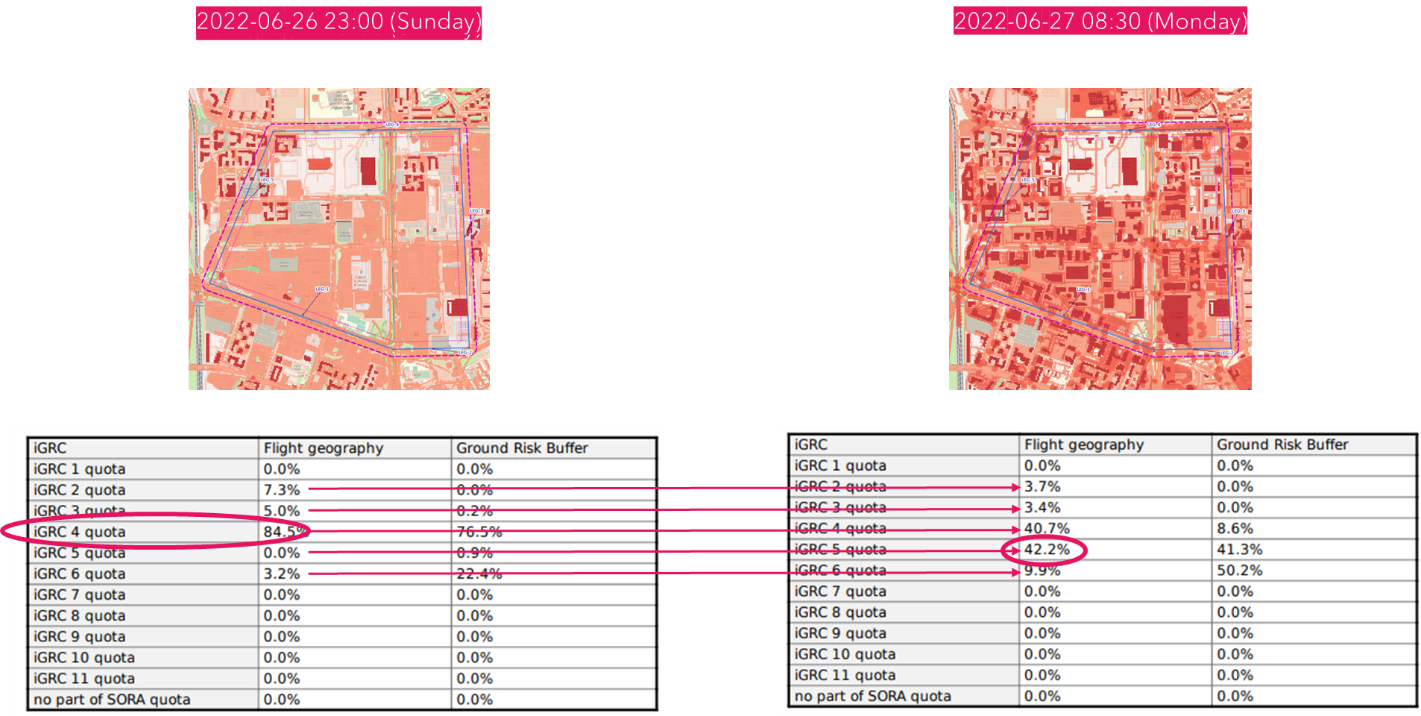
Anyone wishing to perform a drone mission in the specific area will need to meet the SORA (Specific Operational Risk Assessment) requirements. In order to correctly determine operation safety, the crucial information required is the potential risk the operation poses to population situated within the operational area called Ground Risk. The population information is important to assess the operation characteristic even though SORA regulatory are not fully constitute now, the Easy Access Rules for UAS, document that was published by EASA for transitional period for Regulation (EU) 2019/947 and (EU) 2019/945, list population density information as important for every specific operation.
Service/ system concept
Space Added Value
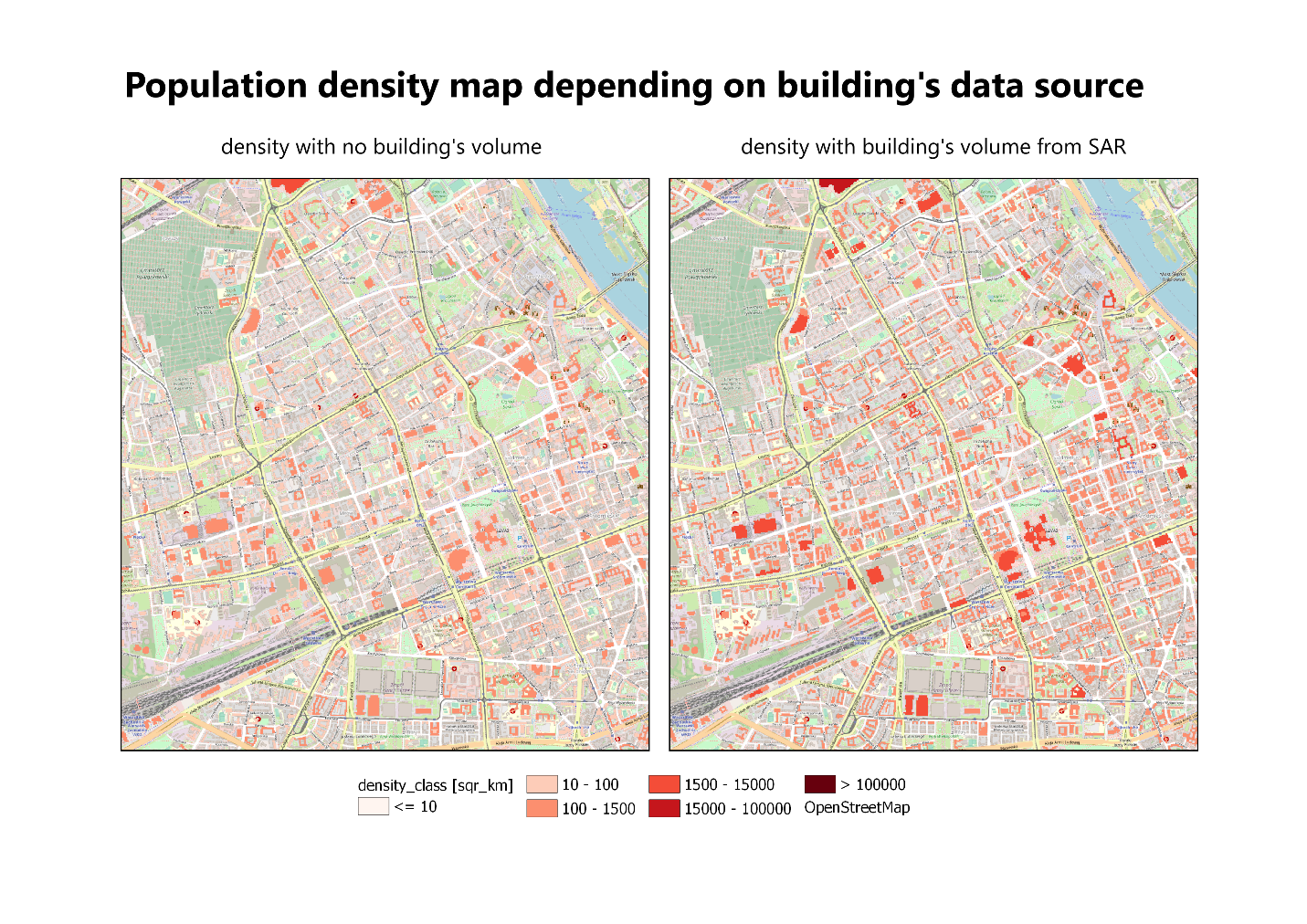
When considering population density, information about the type of urban environment is important. Building volume is particularly required to assess how many people it could accommodate.
The project utilises SatEO data (Sentinel 1 GRD products + Sentinel 2 to enhance capabilities/accuracy if needed) to process imagery into building volume information (processed volume is assigned into building footprint geometry [2.5D data]). It is important to mention that our use case don’t require sub-meter accuracy – we only need an estimation of “number of floors” accuracy for the statistical modelling.
Our preliminary results are promising and in line with the existing research and acceptable for our use case scenario.
Current Status
-
Technical and economic feasibility have been validated.
-
The service mock-up was developed.
-
Stakeholders feedback show high interests and expectance for further development.
-
Prediction quality could be improved further high-resolution input data but the current model with basic data available satisfies our end user needs.
-
Achieving independence from expensive and complicated networks data is highly desired by engaged users.