
Objectives of the service
HSAT are building Inference to understand and predict sugar production around the world.
Understanding the growth of sugar, especially in less developed areas, is a significant challenge due to the lack of good data.
For example India has over 70 million sugar farmers, with the average farm just over 1 hectare. There is no centralised recording system for this data, crops are constantly rotating, and there is no way to know how big a field is or what it will contain each year. In areas like Thailand, this challenge is made more complex due to the high amount of cloud and the inability to “see” the crops.
Inference predicts the area of sugarcane being grown it is: Accurate. Efficient. Reliable.
Users and their needs
HSAT’s Inference will be used by multiple groups of people, including:
-
Commodity Procurement / Risks Specialists in Food and Drink
-
Commodity Traders
-
Agribusiness
HSAT is currently working with multiple global firms that need accurate data about sugar. The individuals using the platform are either buyers of sugar (for their food and drinks companies), traders in sugar, or growers of sugar.
Users need to understand how sugar is growing at the moment, what the previous performance was and what it is projected to be. This allows users and companies to make informed decisions on what and when to buy sugar.
The users are mainly in the EU, UK, US and Brazil – however, the sugar is being monitored in a variety of countries, including India, Thailand, Brazil and Indonesia.
Service/ system concept
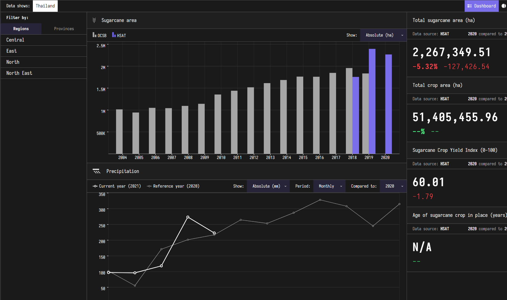
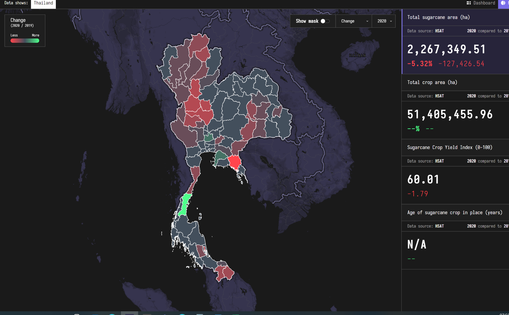
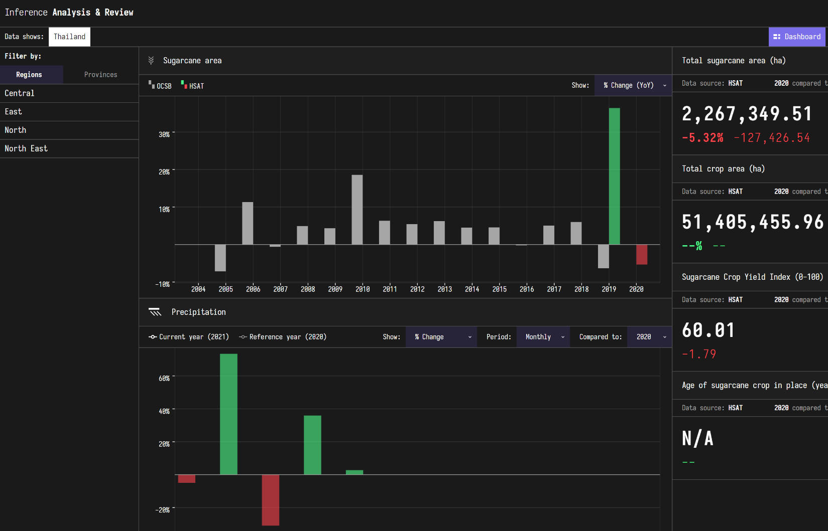
Inference provides an interactive dashboard that allows users to get information about sugar. This includes:
How much sugar is being grown, where it is being grown, how this has changed at a regional and province level as well as indicators for sugar health.
The user can navigate through the dashboard, creating charts and reports on the fly – enabling their analysis.
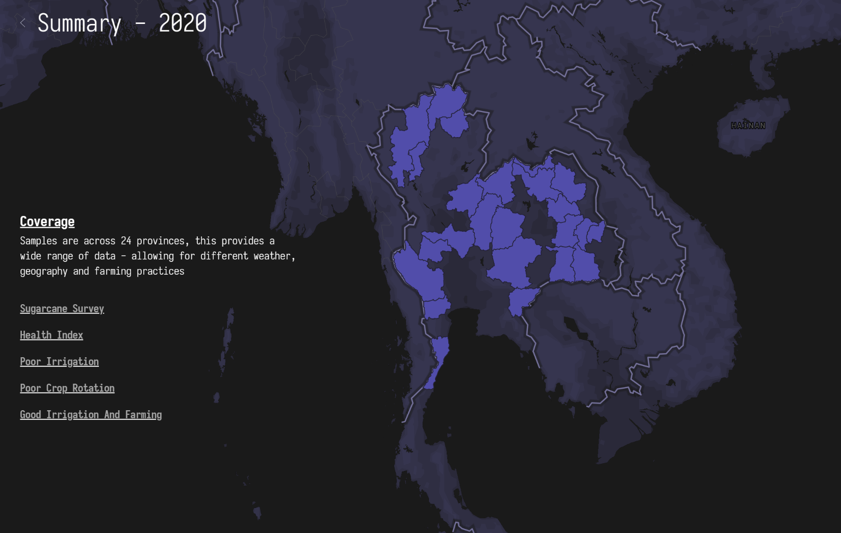
Examples of the dashboard are shown below. This is demonstration data is not actual data. For commercial reasons, this information is not provided here.
Inference works by collecting data from four primary sources
-
Satellite data
-
optical data and radar
-
-
Weather data
-
Hisorical weather data
-
-
Ground Imagery
-
Drones
-
-
Farmers
-
Farmers provide feedback on surveys in relation to their crops
-
This data is used to build up a detailed ground survey; historical weather patterns map the sugar across a region, country of continent.
Complex data models are then used to predict the sugar growth, using historical data and ground truth to predict future growth.
The result of this analysis is then made available in our platform.
Space Added Value
Multispectral Earth observation imagery from Sentinel-2 is used to map the sugar. Other technologies that have come out of space investment such as navigational systems GPS, Galileo and communications satellites enable ground surveys to be conducted (drone, mapping technology, etc).
Current Status
Inference is currently deployed in multiple countries, including India, Thailand, Brazil and Indonesia. Tens of thousands of data points have been collected from around the world and over 14 trillion calculations have been conducted to predict sugar.
The focus now is to continually improve and update the platform – providing greater capability in more countries.
Examples of the dashboard are shown below. This is demonstration data is not actual data. For commercial reasons, this information is not provided here).


