Objectives of the service
OGOR WORKSPACE links satellite data, ground truth and stakeholder annotations with farm operations and field inspection (work plan), while crop stages provide the necessary structure for live-reporting. The innovation lies in its dynamic canvas, which is a time series of satellite maps or composite indices that users can add information to. Some of this information remains relevant over time, while other information decreases rapidly in importance.
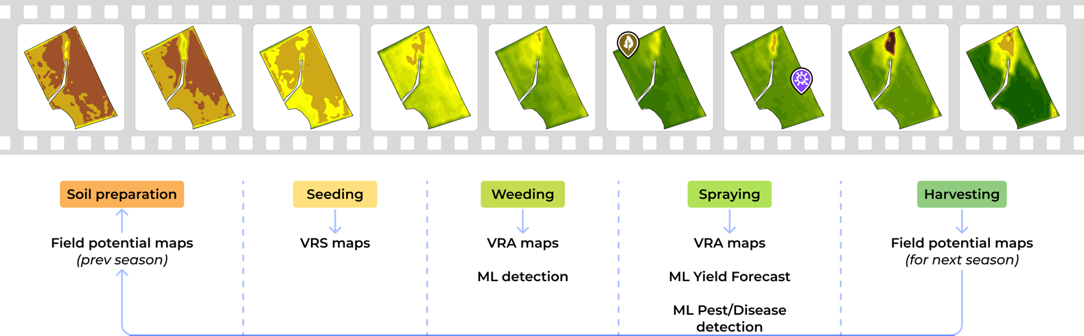
Imagine collaborating on a movie and adding metadata, subtitles, and different elements of the soundtrack. These elements are linked to a part of the scene or a set of frames with common characteristics. The same concept applies to analysing a crop field.
Users and their needs
Customer segments and problems
Farm owners. Large farms
- Difficulty in monitoring fields and activities due to extensive fragmentation of land, resulting in missed crop issues and field problems.
Farm owners. Small farms
-
Low specialisatio
-
fitability.
Agronomic consultant.
-
Providing agronomist consultancy in Romania is not cheap because field scouting visits are expensive due to the lack of transport infrastructure.
-
Satellite data is used for crop monitoring, but communication with farmers is done via phone and text messages.
Target countries: Romania.
Service/ system concept
Our system is designed in multiple logical modules:
-
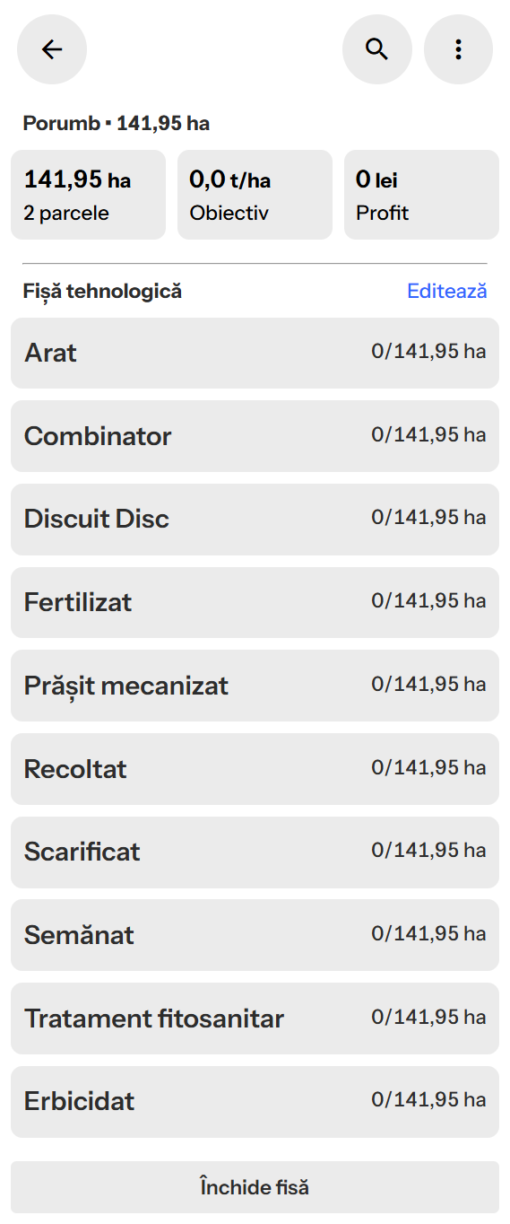
PLAN module
-
REPORT module
-
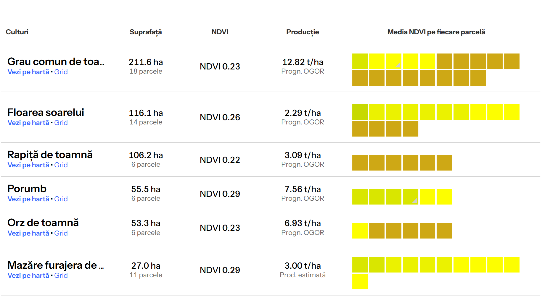
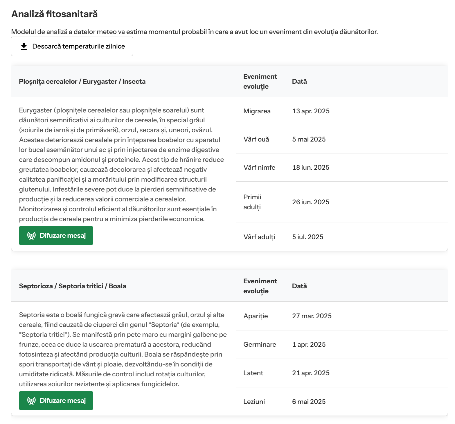
HEALTH module
-
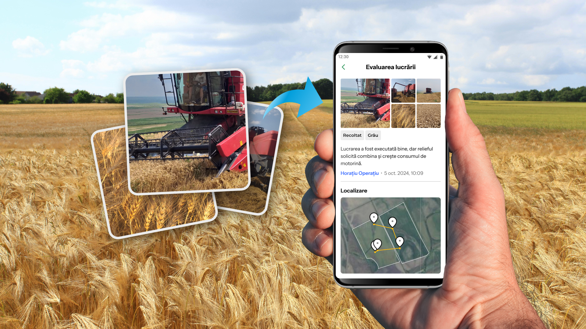
SCOUT Mobile application
-
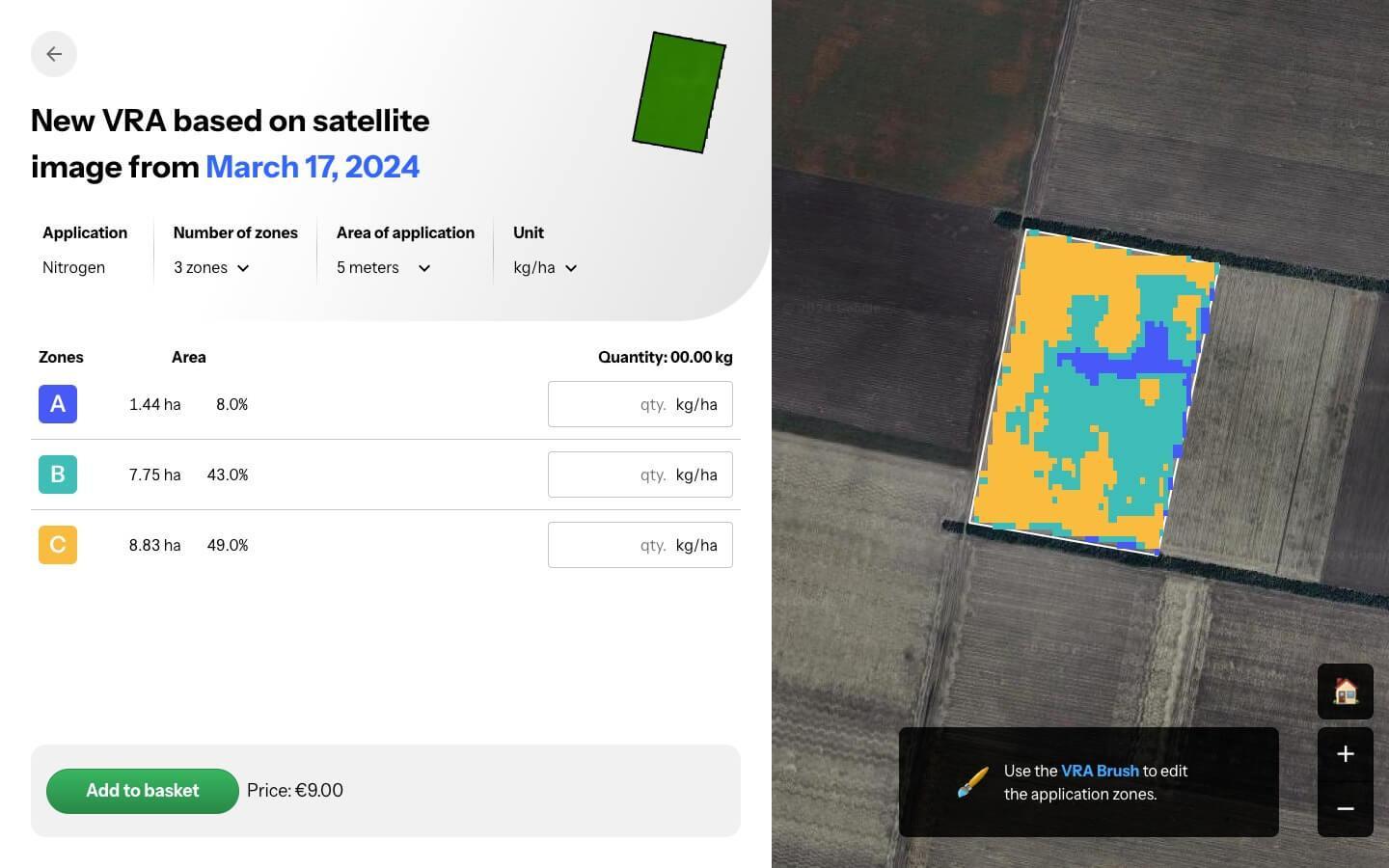
VRT (VRA/VRS) module
Thus, the user is able to:
-
Plan and execute an activity work schedule tailored by the specifics of the farm crop and agricultural practices system used in the farm.
-
Collaborate with an external consultant on monitoring the fields based on EO data
-
Collaborate with an external consultant on monitoring the crops based on weather data
-
Execute specific field scouting tasks
-
Generate maps specific to precision agriculture (VRA/VRS)
Space Added Value
Satellite Data Service
This component performs several functions related to satellite data:
-
It serves as a registry of tile-level Sentinel-2 products available in OGOR’s in-house data store.
-
It implements FMASK for automated clouds, cloud shadows, snow, and water masking for Sentinel 2 observations. We can use it to recognize that the NDVI (and others) values are not useful in those periods and instead replace them with interpolations.
-
It performs scheduled and event-triggered rasterization of parcel-level satellite observations.
-
It interfaces with and fetches data from Sentinel-2 Cloud-Optimized GeoTIFF sources, for ad-hoc parcel-level EO provision.
Current Status
The demonstration project is completed.
The piloting phase was a success, and all KPIs were met.
OGOR PLAN