Objectives of the service
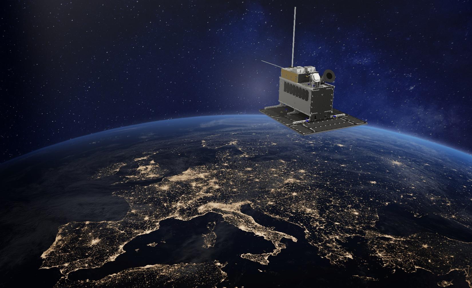
NorSat-3 was launched on the 29th of April 2021. Illustration: Norwegian Space Agency
Dark vessels are vessels that does not self-report as required by national or international law through systems like Automatic Identification System (AIS), Long-Range Identification and Tracking (LRIT), Vessel Monitoring Systems (VMS), etc. Dark vessels can be involved in illicit activities such as Illegal, Unreported and Unregulated (IUU) fishing, smuggling, piracy, human trafficking, etc. and these are vessels of interest for different authorities and organisations.
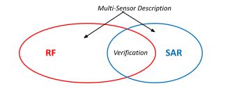
Currently satellite based vessel detection services provide information about dark vessels by utilising mostly Synthetic Aperture Radar (SAR) but also very high resolution electro-optical imagery. The addition of satellite-based RF-data, especially the detection of vessel navigation radars, is expected to provide a valuable addition to these services. Using extended frequency information for the navigation radar detected it is also expected that it can be possible to create fingerprints of the individual radars, hence making it possible to identify a vessel that has been detected.
KSAT is expanding the existing vessel detection service based on SAR and optical data to include RF-data from the Navigation Radar Detector (NRD) on the Norwegian NorSAT-3, as well as from commercial providers such as Unseenlabs.
Users and their needs
Defence
Norwegian Defence Joint Headquarters, Joint Monitoring Centre
-
Responsible for applying sovereignty for all Norwegian EEZ.
-
Want to know about all vessels inside or approaching the Norwegian EEZ.
Maritime Security
The Spanish Maritime Safety and Rescue Society, SASEMAR
-
In charge of maritime traffic control, safety and rescue operations, and protection of the maritime environment. (Have no law enforcement responsibilities)
Maritime Coastguard Agency (UK)
-
Responsible for continuously monitoring vessel traffic in UK waters for safety and environmental protection.
Norwegian Coastal Administration, the Vessel Traffic Station in Vardø
-
Responsible for continuously monitoring of the activity in Norway's sea territories. Their main goal is to monitor the civil traffic and avoid accidents and pollution.
Combatting IUU
The International Blue Justice Tracking Centre (part of the Blue Justice Initiative)
-
Mapping fishing vessel movements and detect Illegal, Unreported and Unregulated (IUU) fishing.
-
Provide actionable intelligence where needed
Service/ system concept
Service Offerings:
| Marked Service offerings | Details |
|---|---|
| 1. Multi-Mission RF Signal detection service* |
Detecting, geolocating and describing RF-signals within defined AOI based on an observation by an RF-sensor. Description includes the following:
All the above including an uncertainty description. |
| 2. Multi-Sensor VESSEL DETECTION SERVICE* |
Detecting, geolocating and describing probable vessels within defined AOI based on observations by multiple sensors - SAR, RF, AIS/VMS (and Optical)
|
| 3. Multi-Sensor VESSEL TRACKING SERVICE* | Vessel tacks are induced based on multiple observation at different points in time. The idea is to draw upon observations from both SAR, RF, Optical and AIS. |
*A core idea for all the above services is that it draws upon a pool of satellite-based sensors from different providers. This is referred to as “Multi-mission”.
The overall system enabling the service offers looks like this:
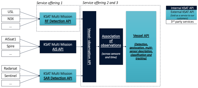
Service offering 1 is enabled by the “KSAT Multi Mission RF Detection API”, While Service offering 2 and 3 are enabled by a Multi-Sensor Fusion-part and an association part. See dotted rectangles indicated in the above figure.
As seen in the figure above, some of the APIs are both used internally and externally. The idea of making a “layered system” is because different users will have different needs.
Some customers want a convenient way to access relevant vessel observations from SAR and/or RF in order to draw their own conclusions about vessel-location, identity and sailing route. Typically, these customers have a lot of internal information they want to combine with the “KSAT information” before the conclusion is made. Other customers want KSAT to perform the fusing, association and tracking for them.
Space Added Value
The space-based RF data represents the new and innovative element for the vessel detection service. The Norwegian NORSAT-3 satellite and the Unseenlabs constellation both operate navigation radar detectors, NRD, which can detect X- and S-band navigation radars. Other RF satellite constellations like HE360 provide additional spectrum capabilities capable to detect VHF, UHF and L-band communication as well as GPS jammers in addition to navigation radars.
It is possible to build a database of detected navigation radars making it possible to identify individual vessels based on the signature of the of navigation radar when combining it with AIS, LRIT and VMS.
The near real-time multi-mission SAR data has been the main source for the KSAT vessel detection service. The SAR data is the main source for initial detection and positioning of targets at sea. The SAR data covers large areas and provides surface information and is independent of light conditions and cloud-free skies.
Satellite AIS data as well as LRIT and VMS are the main components for the self-reporting vessel information used in the service. Combined with the RF and SAR detections it provides the basis for detecting dark vessels.
Current Status
The International Blue Justice Tracking Centre, the Vessel Traffic Station in Vardø and the Norwegian Defence Joint HQ have been visited physically, while the Maritime Coastguard Agency UK and SASEMAR in Spain have been interviewed by videoconference.
An initial system architecture has been established and interfaces to ingest the RF data from NorSat-3 NRD and Unseenlabs have been implemented. A Poof-of-Concept focussing on Service Offering 1 was performed based on the initial system architecture. All the critical aspect related to Service Offering 1 has been investigated. and Service offering 1 is concluded as both technical feasible and commercially viable. The critical aspects related to Service Offering 2 and 3 has not been investigated properly in this project. The reason for this is that the effort required to investigate this properly was larger than expected.
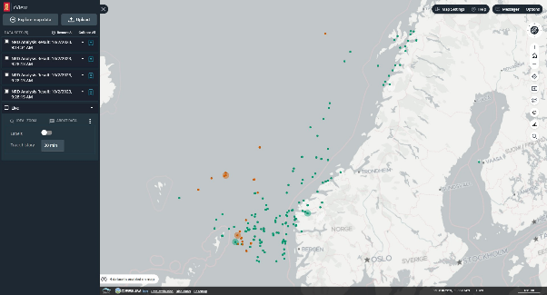
The above figure shows unidentified and AIS-correlated navigation radars detected by NorSat-3 NRD and Unseenlabs.