
Objectives of the service
Sust Global developed a geospatial AI platform to unlock unique insights on project permanence, durability and sequestration potential for global forest and blue carbon projects. This new analytics platform, Regen Atlas, increases transparency, trust and uptake of carbon credits in the nature finance space. Our analytics of global forest and blue carbon projects provide accurate forward-looking data on emergent sequestration risks from physical climate risk (e.g. wildfire or water scarcity), pests and insects, seismic risks. Regen Atlas transforms complex layers of geospatial, satellite and risk data into metrics on project durability and permanence. This service provides cost-savings through de-risking project investment, creating trust in carbon markets, and ultimately accelerating sustainable forestry and blue carbon project deployment.
Our data products take satellite-derived observations, proprietary climate models, and novel geospatial datasets on biodiversity, biomass and water scarcity. These datasets are fused using machine learning and computer vision-based AI techniques for high cadence, high quality carbon offset risk analytics at global scale.
Users and their needs
The Regen Atlas platform has been utilized by carbon project developers, carbon project investors, advisor firms, carbon credit marketplaces, and project and offset ratings agencies to analyze forward-looking natural hazard risk exposure and offset permanence and durability. The tool has a global user base, with many of the user firms based in Europe and North America while many of the projects being analyzed are based in the Global South.
Users of the tool need to understand the long-term risks that nature-based carbon projects are exposed to and factor these risks into decision-making. These risks are particularly material given the long lifespan of nature-based carbon projects – often 30-40 years – and the reputational and financial damages associated with offset reversals. Climate change is going to alter historical hazard patterns, so teams are looking for a tool that can help them account for climate change impacts on risk exposure and to provide outputs in a format that is useful within their existing analysis workflows.
Service/ system concept
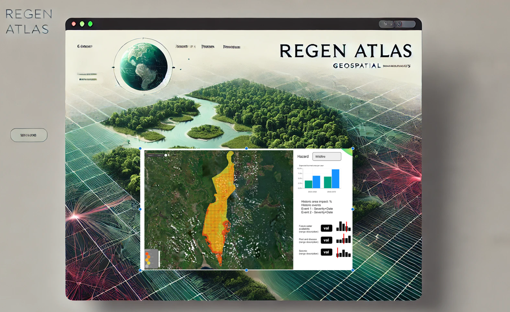
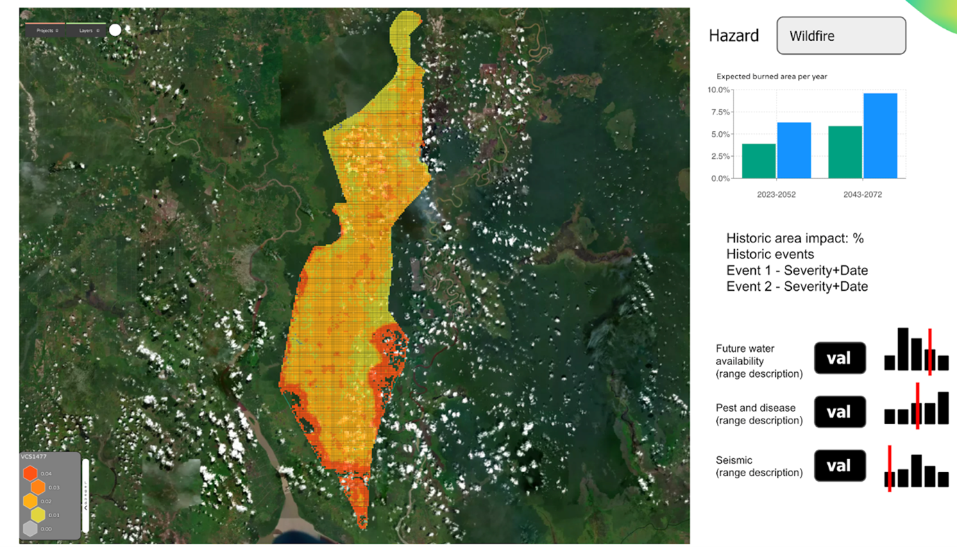
Regen Atlas provides advanced analytics to help users assess carbon credits by offering detailed insights into sequestration potential, durability metrics, and risk assessments. The system enables users to visualize geospatial data for carbon projects, generate customizable project-level summaries, and compare multiple projects for risk and return analysis.
The system works by leveraging satellite imagery and machine learning to analyse carbon project data. Users can upload project boundaries or explore preloaded demo projects through a user-friendly interface or programmatically via an API. Regen Atlas processes the data to produce actionable outputs, such as spatial risk analysis and sequestration predictions, helping users make informed decisions about project quality and value.
At a high level, the system integrates satellite data, global fire databases, and land cover maps into a cloud-based processing layer. This layer uses machine learning models for bias correction and advanced predictions. The results are delivered through a web interface and API, providing seamless access to summaries, visualizations, and standardized scoring metrics for carbon credit evaluation.
Space Added Value
Regen Atlas leverages satellite data as a key space asset, integrating high-resolution imagery from Sentinel-2, ESA CCI Land Cover, and global fire datasets like GFEDv4 and GFAS from ECMWF. These space-based data sources enable accurate, large-scale assessments of carbon sequestration potential and durability metrics that are crucial for evaluating the quality of carbon credits. By using satellite-powered analytics, Regen Atlas delivers consistent, unbiased, and up-to-date insights that are not easily replicated through traditional methods.
The added value of combining these space assets lies in their ability to provide global coverage and high-frequency observations, offering granular geospatial data that traditional on-the-ground methods cannot achieve at scale. Space assets also reduce dependency on manual data collection, which can be costly, inconsistent, and subject to localized biases. Regen Atlas’s machine learning models further enhance the utility of satellite data by correcting biases and generating actionable predictions, such as risk assessments and sequestration estimates, with >60% accuracy. Competitive offerings will rely on static, present-day analytics, whereas Regen Atlas will provide high-resolution, globally accurate and forward-looking analytics.
Current Status
The Regen Atlas project has been completed, and the platform is now commercially available to nature-based carbon project developers, project investors, advisory firms, carbon credit marketplaces, and project and offset ratings agencies.
The tool was developed using innovative geospatial AI capabilities to model forward-looking natural hazard risks to projects, and it’s been refined based on feedback from 11 pilot users across nature-based carbon project investors, project developers, advisory firms, and marketplaces.