Objectives of the service
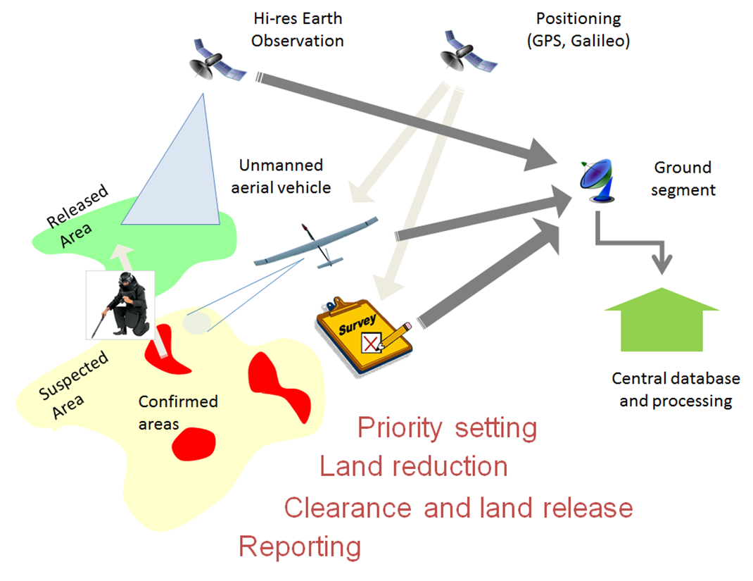
The overall purpose of the studies is to prove the viability and sustainability of an integrated set of services supporting Land Release in Mine Action at all its levels. Land Release in Mine Action is the process where the demining community identifies and prioritizes suspected hazardous areas for even closer investigation, clears mines in areas where mine contamination is confirmed, and ultimately releases land to the local population. The services will be based on the integration of Earth Observation data, GNSS navigation and SatCom technologies with existing Mine Action tools and methodologies, databases and procedures. Aerial survey technologies will be evaluated as well. In addition to the technical and operational aspects, the legal and end-user point of view with particular focus on user habits, affordability, field use and appropriateness of the technologies will also be assessed.
Space Added Value
The scope of the activity has been defined broadly within the end-to-end process of land release in Mine Action, based on the a priori expectations that Earth Observation data, Satellite Communication and Satellite Navigation could be considered of assistance:
- To produce socio-economic impact maps, for decision makers to set mine action priorities.
- To identify low-risk areas that could be released without performing the costly and risky step of clearance, by combination of indicators of mine/ERW presence and indicators of mine absence. Those indicators can be derived from historical records, geo-referenced in-situ, air borne and space borne observations. They can be for instance features of topography, land and infrastructure usage, warfare evidence such as trenches or damaged buildings, etc...
- To characterize the environmental setting of a hazardous area (humidity, slope, surface roughness), which helps select the most appropriate detection tools and the right time for their deployment.
- To support the geo-referencing of data and the navigation needs for non-technical surveys, stand-off detection, demarcation of hazardous zones, close-in detection and clearance.
- To provide global communication capabilities to securely transfer collected data into e.g. IMSMA (Information Management System for Mine Action), for easier access to updated consolidated information, improved traceability and quality management of mine action.
The process improvement that can be achieved by better integration of these space enabled solutions into the information management, data analysis and reporting in Mine Action was also part of the study scope.
Study Outcome:
The six services that have been identied by the user community and the study teams of particular interest for operational deployment are:
- GeoBIGeospatial Business Intelligence. This service is a dashboard providing decision support at national level, within the IMSMA environment.
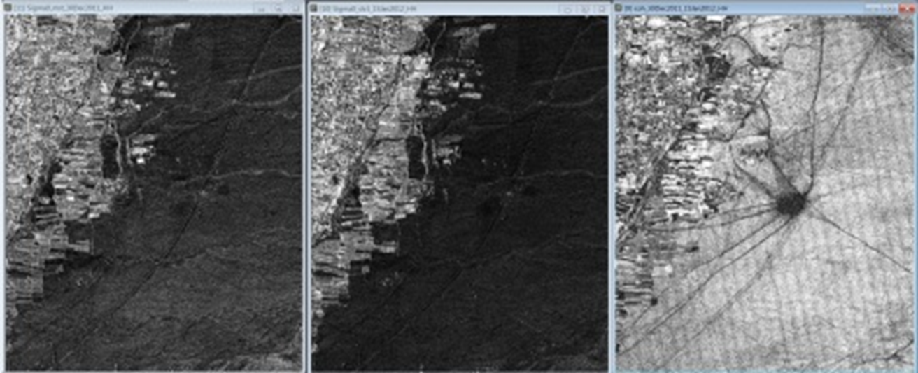
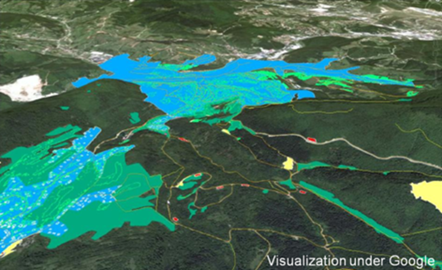
- Non-Technical Survey support. This service provides support to identify suspected and confirmed hazard areas (SHA/CHA) to enable land reduction, by georeferenced mine action data with features, risks and changes derived from radar, optical, near infra-red and thermal imagery. This service is expected to create an economic benefit to mine action as it provides a cost-effective additional data layer of information that can help reduce the area to be cleared and allows for some land to be released without need for an in-situ survey.
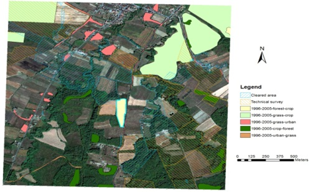
- Post Clearance Survey reporting to donors. This service processes a time-series of remote sensing imagery in order to help quantify the socio-economic impact of mine action. It is expected to fully replace the current post-clearance field survey and reporting process.
- Hi-res cartography service and user interface. This service provides the user with easy access to reliable and up-to-date maps. They are obtained with the help of high resolution imagery from satellites and Unmanned Aerial Vehicles (UAV) and help field operators to plan site access and estimate hazard levels.
- Affordable and reliable positioning. An off-line software-based DGPS solution (Differential Global Positioning Service) with a user-friendly interface is expected to provide a low-cost, fool-proof and high-integrity positioning solution for operators. This service remains to be developed.
- Field kit. A smart app for standard (rugged and low-power) portable devices that allows access in the field to maps and positioning services, as well as robust data entry. This service remains to be evaluated.
User response:
GICHD has expressed its interest in these services and will continue to support them. So far, five national mine action centers have indicated strong interest to be involved in further service development. These users have listed below benefits they foresee based on the Feasibility Study results:
- Improvement of planning and prioritization of mine action activities.
- Identification, collection and combination of indicators of presence or absence of contamination. The costs of the conventional survey is far above the average price of the SADA Non-Technical Survey support service. At the same cost, staff can evaluate more SHA's per year.
- Increase in the speed of the Non-Technical Survey. SADA services are expected to increase the area of land covered on a yearly basis by at least four times.
- Information support to improve land release without technical survey and more objective SHA delimitation, i.e., reduced cost in technical survey and clearance activities by 10-20%.
- Information support to enable land release for access to blocked resources, repopulation, agriculture/farming, infrastructure development (pipelines, roads, buildings ...), refugee return, tourism, etc., i.e. increased socio-economic benefits resulting from the additionally reduced land.
- Staff risks reduction due to better information about the field situation and less need to access it.
- The possibility of obtaining a clear tracing of mine action activities in a quantified, visual and objective manner for donor investment verification, which will help to obtain future funding.
Current Status
Please refer to the following project pages for details on the individual activities:
Subcontractor(s)


