
Objectives of the service
SAFERDANUBE will help the Romanian River Administration of the Lower Danube (AFDJ) in improving safety and fluency of the naval traffic during the winter and summer periods where ice banks/sand banks appear in the Danube. This is required by AFDJ to comply with their obligations with the Ministry of Transports, Constructions and Tourism in accordance with Government, as stated in the decree HGR 492/2003. In addition, the project expects to demonstrate how the use of Satellite Communications can be a competitive alternative to standard mobile telephony for vessels navigating along the Danube.
To achieve this objective, the project envisages the design, development, integration and pre-operation of a service to detect, monitor and distribute obstacles information (i.e. ice and/or sand banks) in the Danube river in near-real time. The service will be based on Satellite Earth Observation (Very High Resolution Synthetic Aperture Radar) information products will be accessed from the river vessels via Satellite Communications and delivered through a web platform, integrated with current AFDJ data products or directly transmitted and integrated with vessels’ own Satellite Navigation systems. The system will be installed and validated on operational vessels of both AFDJ and of Transport Companies during the pilot demonstration phase at the end of the project.
Below there are pictures from Giurgiu, that were taken from internet.
Fig. 1. represent a buoy stranded in a critical period.
Fig. 2. represent Frozen Danube during the winter of 2012.
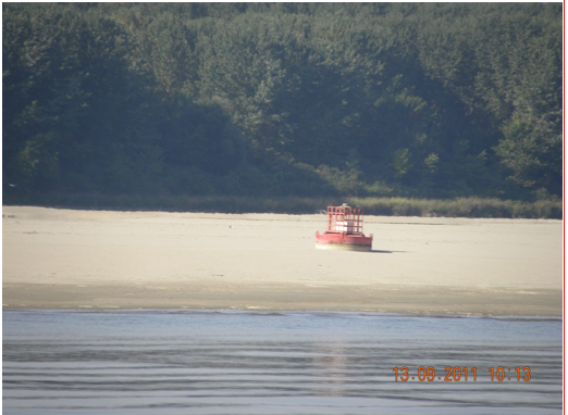
Fig. 1. Buoy stranded due to a sudden decrease of the water level during the summer of 2011 in Giurgiu (Romania).
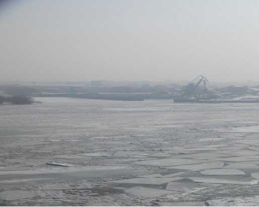
Fig. 2. Frozen Danube during the winter of 2012 in Giurgiu (Romania).
Users and their needs
Navigation on the Danube River is limited by the presence of sand banks(dry periods) and ice banks(winter), phenomena that have an important impact on navigation safety and continuity and effectiveness of goods and passengers’ transport operations. Users claimed about: lack of coverage in some areas, ships positioning too slow, signalling updates too slow ships tracking and positioning , fairway signalization, fast data receiving in areas with gsm coverage
Presently the updates of the maps are periodical, not in real time and could be improved using the solution envisaged.
The needs are: increasing the transportation safety; transportation efficiency; in winter there are areas not presently monitored and ice formations can occur with obvious danger for transiting ships; in summer , with low level of Danube River, it is a need for correct assessment of distances to floating signals and for navigation maps updating accordingly; monitoring the areas with difficulties, where ships may be stranded; monitoring of the shorelines and buoys position; islands monitoring; traffic monitoring; erosion of banks and hydraulic works monitoring.
Service/ system concept
The basic service is the detection of location, extent and shape of the sand and ice banks. The added-value brought through the solutions includes Reliable and fasr access to information (including EO data) through satellite communications and navigation. This basic activities leads to a set of possible "services": indicate the optimal route to have a fluent trip, indicate if there are also other ships blocked because of the phenomena, etc.
The service will provide a continuous monitoring during the emergency periods on a specific area in order to avoid collision or navigation problems due to the presence of sand or ice banks. The service will be used during the alert period, summer or winter, in order to assure the correct data providing representing the area of interest. Within "normal" periods the service will provide a regular two times per month monitoring of the area of interest using webservices.
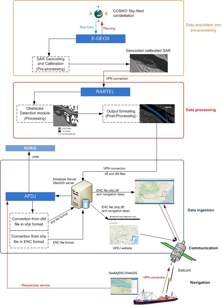
Fig. 3. SAFERDANUBE System Architecture.
Space Added Value
The added-value includes improving the functionality of existing navigation systems, accuracy of sailing management information, dissemination of information, integration with the vessel on board system, a model for sustainability of the service, satellite communications and navigation systems.
It will be easier to define the extent of the area of interest and move its geo-localization above the territory. Selecting the VHR SAR sensors within the range of EO systems take opportunities disregarding the visibility conditions and leveraging on the known capabilities of Synthetic Aperture Radar sensors, reduce the effort on the delineation of navigation obstacles over the river surface. It will be possible to grant multiple daily opportunities of acquisitions and so to widen the portfolio of higher value product available.
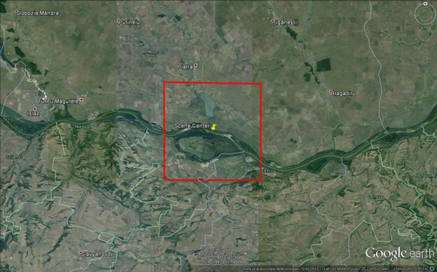
Fig. 4. Representation of the area of interest.(Copyright for this image - e-Geos)
Current Status
The project was concluded in March 2018. The team is working both with Authority and Commercial stakeholders to define the next phase. The Romanian River Administration of the Lower Danube (AFDJ) Authority will advocate the upgrade of the river navigation maps in order to allow the visualization of the obstacles of the navigation (i.e. sand and ice bank). On the commercial side, dialogues are taking place with different shipping companies which would like to combine SAFERDANUBE with the their existing fleet management system.