Objectives of the service
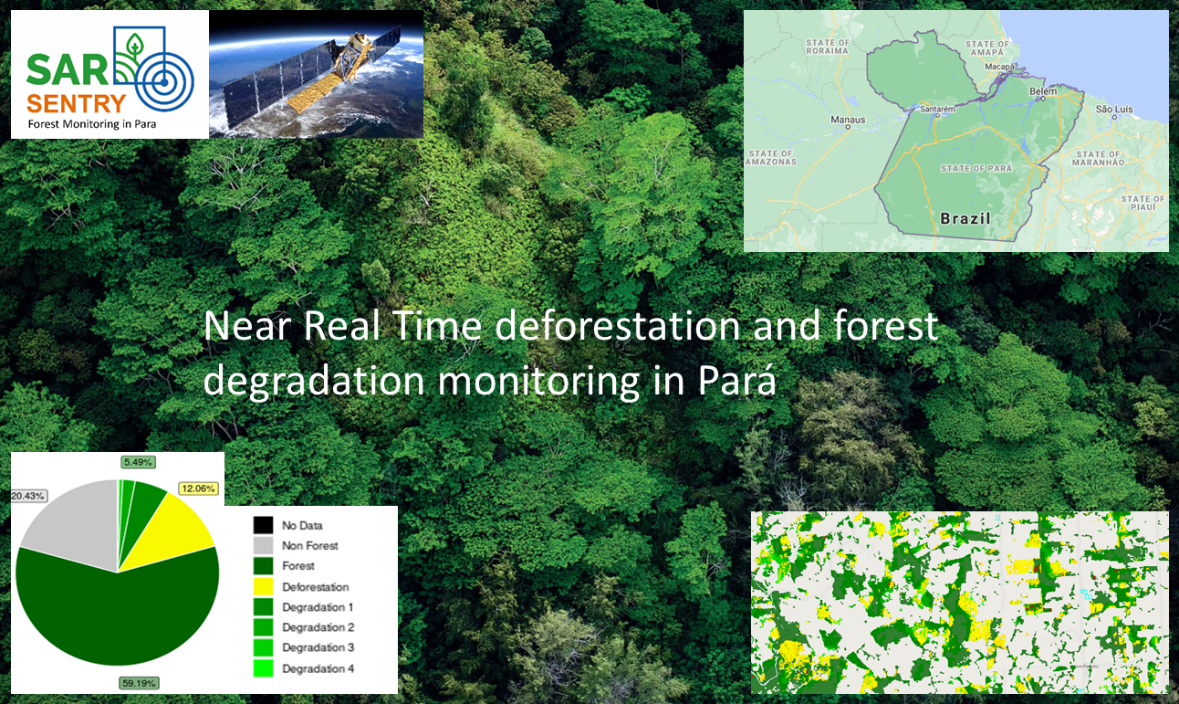
Previous forest monitoring by SEMAS in Pará was hampered by frequent cloud cover and the system was not fully automated. As a consequence, illegal activities in Pará’s forests were not always detected in time. This will change as Pará will use SarVision’s radar based SarSentry forest monitoring system which is able to detect and quantify deforestation and forest degradation near real time. The system generates forest change maps and anomaly alerts every 12 days in 15m resolution and with a high accuracy. The SarSentry system has been demonstrated to SEMAS for different monitoring themes in order to prove its complementary value for the state.
Users and their needs
The main user of the SarSentry system is SEMAS in Pará, but other state departments in the Amazon area and the federal Management and Operational Center of the Amazonian Protection System CENSIPAM also indicated their interest to use the innovative forest monitoring system. SEMAS wants to use SarSentry to increase the temporal monitoring resolution, add the detection of forest degradation, reduce current monitoring costs. SarSentry will not only make the monitoring more efficient but will also generate additional revenues with help of improved fiscalization (fines for illegal activities) and by offering monitoring support to commercial forest operations. In addition, SarSentry provides essential input for REDD programs. SarSentry is used by SEMAS for:
-
Evaluation of changes in terms of the legality of deforestation and degradation.
-
Validation of registrations in PRA and identification of properties still in need of PRA.
-
Assessment of compliance with the REDD+ requirements developed by ART.
This applies for several types of land use:
-
Timber concessions areas (inspection of legal selective logging operations).
-
Rural properties (agriculture, tree plantations, farming, mining).
-
Natural parks and indigenous lands
Results of the project have been shared with other interested states during outreach workshops.
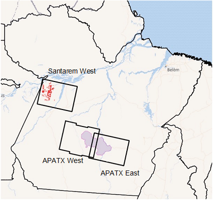
Three test site locations were acknowledged by the client.
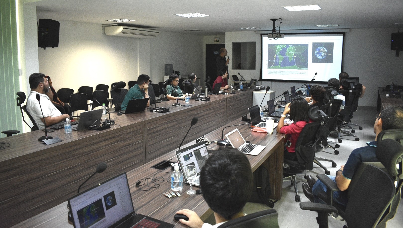
Three training sessions have been conducted at SEMAS in 2021 and 2022.
Service/ system concept
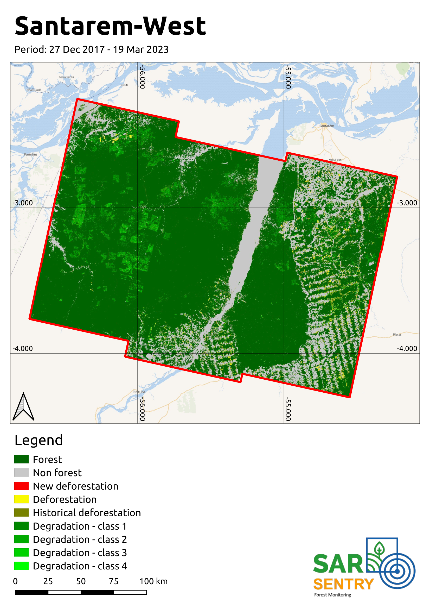
The first project activities comprised of data preparation and pilot trials per test area. Sentinel-1 data have been processed for the period 2017-2022, a 2019 baseline is made and used as reference layer and the system has been calibrated and validated with input from SEMAS. SarSentry software has been installed at SEMAS and the system is adjusted, implemented and demonstrated after a user requirement workshop, for each of the three pilot trials. Basic and technical training has been provided to SEMAS staff and during intermediate workshops, progress is discussed and evaluated. The results have been validated by SEMAS and for the last 6 months of the project NRT forest change maps were produced.
Space Added Value
Images from the Sentinel-1 radar (S1) have been used as the core data input for the SarSentry system. Next to S1, use is also made of other sensors for e.g. the development of the baseline in case no existing baseline is used, and for calibration and validation purposes (e.g. Sentinel-2 optical imagery, Landsat-8).
The SarSentry monitoring system is very innovative and outperforms systems from other competitors regarding its high accuracy (for deforestation > 95%) and ability to detect and quantify forest degradation. The latter is not detected by any of the current operational wide area monitoring systems in the world.
Current Status
The project started on 15 November 2021 and has been completed in April 2023.
Radar imagery has been processed for the three pilot test sites from 2017 onwards, while the deforestation and forest degradation monitoring started from 2018 onwards. SarSentry software is installed at SEMAS and is called SimarPa. In December 2021 and May 2022 training sessions and several workshops have been conducted at SEMAS to SEMAS and CIMAM staff. The system has been adjusted and tested per theme in the test areas. A field visit has been conducted in May 2022 as well, to guide the process of interpreting field verification data by CIMAM. Degradation results have been validated with help of field data from CIMAM. During the last training also staff from the other Amazon states participated. System requirements were prepared for testing analyses and demonstration. The system has been tested by SEMAS staff who provided feedback used for optimizing the system.
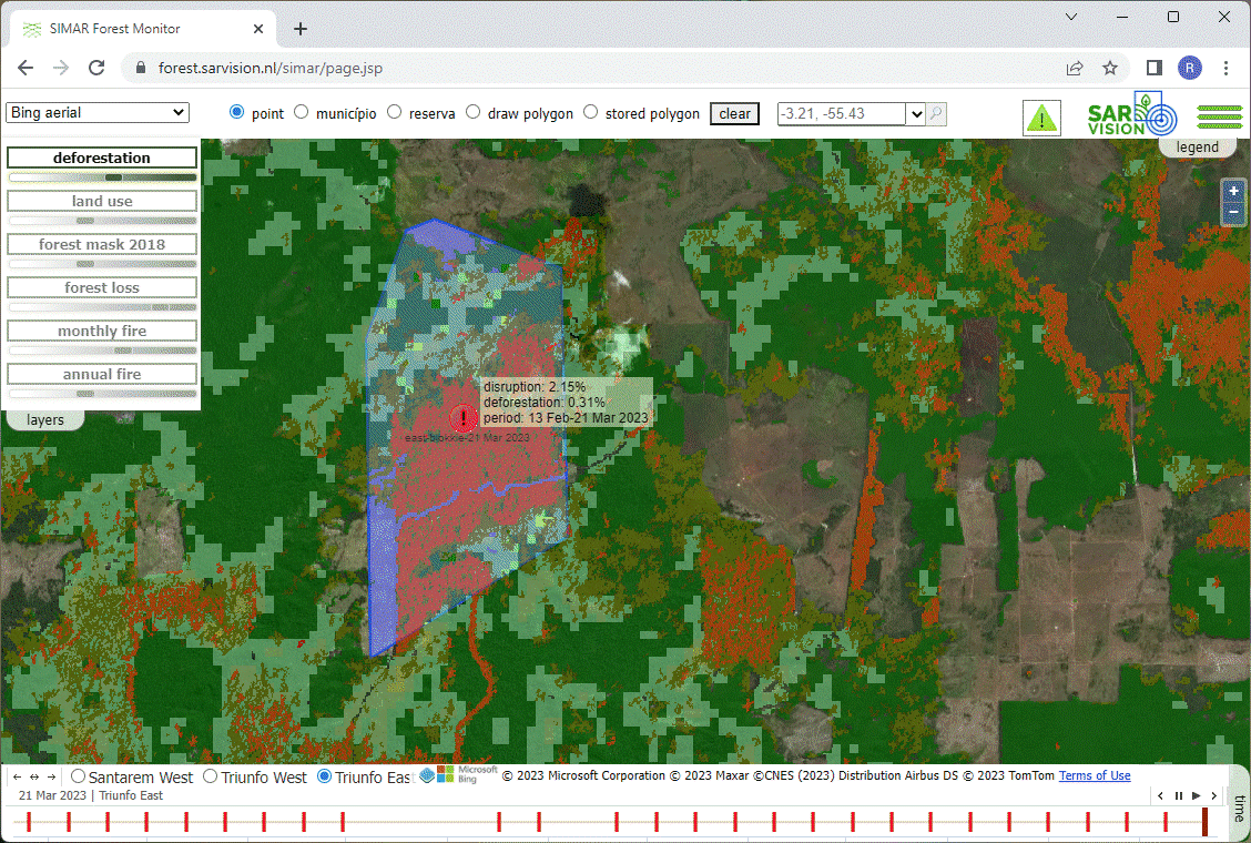
The SimarPa viewer is made available online and accounts can be administered. It is possible to select and draw polygons in that area and to produce an online chart with the deforestation and degradation for that specific area through time. As a forest change alert tool has also been developed. CIMAM is using the viewer to view and analyse the forest change data and alerts for all three test sites. Technical staff can access the viewer and data in their office and in the field in case of internet access. The most recent data have priority so that a precise location of recent forest change can be provided to field teams that would like to inspect these sites. The maps can be used as legal proof for illegal deforestation. CIMAM is pleased with the SarSentry output as they have access now to both accurate deforestation ánd forest degradation data in near real time.
Prime Contractor(s)