Objectives of the service
Carbon markets face significant challenges, including uncertainty over the quality of carbon credits. This lack of transparency undermines trust in the real value and profitability of carbon projects, affecting key stakeholders such as project developers, insurers, brokers, and industry.
UTE’s Earth Observation-based rating system service addresses these issues by providing transparent, reliable, and customizable solutions tailored to agricultural, coastal, and urban areas.
By leveraging advanced Earth Observation data, the service empowers users to reduce risks, enhance project performance, and maximize profitability of carbon projects. This activity aims to create a robust rating framework that improves credit quality, builds confidence in carbon markets, and drives investment in impactful climate solutions.
Users and their needs
Users of UTE’s EO-based rating services are stakeholders in the Voluntary Carbon Market (VCM) supply and sales sectors, including:
-
Public and private carbon project developers who need tools to assess, improve, and monitor project quality, profitability, and risk
-
Carbon credits marketplaces and brokers requiring reliable assessments to trade high-quality credits
-
Insurers needing risk models to support new insurance products and reduce project permanence loss (e.g., fire risk).
Key needs and challenges:
-
Increase climate resilience through targeted interventions.
-
Develop policies with measurable revenues from carbon credits.
-
Access high-resolution, cost-effective EO data for impact analysis
-
Perform robust ROI and cost-benefit analyses for restoration projects.
-
Reduce consultancy costs and integrate advanced risk assessment for long-term project viability.
Service/ system concept
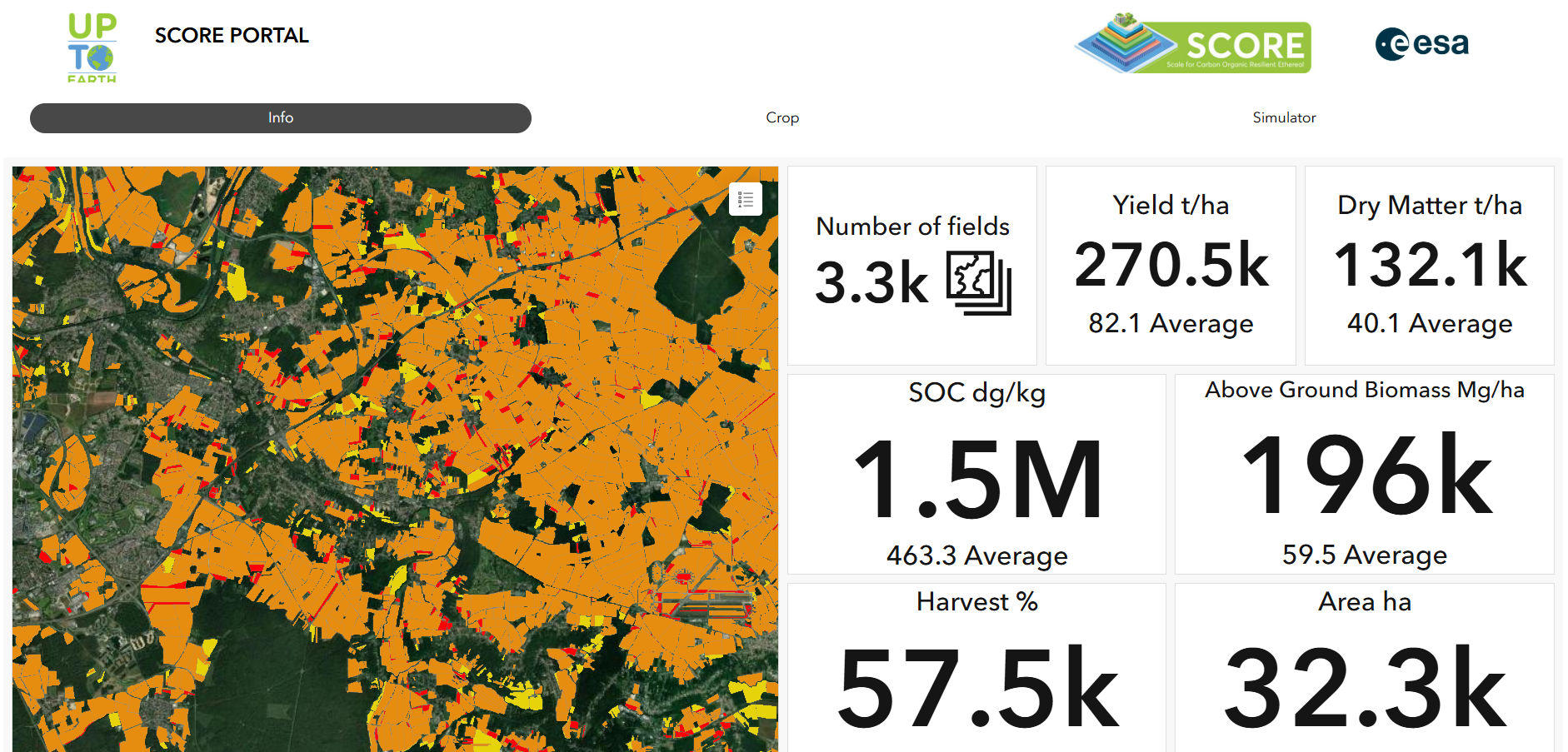
The proposed system integrates satellite data, environmental analysis, and simulation tools to assess carbon sequestration potential and environmental conditions in coastal, urban, and agricultural areas. It provides users with insights into carbon dynamics, environmental risks, and sustainability by analyzing satellite imagery and auxiliary data.
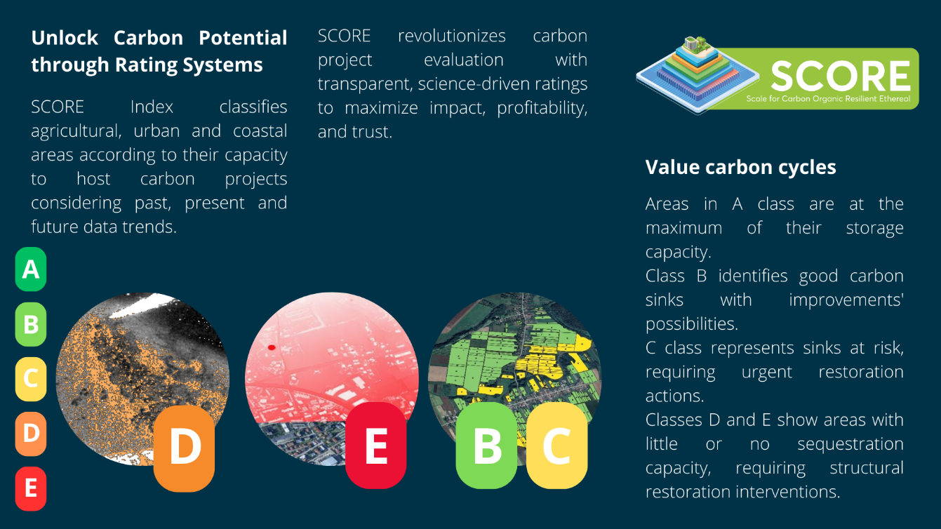
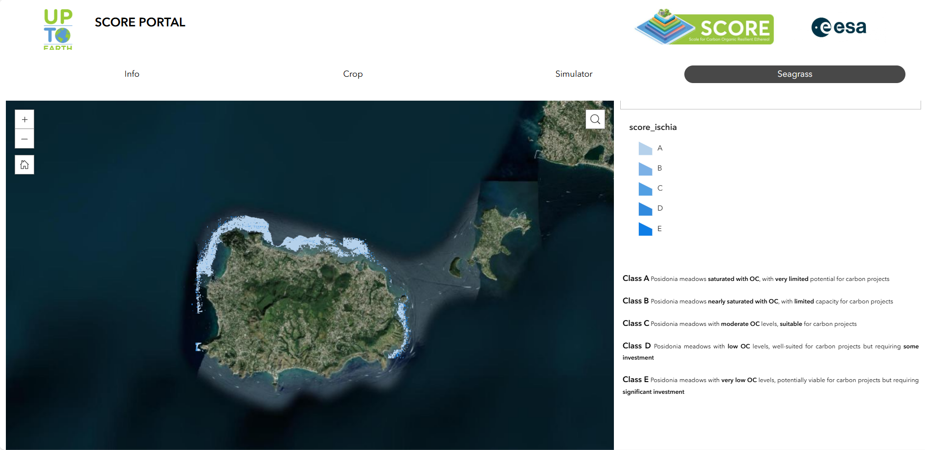
Thanks to the rating system, areas are classified as carbon-poor, medium, or carbon-rich, helping users identify regions for improvement or conservation.
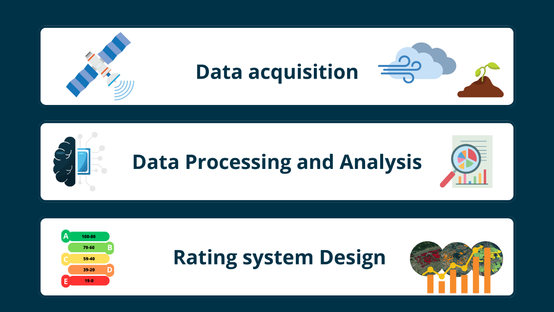
The System Architecture of the system includes:
-
Data Acquisition: Collects satellite data and auxiliary datasets.
-
Data Processing: Pre-processes and classifies the data using harmonized methods.
-
Rating system design: Generate the rating system for coastal, urban, and agricultural areas.
The architecture consists of interconnected subsystems that work seamlessly together to provide valuable insights for environmental decision-making.
Space Added Value
The service leverages satellite-based Earth Observation (EO) assets to revolutionize carbon project rating in agricultural, coastal, and urban ecosystems. By utilizing high-resolution optical, radar and LiDAR imagery, the service enables continuous monitoring of land use, vegetation health, biomass, and carbon sequestration. Historical satellite archives provide extensive temporal data, while modern satellites offer frequent revisit times, ensuring up-to-date insights.
This approach surpasses current non-satellite methodologies, which lack scalability, temporal depth, and scenario simulation capabilities. Satellite data, combined with in-situ measurements, allows for precise modelling of carbon storage in three dimensions: past, present, and future trends. This holistic perspective enhances project transparency and reliability.
The scoring system offers intuitive outputs tailored to diverse users: points for experts and color-coded ratings for non-experts, improving accessibility and usability. Satellite-driven insights reduce reliance on costly, localized assessments and provide scalable, cost-effective solutions for continuous project evaluation.
Current Status
UTE has carried out three pilot activities in collaboration with WE2SURE, the Municipality of Padova, and the Marine Protected Area "Regno di Nettuno" on Ischia Island. Additional pilot initiatives are planned for deployment.
Throughout the project, SCORE has been presented at major events and conferences, including the EEA-ESA Conference on Earth Observation for Monitoring, Reporting and Verification of Carbon Removals, the 2nd European Carbon Farming Summit and the One Ocean Science Congress 2025.
Key achievements during the project include:
-
Addition of a new PhD team member
-
Partnership agreement with WE2SURE and Stoic Foundation
-
Membership in the European Association of Geographers
-
Ongoing application for membership in the EuroGEO Agriculture Action Group
-
Four new service contracts signed/under signature based on SCORE's intermediate products
-
Over €50,500 in sales generated from service contracts based on SCORE's intermediate products
Prime Contractor(s)