Objectives of the service

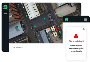
Our service provides a situational awareness tool for emergency management, addressing key challenges faced during incidents. Firstly, it ensures locational awareness of crucial assets—people—via integration of Earth Observation and Satellite Navigation data. This facilitates real-time tracking of individuals within incident zones and enables direct communication for evacuation management. Additionally, the tool allows users to establish virtual security zones, tracking access without complex systems, particularly beneficial in remote areas. By combining map data with various spectra of Earth Observation, it detects hazardous zones like fires or toxic clouds, alerting nearby workers via targeted messaging. The objectives are to enhance incident management by providing real-time locational awareness, streamlined communication, hazard detection, and evacuation optimization, ultimately improving overall emergency response effectiveness.
Users and their needs
The project targets users involved in disaster recovery and incident management globally, emphasizing two critical aspects: situational awareness and communication.
The user can be anybody working/visiting buildings/site for the industrial companies, or anyone working fixed/temporary/voluntary in case of accidents/incidents. Users can be all around the globe.
Their needs revolve around:
- Complete situational awareness through a Common Operating Picture (COP)
- Easily accessible platform for cross-organizational collaboration
- Swift user onboarding process
- Fast, reliable, and secure communication channels
- Seamless integration of various communication methods
- Aggregated view of the situation in real-time
- Access to digital channels for both public safety and non-public safety units
Service/ system concept
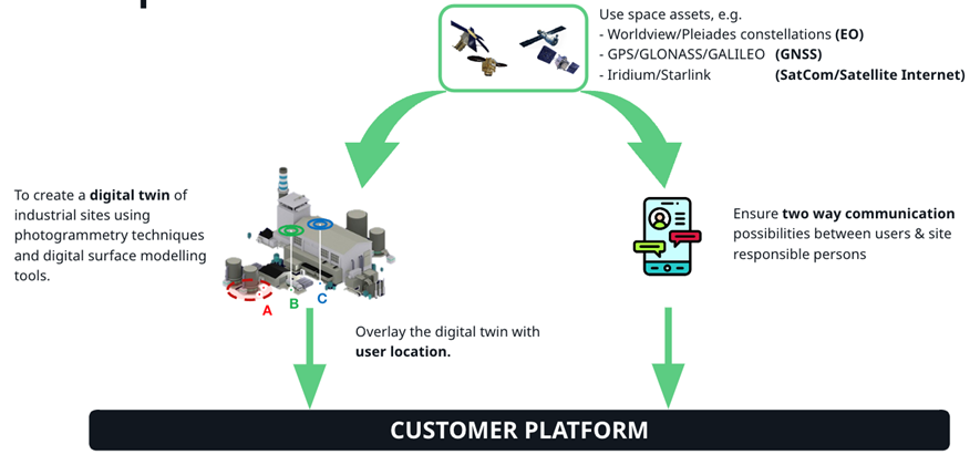
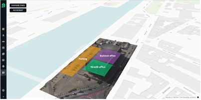
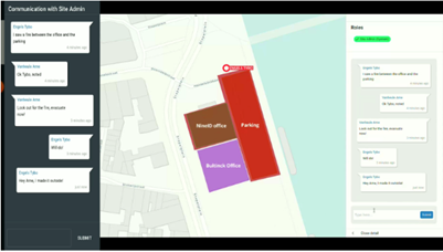
SESIM uses spaces assets, for example Earth Observation data or Global Navigation Satellite Systems, to create a digital twin of industrial sites using photogrammetry techniques and digital surface modelling tools. At the same time ensure two-way communication between users and site managers. Both these components will be put in a ready to use customer platform.

Space Added Value
Earth Observation data and Global Satellite Navigation Systems will be used to create 3D models of industrial sites to make digital twins.
Current Status


On the commercial front, our efforts we focused on sending out surveys to potential customers, had conversations with existing clients and did a thorough market analysis about incident management and digital twins.
For the technical side, we produced a PoC with a working digital twin, two-way communication system and location tracking of people on site. This PoC is tested both internally as with our champion customer.
This concerted effort across both commercial and technical domains exemplifies our dedication to driving forward SESIM with purpose, positioning it as an innovative solution ready to meet the evolving demands of our clients.
The study successfully concluded Q4 2024 and NineID are proceeding with a BASS demonstration project to accelerate commercialisation of the SESIM service.


