
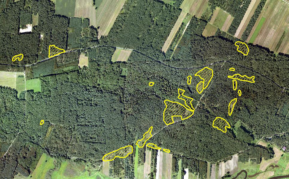
In June 2016, a violent thunderstorm ravaged a forest in the Dojlidy superintendence of Poland. Using a new forestry monitoring system being developed with the support of ESA, forestry authorities immediately began inventorising the damage. Satellite operators providing Earth Observation data were asked for high-priority data collection, with a maximum collection window of two weeks. The data was rapidly analysed, revealing that some 1,100 hectares of woodlands had been almost completely destroyed. The outputs and orthophotomaps were uploaded into a central EO/GNSS repository, which could then be viewed remotely on mobile devices by foresters working on location.
For verification purposes, field measurements were then undertaken to validate the new service, called Integrated Web-Based Service for Forestry (IWBSF). “The forestry personnel involved in this episode gave us very positive feedback,” says Bartosz Kulawik of SmallGIS, the developer of the service. “The new process significantly decreases response times, which is crucial during such crises. The fast data collection and analysis that are provided to the foresters via the IWBSF service reduces the time and cost of forest damage estimations.”
Web-based services
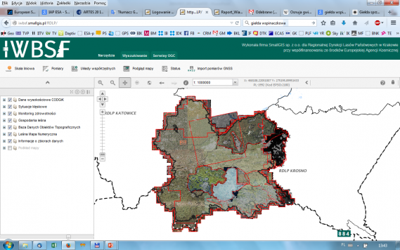
The IBSWF service, which is currently being used by three regional forestry departments in Poland, combines space and terrestrial data with a web-based interface. The system offers three specific services, Forest Management, Forest Health Check, and Damage Assessment, all of which offer highly detailed information about woodland areas.
The Forest Management service is of great value for the regional forestry departments, which are required to create and maintain ten-year plans for the forests they manage.
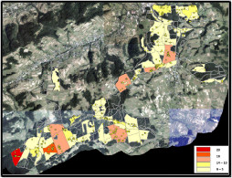
The Forest Health Check (see right) is vital for pest control and health improvement. Using the system, individual species of trees as well as spot single trees affected by pests can be identified, as well as mapping areas damaged by severe weather.
The new monitoring service was developed with the support of ESA under the Business Applications Programme. Co-funding for the IAP Feasibility Study was provided by the Polish forestry agency, Poland State Forests. SmallGIS, the prime contractor, is a Polish software house specialising in the development of Geographical Information Systems.
space-based TECHNIQUES
In Poland forested areas are nearly all owned by the state and are managed by Poland State Forests. Up to now, aerial imagery has been used for a limited number of tasks, mostly focused on visualisation purposes, without applying advanced data analysis techniques. The goal of IWBSF is to promote widespread use of EO and GNSS data, encompassing forestry case studies, information distribution, inventory uploading, resource management, and archival functions.
With the new service, users can display, edit, and analyses, as well as integrate GNSS measurements with EO observations and export data for distribution and publication in a quick and efficient way.
“Since Poland joined ESA in 2012, knowledge about space capabilities has become more widespread, and Poland State Forests began to look at the possibilities,” says Bartosz Kulawik. “The IWBSF project is a perfect example of promoting integrated EO and GNSS technologies that highlight the benefits of such solutions.”
“IWBSF took a relatively short time to go from conception to delivery, an impressive achievement.” says ESA’s César Bastón Canosa, Technical Officer for the IAP Feasibility Study. “The service has been very well received by the forestry service employees in the regions.”
Poland State Forests is currently evaluating the possibility of deploying the forestry monitoring system nation-wide.