Objectives of the service
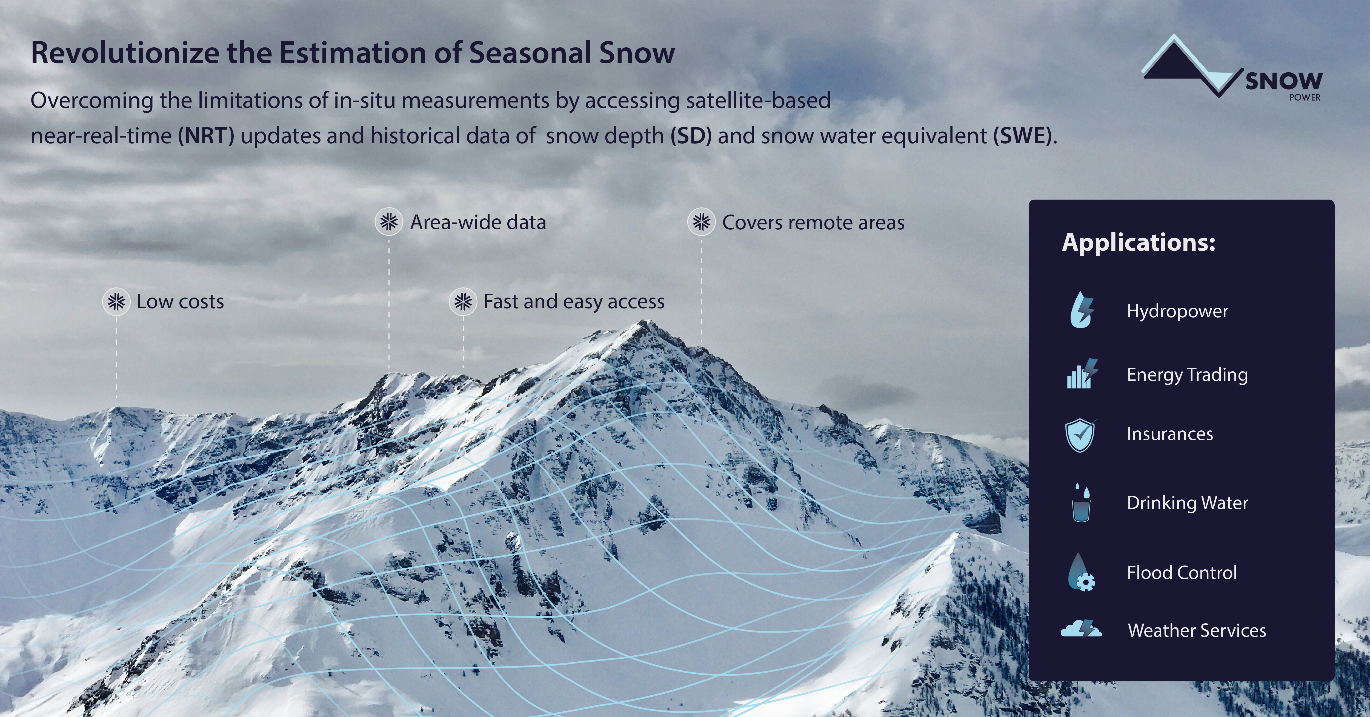
Water resources in snow, defined by the SWE, are of key importance to supply renewable energy production through hydropower. Information of the spatial distribution and temporal evolution in SWE are essential to forecast and manage reservoir water levels and electricity production. Timely information on snow properties, such as watershed peak SWE and melt timing, offers an extended planning horizon to optimize efficiency. Based on recent advances in snow remote sensing techniques, remote sensing has the potential to provide essential information on the spatio-temporal distribution of snow, offering frequent high-resolution observations over large areas. This project aims to push forward these recent technological, scientific developments into a leading operational service, offering accurate, near-real-time snow information to the hydropower sector. The knowledge of daily, area-wide snow properties at the watershed, mountain range, or potentially even continental to global scale, is expected to improve the way that businesses are currently conducted. Accurate NRT monitoring of snow conditions offers an excellent planning horizon for timely management decisions but can also support energy trading and a range of other applications. The resulting service offers accurate, daily, spatially distributed snow depth (SD) and SWE information at sub-km resolution, over any region of interest.

Users and their needs
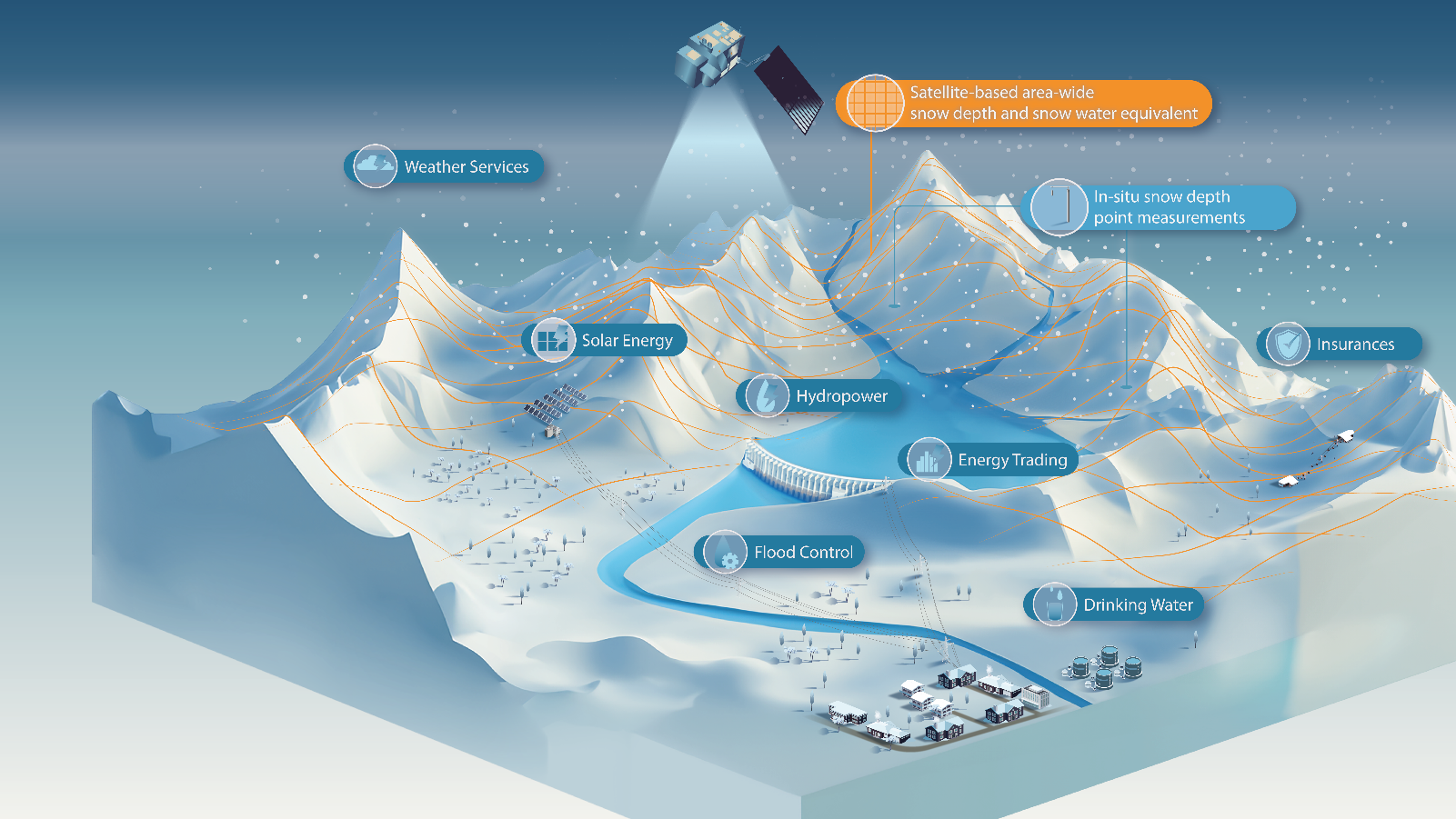
The targeted primary users are hydropower operators and planners. Secondary users are energy traders, solar energy companies, insurances and weather services, as well as water managers and scientists. Hydropower operators can use the snow information to optimize their production, as timely and robust information on snow conditions offers an extended planning horizon to optimize production efficiency. Hydropower operators as well as planning or consulting agencies can use snow information to design new projects or to optimize current infrastructure. For energy traders, the trading risks can be reduced by information on past and current snow conditions. For solar energy companies, the design of new alpine solar power plants benefits from estimates of the climatological snow heights in the area. While insurances can employ a client payment system to cover possible damage from lack (or abundance) of snow. Furthermore, meteorologicalservices, flood forecasting, and drinking water storage can be improved. The main advantage lays in mountain regions worldwide.
User needs:
-
Knowledge on the water stored in snow in the catchment
-
Large-scale snow data at a high resolution, for regions with sparse data so far, or previously unobserved regions
-
Robust and timely information
-
Near-real-time information
-
Low cost
Main Challenge:
-
Robust worldwide information
Service/ system concept
The service consists of the near real-time (NRT) provision of satellite-based information on snow depth (SD) and snow water equivalent (SWE) to the users, as well as providing historical SD and SWE data. The focus lays on mountainous regions, with typically strong variability of snow conditions in space and time, often including deep snow. For such regions, our service is expected to provide the largest benefits. The resulting service offers accurate, daily, spatially distributed SD and SWE information at sub-km (e.g., 500 m) resolution, over any region of interest to support large scale operations. The main field of application is seen in the hydropower sector, for daily operation to optimize the production as well as planning of new plants. But also, other industries are supported such as energy trading, insurances, water management for flood control and drinking water, weather services, and solar energy companies.

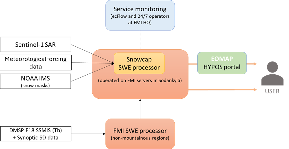
The system architecture builds on the SWE processor developed by Snowcap, which will be implemented on FMI Sodankylä satellite data centre servers that are monitored 24/7 by FMI operators. The processing system utilizes Sentinel-1 SAR, NOAA IMS, Meteorological forcing data and SWE estimates based on DMSP F18 SSMIS by FMI (available outside the mountainous regions).

Space Added Value
Information of SWE is to-date still mostly inferred from intensive in situ measurement campaigns. These measurements present several challenges, including high personnel costs, and the limited amount of information contained in the measurements, restricted to the specific time and location of the samples. This is especially relevant in mountain areas, with poor accessibility, lack in existing monitoring infrastructure, and high spatial heterogeneity due to complex topography. The SnowPower solution for estimating SD and SWE in mountains utilizes the satellite-based information provided by the ESA Sentinel-1 SAR mission. The SWE outside the mountains is estimated using passive microwave radiometer (PMW) data from DMSP F17/F18 satellites. The developed methodology can combine the Sentinel-1 based data with the PMW based information using a modelling framework and therefore it is possible to provide SD and SWE estimates to practically any region of interest. Furthermore, IMS snow cover is used within the Sentinel-1 SWE retrieval as an additional auxiliary dataset. By using also meteorological forcing data, daily SWE estimates are produced from the SAR and PMW-based SD/SWE estimates. In contrast to many AI-based approaches, the method can also be applied to new regions, like the Andes in South America, where in-situ data is extremely sparse.
Current Status
NRT delivery of snow data for the Alps is running fully operational. Historical snow data is available for both Alps and Scandinavia. A global coverage with historical snow data is prepared along with a fast conversion of the whole process to new regions worldwide. Some upgrades for the algorithm were already established between the first (2024) and second (2024/25) winter season of the project. A new version of data processing is now as well implemented, enabling even better results for the ongoing (2025/26) and coming winter season.
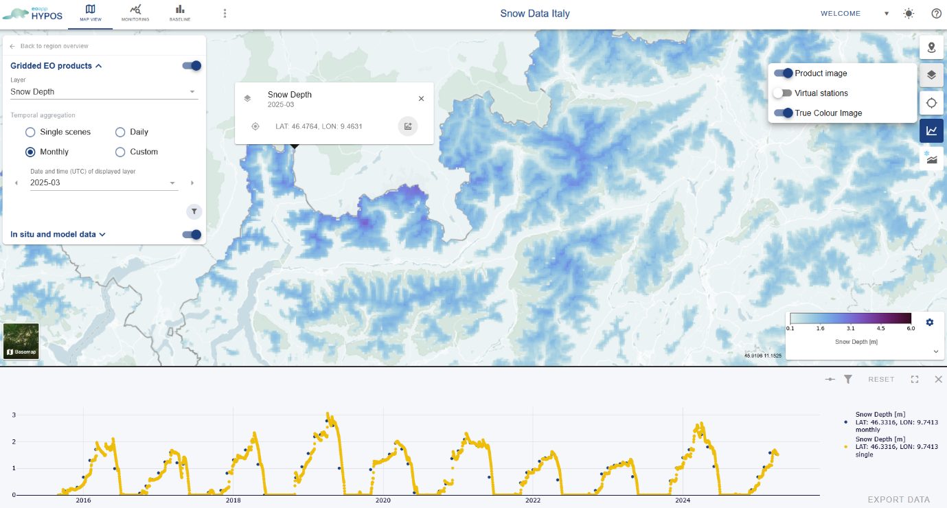
The generated snow data can be accessed via the eoapp Hypos, a user-friendly web application. Within the eoapp Hypos as well data analysis is possible, like the creation of elevation bands, data comparison between different seasons, years, and as well with customer tailored in-situ data.
The regular exchange with the two pilot users within the demonstration project helped improving the snow data and the eoapp Hypos portal continuously.


