
Objectives of the service
The STELLAR project was initiated in response to the strong interest expressed by agricultural production companies in enhancing supply chain information with minimal involvement from growers. Stakeholders seek an independent source of information, separate from the farmers, regarding the quantities and quality of agricultural produce contracted and supplied to them.
Additionally, small-scale farmers have shown significant interest in obtaining information about their crops. However, commercial sources typically require orders for larger areas than those owned by these farmers. Therefore, STELLAR aims to bridge this gap by enabling small-scale farmers to access crop information for smaller areas.
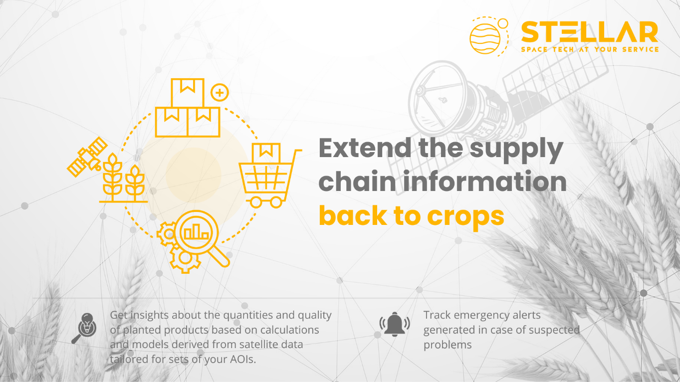
Stakeholders seek insights into the quantities and quality of planted products based on calculations and models, with emergency alerts generated in case of suspected problems. This will be provided through interfaces for convenient ordering, processing, analyzing, and storing processed satellite data for their ERP systems, along with a user-friendly presentation layer. This is the core goal of the STELLAR project.
Users and their needs
The STELLAR service focuses on two customer segments:
-
Agricultural Production Corporations
-
Agricultural Production SMEs
Both customer segments emphasize the following needs:
-
Yield maps to predict the yields for crops like potatoes, apples and berries.
-
An alerting solution for the crops they manage.
-
Knowledge of their rank compared to similar entities in their region.
They want to receive alerts (on their mobile phones) about threats to the crops they manage and view their benchmark Key Performance Indicators (KPIs) compared to similar businesses in the region.
Upon launching the pilot version of the STELLAR services, they will initially be offered to entities across the Polish market, with plans for subsequent expansion to the East European market.
Service/ system concept
STELLAR aims to meet the growing demand for precision farming by providing seamless and interoperable satellite data services to both large and small agricultural enterprises. These services enhance their ability to monitor and manage agricultural production efficiently and sustainably.
These services will be available through the STELLAR web application and API:
-
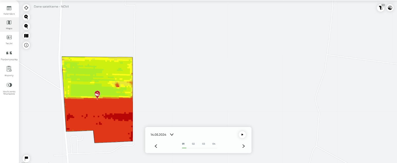
Automated Index Calculations: Streamlining client processes by automating the calculation of satellite-based vegetation and soil indices for defined areas.
-
Management Zone Maps: Providing automated, satellite-based management zone maps to clients, eliminating the need for individual processing and ensuring seamless integration with agricultural devices.
-
Yield Maps: Using satellite data and AI models to predict yields for crops such as potatoes, apples, and berries.
-
Crop Classification: Utilizing AI for advanced recognition and classification of crop types based on EO images.
-
API Interface: Offering an API for all services above to meet corporate client needs, enabling integration with internal IT systems.
These offerings position STELLAR as a comprehensive solution for modern agricultural needs, driving efficiency and sustainability in the sector.
Space Added Value
The fundamental space resources required for the successful implementation of this project are Earth observation satellite data, including low, medium, and high-resolution imagery, along with synthetic aperture radar images.
The primary purposes of using satellite data are to verify the accuracy of crop information, identify threats, and respond effectively to avoid crop losses. Additionally, it aims to assess whether a farmer's performance is efficient compared to regional standards or if there are inefficiencies in cultivation practices.
Satellite data enables the monitoring of crop health, soil moisture assessment, yield forecasting, and the detection of threats such as droughts and pests. Utilizing these technologies allows farmers to optimize resources, increase production efficiency, and minimize negative environmental impacts. The growing importance of big data, IoT, and AI further supports the integration of satellite data in agriculture, leading to more advanced and personalized solutions.
Current Status
The project team has conducted a feasibility study for the development and deployment of automated interfaces. These interfaces are designed for ordering, processing, and visualizing agricultural data derived from optical imaging and Synthetic Aperture Radar, ensuring interoperability with the existing ERP systems of large agricultural corporations and agricultural SMEs. In this regard, the STELLAR project has recognized and responded to the most significant user needs:
-
Automatically gather information on a large number of crops simultaneously, covering over 300 fields for each client.
-
Detect specific crops, such as potatoes, sugar beets, and broccoli, in regions defined by search criteria to identify potential suppliers for future seasons.
