
Objectives of the service
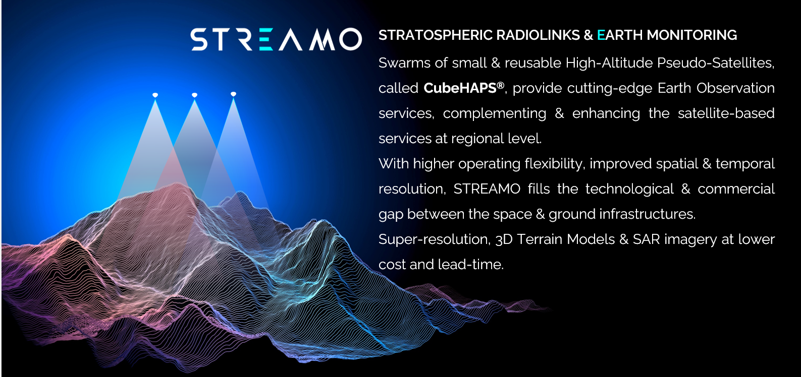
The objectives of this Feasibility Study are, from one side, to validate in commercial environment, the business model of very high-resolution images gathering with a simplified version of a small and reusable High-Altitude Pseudo-Satellite, called CubeHAPS®, and from the other side to raise the Technology Readiness Level of the advanced version of the CubeHAPS®, that, besides improved payload and flight performance, enables the swarm operation mode.
The users’ key problems concern the limited temporal and spatial resolution of the acquired satellite imagery: a more flexible and less expensive technology for data gathering is required for customized services and more frequent fast-response scenarios. There is a missing layer of space-based services located in the middle between the satellites and airborne solutions.
The solution proposed enables near-real-time monitoring from the stratosphere at regional level, with advanced earth monitoring products, including improved images with super-resolution techniques, 3D digital terrain maps in near-real-time and SAR datasets. The images are sold at very competitive pricing to other businesses and institutions with the similar channels used by satellite data services providers, as the solution can be used in synergy with existing infrastructures.
Users and their needs
The users involved in the STREAMO Feasibility Study, are of two kinds:
-
The companies and institutions that have the capacity and the knowledge on how to process raw datasets and extrapolate useful information. These are downstream companies of the Earth Observation market and the environmental and civil protection agencies.
-
The companies and institutions that just need the value-added information from the images, with minimum knowledge of data processing.
The users' needs are:
-
more affordable datasets compared to satellites and drones.
-
higher spatial and temporal resolution compared to satellites.
-
a more flexible solution for data gathering.
The project challenges to meet the above needs are the following:
-
weights constraints for some type of sensors
-
long lasting missions with high station-keeping capability over a specific target.
The targeted users, for this study, are all located in Italy.
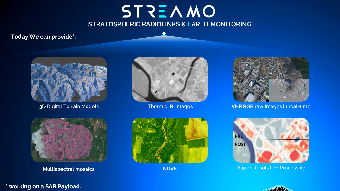
Service/ system concept
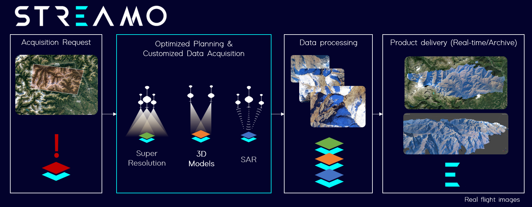
The end-users are supplied with very-high resolution images, coming from three different operations:
-
datasets generated with super-resolution algorithms.
-
3D digital terrain models in near-real-time.
-
Synthetic Aperture RADAR (SAR) images.
The customer can ask an on-demand flight or gather the products from the archive, at different pricing.
Two of the main features are the CubeHAPS® capability to operate flexibly (can be used in different periods of day) and rapidly (maximum few hours) in different scenarios, using different types of payloads, too.
Once the service will be deployed, the users will have the possibility to gather advanced earth monitoring products with the maximum of flexibility and rapidity, in near-real time, with very low pricing.
Space Added Value
The space assets used during this Project are very beneficial for the technology, operations and final product developments.
The space assets used are:
-
GNSS sensors: to check in real-time the platforms positions and to predict the remaining flight trajectory, and on the other side, to add valuable information to images metadata, used to georeference the images after the acquisition.
-
Satellite modem for telemetry, with a Short Burst Messaging Service, as a backup for position check and for command imparting.
-
World Coverage Map from Copernicus Program, by using the maps to decide the safe landing areas.
-
Global Forecast System (GFS) model for the winds, pressures, and temperatures forecast, to implement a predictor that calculates and shows the trajectory of the platform, during the simulated and real missions.
-
Copernicus datasets as reference layer for the stratospheric datasets, during the data processing. Useful also to test the super-resolution algorithms.
-
The use of SAR Satellites in LEO (e.g., Sentinel 1a/1c) as a “Transmitter”, while a swarm or a single platorm of CubeHAPS® as “Recievers”, improving the SAR datasets spatial and temporal resolution. The STREAMO Project studied this peculiar configuration and its feasibility, in terms of system requirements, is confirmed.
Current Status
Current status: Final Review
Up to the Final Review of this project, from the technological point of view, we tested two different performant RGB cameras, one multispectral camera, one thermic infra-red camera, with dedicated flights. Furthermore, we tested a light configuration of CubeHAPS® version 2. All these tests are done in collaboration with potential customers and the main goals were to understand their main pains and to direct our capacities in the optimized direction in terms of business model.
From the customer point of view, we worked on different potential selling channels:
-
Our own market-place (a simple on-demand data acquisition by drawing on the map the area of interest)
-
Third Parties market-places (more sophisticated but robust solutions with customization possibility e.g. https://www.earthdataplace.com/)
We are in touch with potential suppliers of their own marketplace and would like to involve them in future projects.
From the commercial viability point of view, we were able to firm a commercial contract: we will use our technology to map a wide area in the North-Western of Italy.
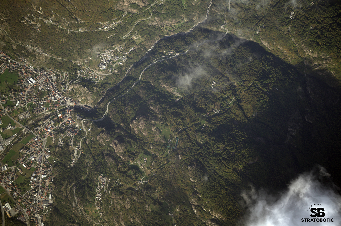
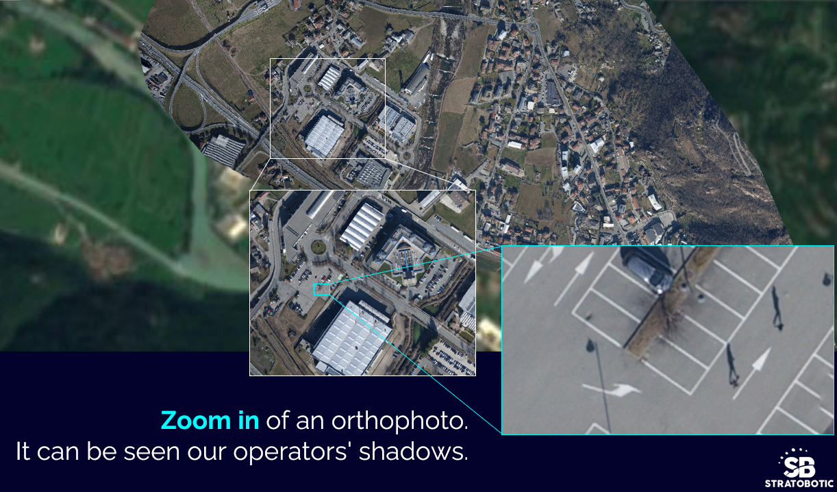
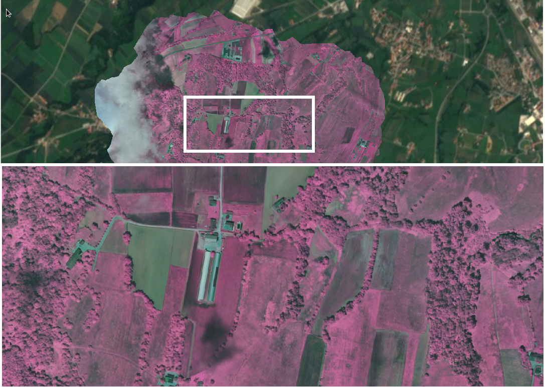
The picture above is a very high-resolution image taken by the stratospheric platform in October 2023, in the northwestern of Italy. The flight was performed with first version of CubeHAPS®, with no datalink present on board, while the picture below is from a flight performed in February 2024 and shows its high-resolution quality.
We performed then a flight testing a high bitrate datalink and we were able to maintain the connection for 24 minutes, with a peak bitrate around 5MB/s. The pointing system were manual, so further developments are required to improve the tracking system and the downlink capacity. Regarding the datalink, we made the feasibility analysis with our partners, and the result was positive: we would need though a dedicated operation frequency to have an optimized datalink.
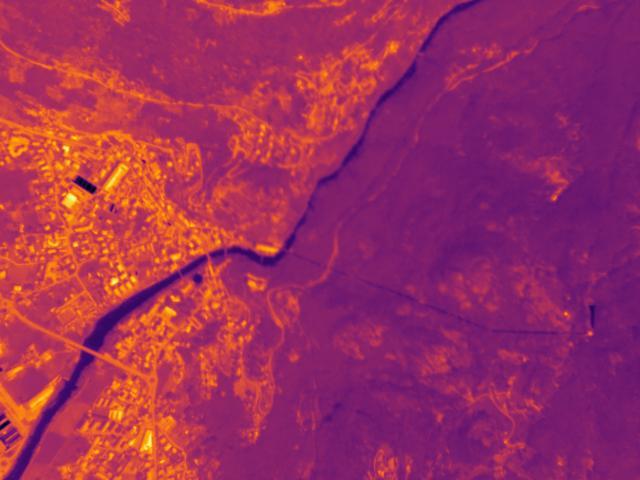
Then, we integrated two different kinds of sensors: Thermic IR and multispectral.
Here an example of thermic IR raw images acquired by our CubeHAPS®:
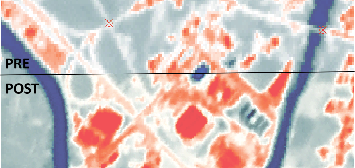
We also performed post-processing activities to calculate the radiometric values (the temperature of the pixels). Here is a normalized picture (brighter colours mean higher temperatures, darker colours mean lower temperatures):
We also started to implement the Super-Resolution algorithm to these images, with relative good results.
Regarding the Multispectral acquisition we have the possibility to generate the NDVIs of agricultural fields, as follows:
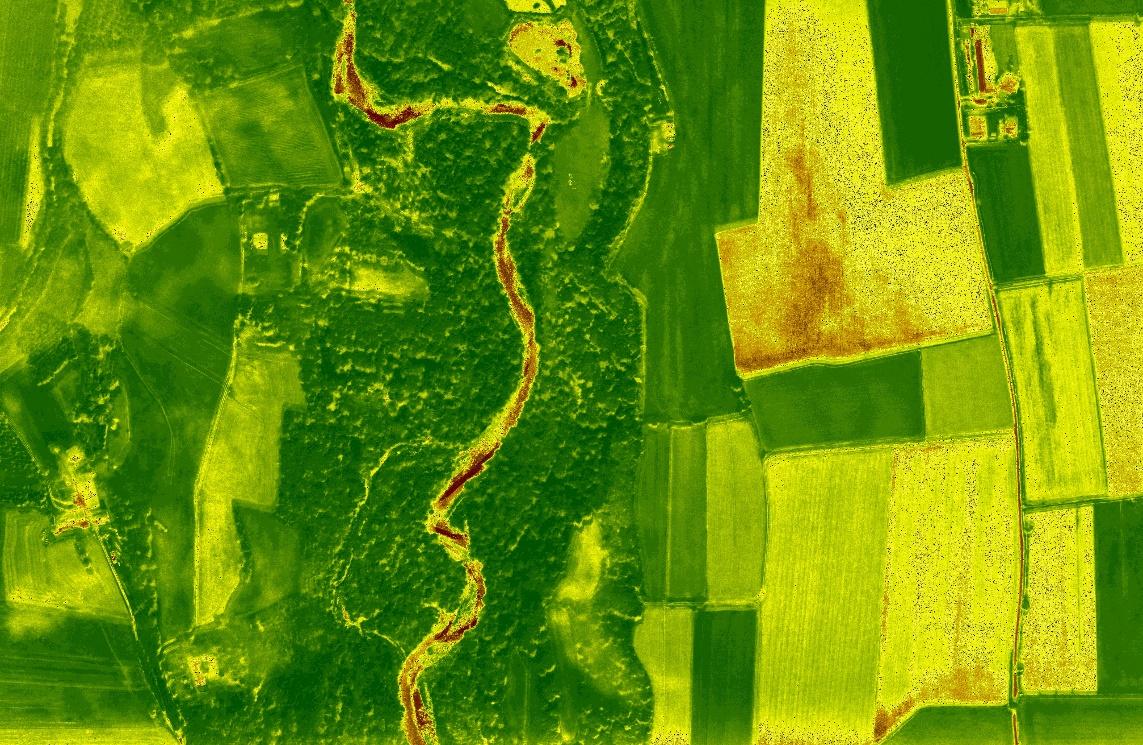
We can also provide orthomosaics of NIR, with a very good resolution.
It is necessary to explore more the Multispectral datasets as they have a very big potential and it is an important market request.
Furthermore, we studied the possible configurations for the multistatic RADAR, and decided to go with a bistatic configuration and defined the datasets for the post-processing pipeline, including the usage of the available tools to perform the super-resolution algorithms. Some tests are already done, but further development and fine-tuning are necessary. It was calculated the work effort and the costs to rise the multistatic RADAR’s TRL. Detailed choices on the components were made, too.
Today the consortium held different workshops with a potential customer that operates in mountainous environment. The results are that they saigned a pre-commercial contract.
Furthermore, the consortium presented this project at the third HAPS4ESA workshop held in Leiden (NL) from 12th to 14th of February 2024 (https://atpi.eventsair.com/haps4esa2024/).
We presented the swarm configuration at the benefit of science and education at the 26th ESA Symposium on European Rocket & Balloon programmes and related research, held in Luzern (CH) from 19th to 23rd of May 2024 (https://atpi.eventsair.com/26th-esa-pac-symposium/).