
Objectives of the service
Climate change provides many new challenges for forestry and environmental management. Long dry periods combined with an increase in extreme weather events call for new solutions and ask for a solid and comprehensive information base. Stakeholders need such an information base for proper and quick decisions in the field as well as in the office.
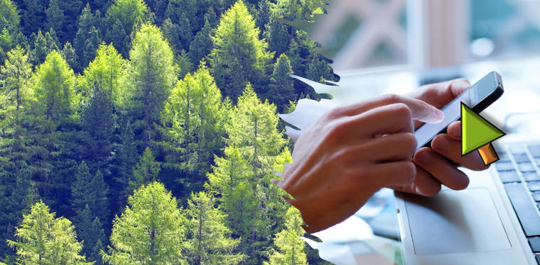
Key problems of the industry, such as the reduced number of people in the field, an increasing degree of climate stress caused damages as well as tight margins of the operations are the primary motivation and driver for the Tama WaldCursor. This new product, designed as an app and cloud-based assistant for forestry and environmental stake holders, provides a reliable digital platform for measures. The effective combination of situation maps, project management tools and powerful analytics provides each user with actionable information, right in the field. Continuous use of Sentinel-2 data, combined with locally provided drone image data are destined to assist the individual forester and environmental care taker efficiently and cost-effectively.
Users and their needs
The WaldCursor is designed for two major user groups: i) private, governmental and commercial forestry operations and ii) environmental managers and care-takers.
The WaldCursor offers:
-
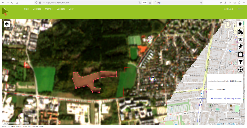
An easy to use digital information platform
-
Access to satellite imagery even for sat-newcomers
-
Tools for project management in the field
-
A comprehensive set of imagery and maps, providing current situation maps,
-
Possibility to upload self-created drone imagery
-
Powerful analytics for imagery and plans
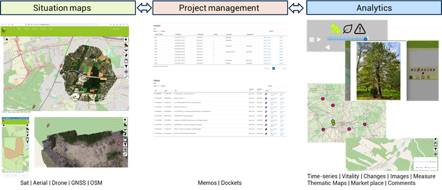
Service/ system concept
The WaldCursor offer users timely, accurate and comprehensive information about one’s forests and nature zones and enables their field teams to take swift action.
The WaldCursor consists of three major areas:
-
Situation maps
-
Project management, and,
-
Analytics
Users can easily navigate in their data sets, including
-
Property boundaries
-
Permanent details such as strip roads
-
Geocoded event markers set in the field
-
Marker attributes filled in the field
-
Time series of satellite imagery of the property
-
Geospatially correct highest resolution imagery from self-flown drone data
-
Imported thematic maps
The WaldCurser can be used both by office computers within a standard browser as well as by an app running on the smartphone browser.
Space Added Value
The Tama WaldCurser makes intensive use of two kinds of space based assets. First of all, remote sensing imagery from Sentinel-2 satellites becomes available directly to the smartphone and office of forestry and environmental stake holders. This remote sensing data builds a base layer for other information layers in the system such as a field data and AI based analytics.
In addition to remote sensing satellites, the WaldCursor benefits strongly from GNSS location information. In most cases in forestry, even a 10m level accuracy of local position as provided by commercial smart phones allows the WaldCursor to make intensive use for visualization, analytics, alarms and guidance for field teams. This can be seen as strong upgrade as compared to todays’ methods which are often built on paper-based information gathering.
Current Status
WaldCursor 1.3 is commercially available as of April 2022. Since, Tama Group developed the service further, now within an extension project (CCN) of TSMF10CM_DP. You find the product on www.waldcursor.com