Objectives of the service
The biggest challenge in terms of green buildings is data integration into a common digital infrastructure as well as data gathering/aggregation from different service providers: energy, natural gas, water, satellite data, 3D model, etc. all in one place, while respecting all GDPR rules. There are no common and standardized ways to monitor green buildings. Furthermore, there are no common data models or standardized protocols for green buildings monitoring. Also, green buildings are mostly monitored by companies from sensors located inside the buildings and not from outside. In general, the green building industry needs a solution for area monitoring for the surrounding green building as well as green buildings itself. It can be based on data fusion of remote sensing data with available green buildings external data sets and city datasets. Drone imaging including thermal images of green buildings will bring added value regarding heat leaks information and conditions of insulation that influences the internal state of green buildings. It can help green buildings to solve the issue of data standardization since all satellite, drone or traffic will be in one place in the green buildings Urban AI software.
Users and their needs
The cities of Tampere, Finland and Tartu, Estonia were involved in this feasibility study as test pilot customers. They are interested in applying innovative technologies such as earth observation data for accessing up to date state of green buildings and built environment. This will allow them to monitor the state of the urban areas remotely and have the full picture of urban environments in terms of environmental, energy, and infrastructure state of urban areas. By providing building digital twin from observables from earth observation data and city energy grid, the City of Tartu can better plan and find location for green energies initiative and help to put milestones and monitor the progress towards zero emission city development while monitoring past and current emission state by means of software developed during the feasibility study.
The global effect of UrbanAI is helping B2B and B2G monitor area/city development to adjust their emission reduction, carbon neutrality strategies accordingly. Monitoring and control is crucial when it comes towards the effectiveness of environmental strategies. Green building UrbanAI goes beyond environmental monitoring from satellite data, but also has data fusion and traffic, energy functionalities, analytics dashboards to provide a full picture of energy/environment.
Service/ system concept
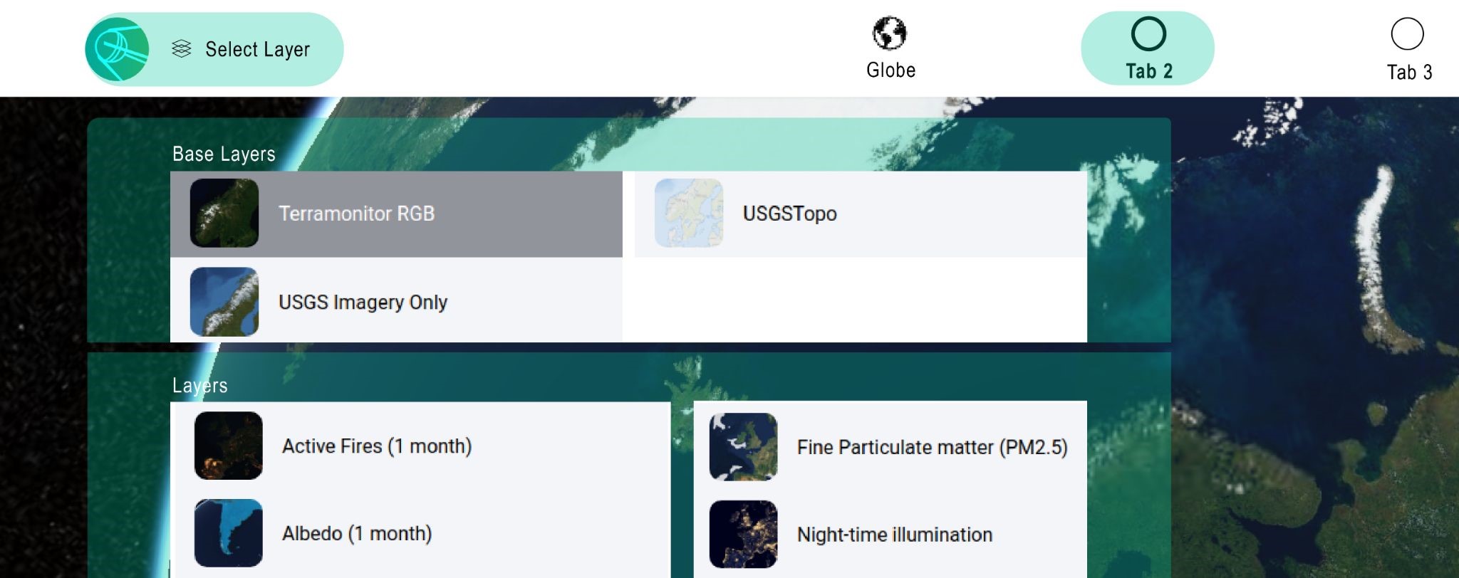
The system architecture is centred around a user interface that takes the form of a web interface. This web interface communicates with our backend using several technologies. The original data coming from satellite, drone or other sources is stored in various formats and is fetched by our backend using various protocols. It is the role of our backend to translate this data into a common format and transpose it in the same way towards the user interface. Our analytics and AI of the raw data is also located on the backend.
Space Added Value
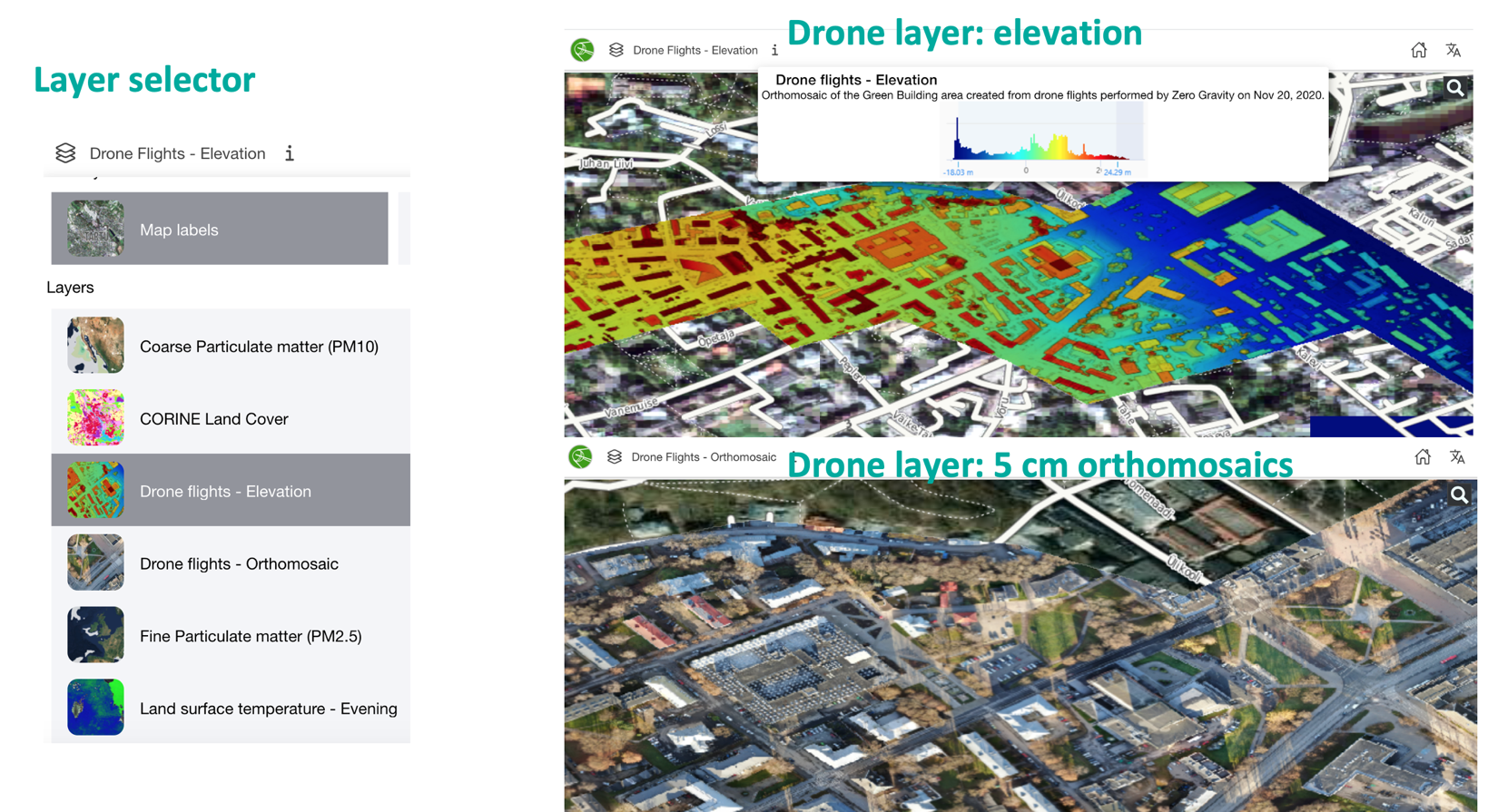
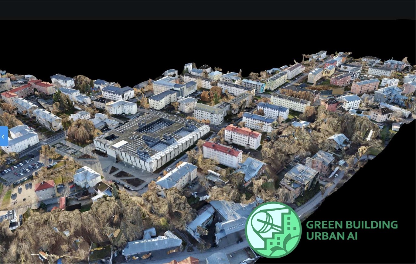
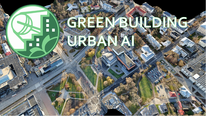
Green building UrbanAI combines various data sources satellite imagery, drone data, 3D model and available city data to provide a digital twin and combine it with comprehensive analytics dashboards to characterize traffic, environmental/energy impact, emissions of green buildings and city areas. Green buildings UrbanAI utilizes optical satellite data as well as air quality data, urban temperature from the Copernicus/Sentinel program, local air quality sensor readouts from city municipalities & green buildings, smart traffic city datasets, high-resolution data from Airbus (e.g., Pleiades). City energy data and optical drone imaging data are part of data fusion in green buildings UrbanAI. These drone data layers merged with satellite imagery will provide closer to real time situational picture and increase the accuracy of green building digital twin as well as provide multidimensional information/knowledge layers of the area.
Current Status
During the feasibility studies, we have interviewed around 10 potential users and we have worked in close collaboration with the pilot cities of Tartu and Tampere to create a set of user requirements for UrbanAI for Green Buildings. Based on this feedback, a working prototype was developed for the city of Tartu. It utilizes optical satellite data, high-resolution 5cm drone data, air quality data coming from city sensors, satellite air quality and traffic flow data, combined with a 3D model of the green buildings area. The prototype also includes user-friendly interactive dashboards for air quality and traffic data layers as well as possibility to zoom in into a building level information screen. It can be demonstrated under request. Furthermore, the feasibility of an environmental impact calculator was examined in detail based on user feedback and analysis of the available data. It opened new business possibilities and next steps for product development and enhancement.